
The Great Western Highway is a 201-kilometre-long (125 mi) state highway in New South Wales, Australia. From east to west, the highway links Sydney with Bathurst, on the state's Central Tablelands.

The Inner West Sydney is an area directly west of the Sydney central business district, New South Wales, Australia. The suburbs of the Inner West are predominantly located along the southern shore of Port Jackson, stretching south to the shores of the Cooks River. The western boundary is Homebush Bay Drive & Centenary Drive.

Greater Western Sydney (GWS) is a large region of the metropolitan area of Greater Sydney, New South Wales, Australia that generally embraces the north-west, south-west, central-west, and far western sub-regions within Sydney's metropolitan area and encompasses 13 local government areas: Blacktown, Canterbury-Bankstown, Camden, Campbelltown, Cumberland, Fairfield, Hawkesbury, Hills Shire, Liverpool, Parramatta, Penrith, Wollondilly and the western portion of the City of Parramatta Council. It includes Western Sydney, which has a number of different definitions, although the one consistently used is the region composed of the nine local government authorities which are all members of the Western Sydney Regional Organisation of Councils (WSROC). The NSW Government's Office of Western Sydney uses the broader Greater Western Sydney definition to refer to the region.

Summer Hill is a suburb of Sydney, in the state of New South Wales, Australia. Summer Hill is located 7 kilometres west of the Sydney central business district, in the local government area of the Inner West Council.

The Cumberland Highway is a 34-kilometre (21 mi) long urban highway located in Sydney, New South Wales, Australia. The highway links the Pacific Highway (A1/B83) and Pacific Motorway (M1) at Pearces Corner, Wahroonga in the northeast with the Hume Highway (A22/A28) at Liverpool in the southwest.

Cumberland County is a county in the State of New South Wales, Australia. Most of the Sydney metropolitan area is located within the County of Cumberland.
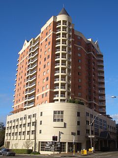
Strathfield is a suburb in the Inner West of Sydney, in the state of New South Wales, Australia. It is located 12 kilometres west of the Sydney central business and is the administrative centre of Strathfield Council. A small section of the suburb north of the railway line lies within the City of Canada Bay, while the area east of The Boulevard lies within Burwood Council. North Strathfield and Strathfield South are separate suburbs to the north and south, respectively.

Auburn is an Australia Inner Western Sydney, suburb in the state of New South Wales, Australia. Auburn is located 24 kilometres west of the Sydney central business district and is in the local government area of Cumberland Council, having previously been the administrative centre of Auburn Council.

The Hills District is a general term for the north-western suburbs of Sydney, in the state of New South Wales, Australia. Situated within the Greater Western Sydney region, its constituent suburbs are generally located in the local government area of The Hills Shire; some parts of the Hornsby Shire, Blacktown and Parramatta Cities are generally given the title.

Lewisham is a suburb in the Inner West of Sydney, in the state of New South Wales, Australia. Lewisham is located 7 kilometres south-west of the Sydney central business district, in the local government area of Inner West Council. The postcode is 2049. Lewisham is surrounded by the suburbs of Petersham, Dulwich Hill, Summer Hill, Haberfield and Leichhardt.

The Strathfield railway station is a heritage-listed railway station located on the Main Suburban line in the Sydney suburb of Strathfield in the Municipality of Strathfield local government area of New South Wales, Australia. The station is served by Sydney Trains T1 North Shore, Northern & Western Line and T2 Inner West & Leppington Line suburban services as well as NSW TrainLink Intercity and regional services. The station is located on the Main Northern and Main Western railway lines, forming a major junction for regional and suburban rail services. The station is also known as the Strathfield Railway Station group, Strathfield Triangle, Strathfield Flyover and Strathfield Underbridges. The property is owned by RailCorp, an agency of the Government of New South Wales. The station and associated infrastructure was added to the New South Wales State Heritage Register on 2 April 1999.
Lidcombe is a suburb in western Sydney, in the state of New South Wales, Australia. Lidcombe is located 18 kilometres west of the Sydney central business district, in the local government areas of Cumberland Council and City of Parramatta.

Chullora, a suburb of local government areas Canterbury-Bankstown Council and the Municipality of Strathfield, is located 15 kilometres west of the Sydney central business district, in the state of New South Wales, Australia. It is part of the Greater Western Sydney region.

Petersham Parish is one of the 57 parishes of Cumberland County, New South Wales, a cadastral unit for use on land titles. It is located to the south of Iron Cove, Rozelle Bay and the Parramatta River, and to the north of Cooks River. It includes the suburbs of Balmain, Leichhardt, Petersham, Newtown, Marrickville, Tempe, Glebe and St Peters.

Concord Parish is one of the 57 parishes of Cumberland County, New South Wales, a cadastral unit for use on land titles. It is located to the south of the Parramatta River between Homebush Bay and Iron Cove; and to the north of Cooks River. It includes the suburbs of Burwood, Croydon, Concord, Canada Bay and Abbotsford.
Toongabbie Creek, an urban watercourse that is part of the Parramatta River catchment, is located in Greater Western Sydney, New South Wales, Australia.

The Darling Mills Creek, an urban watercourse that is part of the Parramatta River catchment, is located in Greater Western Sydney, New South Wales, Australia.


