Parish of Werriwa

Last updated

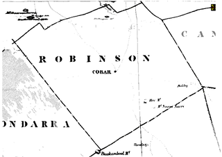
The Parish of Werriwa is a parish of Murray County (Australia). It is located to the north of Lake George and is the local Aboriginal name for the lake.

Murray County, New South Wales Cadastral in New South Wales, Australia

Murray County was one of the original Nineteen Counties in New South Wales and is now one of the 141 Lands administrative divisions of New South Wales. It included the area which is now part of Canberra and as far north as Lake George and Yass. It was originally bounded on the west by the Murrumbidgee River, on the east by the Shoalhaven River and on the north by the Yass River. A large area of the county was transferred to the Commonwealth government in 1909 in the Seat of Government Acceptance Act to make part of the Australian Capital Territory, along with land in Cowley County. Since then, the ACT border is now part of the western boundary. Part of the ACT border is determined by property boundaries in the Parish of Keewong, in the County of Murray; specifically the southern end of portions 177, 218, 211, 36, and 38. This is mentioned in the Seat of Government Acceptance Act of 1909.

Australia Country in Oceania

Australia, officially the Commonwealth of Australia, is a sovereign country comprising the mainland of the Australian continent, the island of Tasmania, and numerous smaller islands. It is the largest country in Oceania and the world's sixth-largest country by total area. The neighbouring countries are Papua New Guinea, Indonesia, and East Timor to the north; the Solomon Islands and Vanuatu to the north-east; and New Zealand to the south-east. The population of 25 million is highly urbanised and heavily concentrated on the eastern seaboard. Australia's capital is Canberra, and its largest city is Sydney. The country's other major metropolitan areas are Melbourne, Brisbane, Perth, and Adelaide.

North one of the four cardinal directions

North is one of the four compass points or cardinal directions. It is the opposite of south and is perpendicular to east and west. North is a noun, adjective, or adverb indicating direction or geography.

The parish, located at 34°59′00″S149°31′00″E / 34.983333°S 149.516664°E / -34.983333; 149.516664 Coordinates: 34°59′00″S149°31′00″E / 34.983333°S 149.516664°E / -34.983333; 149.516664 is near the town of Bungendore and about 50km north of Canberra. The name Werriwa, was in the early 20th century the name of the wider region between of Bungendore, Goulburn and Lake George.

Geographic coordinate system Coordinate system

A geographic coordinate system is a coordinate system that enables every location on Earth to be specified by a set of numbers, letters or symbols. The coordinates are often chosen such that one of the numbers represents a vertical position and two or three of the numbers represent a horizontal position; alternatively, a geographic position may be expressed in a combined three-dimensional Cartesian vector. A common choice of coordinates is latitude, longitude and elevation. To specify a location on a plane requires a map projection.

Bungendore Town in New South Wales, Australia

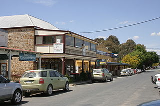
Bungendore is a town in the Queanbeyan Region of New South Wales, Australia, in Queanbeyan-Palerang Regional Council. It is on the Kings Highway near Lake George, the Molonglo River Valley and the Australian Capital Territory border. It has become a major tourist centre in recent years, popular with visitors from Canberra and some of it has heritage protection. It has expanded rapidly in recent years as a dormitory town of Canberra.

Canberra capital city of Australia

Canberra is the capital city of Australia. Founded following the federation of the colonies of Australia as the seat of government for the new nation, it is Australia's largest inland city and the eighth-largest city overall. The city is located at the northern end of the Australian Capital Territory; 280 km (170 mi) south-west of Sydney and 660 km (410 mi) north-east of Melbourne.

The Division of Werriwa, famous as the electorate of Gough Whitlam and Mark Latham was originally in this area at federation, however, demographic and boundary changes over time have seen that electorate now located in Western Sydney.

Division of Werriwa Australian federal electoral division

The Division of Werriwa is an Australian electoral division in the state of New South Wales. The name Werriwa derives from a local Aboriginal name for Lake George, which was located in the division when it was established in 1900. The division was one of the original 65 divisions first contested at the first federal election.

Gough Whitlam Australian politician, 21st Prime Minister of Australia

Edward Gough Whitlam was the 21st Prime Minister of Australia, serving from 1972 to 1975. The Leader of the Labor Party from 1967 to 1977, Whitlam led his party to power for the first time in 23 years at the 1972 election. He won the 1974 election before being controversially dismissed by the Governor-General of Australia, Sir John Kerr, at the climax of the 1975 Australian constitutional crisis. Whitlam remains the only Australian prime minister to have his commission terminated in that manner.

Mark Latham Australian politician

Mark William Latham is an Australian politician. He has been the state leader of One Nation in New South Wales since November 2018, and won election to the Legislative Council at the 2019 state election. He was previously the leader of the Australian Labor Party and Leader of the Opposition from December 2003 to January 2005, leading the party to defeat at the 2004 federal election.

Landmarks in the area include Werriwa homestead built in about 1882. [1]
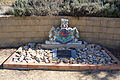
Related Research Articles

Division of Throsby Australian federal electoral division

The Division of Throsby was an Australian electoral division in the state of New South Wales. The division was named after Charles Throsby, a prominent pioneer and explorer in the early nineteenth century of the areas to the south of Sydney.

Division of Hume Australian federal electoral division

The Division of Hume is an Australian electoral division in the state of New South Wales. The division was proclaimed in 1900, and was one of the original 65 divisions to be contested at the first federal election. The division was named after Hamilton Hume, one of the first Europeans to travel through the area.

Anglican Diocese of Canberra and Goulburn

The Diocese of Canberra and Goulburn is one of the 23 dioceses of the Anglican Church of Australia. The diocese has 60 parishes covering most of south-east New South Wales, the eastern Riverina and the Australian Capital Territory (ACT). It stretches from Marulan in the north, from Batemans Bay to Eden on the south coast across to Holbrook in the south-west, north to Wagga Wagga, Temora, Young and Goulburn.

Palerang Council Local government area in New South Wales, Australia

The Palerang Council was a local government area located in the Southern Tablelands region of New South Wales, Australia. On 12 May 2016 the Minister for Local Government announced dissolution of the Palerang Council with immediate effect. Together with Queanbeyan City the combined council areas were merged to establish the Queanbeyan-Palerang Regional Council. Both councils had opposed the amalgamation. Elections for the new Council area will be held in September 2017. The former mayor of Queanbeyan City Council was appointed by the NSW Government as administrator until that date.

Lake Bathurst (New South Wales) Town in New South Wales, Australia

Lake Bathurst is a shallow lake located 27 kilometres (17 mi) south-east of Goulburn, New South Wales in Australia. It is also the name of a nearby locality in the Goulburn Mulwaree Council.

Parish of Majura Cadastral in New South Wales, Australia

Majura Parish is a parish of Murray County, New South Wales, a cadastral unit for use on land titles. It is located to the east of the extreme eastern tip of the ACT. The Queanbeyan-Bungendore railway line and the Kings Highway pass through the parish. About a quarter of the original nineteenth-century parish was transferred to the ACT in 1909. The land transferred was the area between the railway line in the south and the watershed of the Molonglo River in the north. This cut off part of portion 210 of Majura Parish from the rest, giving the parish a small exclave.

Parish of Carwoola Cadastral in New South Wales, Australia

Carwoola Parish is a parish of Murray County, a cadastral unit for use on land titles. It is located to the south of the Australian Capital Territory and to the south-east of Queanbeyan. The original northern and eastern boundary was the Molonglo River; this is still the boundary for most of the parish, except in the north, where the relatively small area north of the Queanbeyan-Goulburn railway line was transferred to the ACT in 1909. The south-western boundary is the Queanbeyan River. Captain's Flat Road is the major road running through the parish. The area also roughly aligns with the locality of Carwoola.

The Parish of Wamboin is a parish of the County of Murray, a cadastral unit for use on land titles. It is located just to the north-east of the Australian Capital Territory and includes part of the town of Bungendore on the eastern edge and the rural community of Wamboin near the south-western edge.

Parish of Lake George Cadastral in New South Wales, Australia

The Parish of Lake George is an Australian parish of the County of Murray which covers Lake George and part of the surrounding area. It is at the northern boundary of the county, with Argyle to the north-east. The Federal Highway runs through the parish where it runs to the west of the lake. Some parish maps of the area just record it as a lake and not as a parish, however it does have separate parish maps.

The Parish of Wologorong is a parish of Argyle County, New South Wales, Australia.

Parish of Towrang Cadastral in New South Wales, Australia

The Parish of Towrang is a parish of Argyle County located to the south-east of Goulburn, and including some of its outer suburbs such as Goulburn North, and the area to the east of the Wollondilly River and Mulwaree Ponds. The Goulburn War Memorial is also located in this parish. The village of Towrang is located at the north-eastern edge of the parish, with Towrang creek part of the boundary in this area.

The Mulwaree River, a perennial river that is part of the Hawkesbury-Nepean catchment, is located in the Southern Tablelands region of New South Wales, Australia.

Currawang Cadastral in New South Wales, Australia

Currawang is a locality in the Queanbeyan–Palerang Regional Council, on the edges of Upper Lachlan Shire and Goulburn-Mulwaree Council, in New South Wales, Australia. It is located to the north of Lake George. It shares its name with the Currawang Parish of Argyle County, in which it is located. This was formerly known as the parish of Currowang. Both names derive from an Aboriginal word for the spearwood tree.

Tirrannaville Town in New South Wales, Australia

Tirrannaville is a locality in the Goulburn Mulwaree Council, New South Wales, Australia. It is located about 11 km south of Goulburn on the road to Braidwood. It was formerly called Terranna, which is the name of the parish covering most of the locality. The northern part of the defined locality, including the small settlement of Tirrannaville and cemetery, is in the parish of Goulburn. At the 2016 census, it had a population of 237. The locality mostly consists of grazing land.

Ellenden Parish, is a civil parish of Murray County, New South Wales.

Currandooly Parish is a civil parish of Murray County, New South Wales.

Nyngan Parish (Robinson County), New South Wales

Nyngan Parish is a civil parish of Robinson County, a cadastral division of New South Wales. It is located on Yanda Creek and the Kidman Way north east of Cobar, New South Wales.

References