
Yalpunga located at 29°02′40″S 142°03′13″E is a civil parish of Tongowoko County, New South Wales.
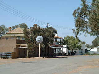
Hermitage, New South wales, is a civil parish of Tongowoko County, New South Wales. The town of Tibooburra is the only settlement in the parish.
Binaroo is a civil parish of Tongowoko County, New South wales. The parish is east of Tibooburra.
Calathunda is a remote civil parish of Tongowoko County, in New South Wales. The parish is north east of Tibooburra.
Mount Stuart located at 29°30'32.0"S 142°01'08.0"E is a civil parish of Tongowoko County, on the opposite bank of the Thomson Creek from the town of Tibooburra. The parish is east of Tibooburra.
Torrens Parish, New South Wales located at 29°14′00″S 142°09′27″E is a rural locality in and a cadastral parish of Tongowoko County, two kilometers north east from the town of Tibooburra, New South Wales. The parish is north east of Tibooburra, within the Sturt National Park.

Olive, also known as Olive Downs, is a civil parish of Tongowoko County in far north west New South Wales, located at 29°02′40″S 141°52′14″E.

Mount King, New South Wales is a civil parish of Poole County in far North West New South Wales, located at.
Nantomoko is a remote civil parish of Poole County in far North West New South Wales. located at 29.2143°S 141.0805°E

Weimbutta is a remote civil parish of Yantara County in far North West New South Wales. located at 30°04′42″S 142°45′50″E, east of the Silver City Highway.
Mount Wood, New South Wales is a remote civil parish of Tongowoko County, New South Wales near Milparinka, New South Wales.
The Parish of Blackwood is a remote civil parish of Poole County in far North West New South Wales,

Koonyaboothie located between Pindera Downs Aboriginal Area and Tibooburra is a cadastral parish of Tongowoko County in New South Wales, Australia.
Bolwarry, New South Wales is a civil parish of Tongowoko County, New South wales. The parish is east of Tibooburra.
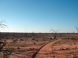
Kurawillia located at 29°36′59″S 142°34′32″E is a cadastral parish of Tokowoko County New South Wales. The parish is east of Tibooburra, and within the traditional lands of Yarli peoples. The landscape is flat and arid scrubland.
Silva located 29°07′49″S 142°21′47″ halfway between Bulloo Downs, Queensland, and Tibooburra, New South Wales, is a cadastral parish of Tongowoko County New South Wales.

Tooncurrie Parish located at 29°31′44″S 142°13′52″E just east of Tibooburra, New South Wales is a cadastral parish of Tongowoko County New South Wales. The town of Tibooburrais just outside the parish.
Warratta, New South Wales is a cadastral parish of Tongowoko County New South Wales.
Kilpara, New South Wales is a remote civil parish of Yantara County in far North West New South Wales, Australia. The Geography, of the parish is mostly the flat, arid landscape of the Channel Country. The parish has a Köppen climate classification of BWh.
Teperago, New South Wales is a remote civil parish of Yantara County in far northwest New South Wales.
