
Poole County is one of the 141 Cadastral divisions of New South Wales. It is located in the extreme north-west of the state, abutting Cameron Corner. It includes parts of Sturt National Park.

Whittabranah is a civil parish of Tongowoko County, New South Wales. The parish is 5 miles north of Tibooburra.

Torrens Parish, New South Wales located at 29°14′00″S 142°09′27″E is a rural locality in and a cadastral parish of Tongowoko County, two kilometers north east from the town of Tibooburra, New South Wales. The parish is north east of Tibooburra, within the Sturt National Park.

Mount King, New South Wales is a civil parish of Poole County in far North West New South Wales, located at.

Fort Grey, is a remote civil parish of Poole County in far North West New South Wales. located at 29.1731°S 141.0307°E.
Pinaroo is a remote civil parish of Poole County in far north west New South Wales, located at 29°08′04″S 141°06′55″E.

Stewart, is a remote civil parish of Poole County in far North West New South Wales. Stewart is located 10 miles south of Cameron's Corner.
Nantomoko is a remote civil parish of Poole County in far North West New South Wales. located at 29°21′43″S 141°08′05″E.
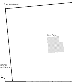
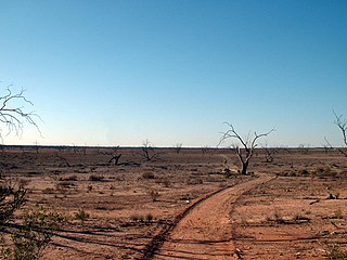
Sturt Parish is a remote civil parish of Poole County in far North West New South Wales, located at 29.433056°S 141.519722°E.
Scott, New South Wales is a remote rural locality and civil parish of Evelyn County in far northwest New South Wales. located at 29°38′31″S 142°01′00″E.
Wirratcha Parish is a remote rural locality and civil parish of Evelyn County in far northwest New South Wales. located at 29°38′31″S 142°01′00″E.
Coally is a remote rural locality and civil parish of Evelyn County, New South Wales in far northwest New South Wales located at 29°51′00″S 141°50′39″E.
Whitty is a remote rural locality and civil parish of Evelyn County in far northwest New South Wales. located at 30°12′34″S 141°05′06″E.
Mouloonk is a remote rural locality and civil parish of Evelyn County in far northwest New South Wales. located at 30°09′04″S 141°07′08″E.
Quintyambi is a remote rural locality and civil parish of Evelyn County in far northwest New South Wales. located at 30°18′40″S 141°05′05″E.

The Parish of Essie, New South Wales is a remote civil parish of Evelyn County, New South Wales in far northwest New South Wales, located at 29.839722°S 141.134722°E, on the border with South Australia.

Parish of Paradise, New South Wales is a remote civil parish of Evelyn County, New South Wales in far northwest New South Wales. located at 29.850000°S 141.844167°E on the border with South Australia.
The Parish of Blackwood is a remote civil parish of Poole County in far North West New South Wales,
The Parish of Tindara is a remote civil parish of Poole County in far North West New South Wales,.
Driel is a rural locality of Warren Shire 31°39′54″S 147°56′04″E a few miles north of Warren, New South Wales Driel is also a civil Parish]] of Ewenmar County, a cadastral division of New South Wales.
