Parkfield House

Last updated

Parkfield House
Parkfield House - geograph.org.uk - 1821060.jpg
The building in 2010
LocationManchester Old Road, Middleton
Coordinates 53°32′47″N2°12′32″W / 53.5465°N 2.2090°W / 53.5465; -2.2090
Built1965
Architect Tom Ellis of Lyons Israel Ellis
Architectural style(s) Brutalist style
Greater Manchester UK location map 2.svg
Red pog.svg
Shown in Greater Manchester

Parkfield House, formerly known as Middleton Town Hall, is a former municipal building in Manchester Old Road, Middleton, a town in Greater Manchester in England. The building, which served as the offices and meeting place of Middleton Borough Council, is currently vacant.

History

The original Parkfield House was commissioned by a local magistrate, Thomas Ashton, in the first half of the 19th century. The site he selected was on the north side of the Manchester Old Road opposite the entrance to Alkrington Park Road. [1] It was designed in the Georgian style, built in ashlar stone and was Ashton's main residence by 1848. It was acquired by another local magistrate, Harvey Heywood, in around 1870. [2] [3]

In 1886, the local area became a municipal borough and the local improvement commissioners were succeeded by Middleton Borough Council. [4] Heywood became the first mayor of the new borough council, which was initially based at the old town hall in Gas Street. [5] After Heywood died in 1920, his widow, Harriette, sold the original Parkfield House to Middleton Borough Council for use as its headquarters in 1925. [2]

A garden of remembrance with a colonnade was established on the west side of the original house in the presence of Lieutenant Colonel Roderick Livingstone Lees of the 6th Battalion, Lancashire Fusiliers in October 1927. [6] [7]

As the responsibilities of the borough council increased, councillors decided to commission a more substantial building on a site between the garden of remembrance (on the left) and the original building (on the right). The new four-storey building was designed by Tom Ellis of Lyons Israel Ellis in the brutalist style with an L-shaped plan, built in concrete and glass, and was completed in 1965. [8] [9] It continued to serve as the headquarters of the borough council for the next decade, [10] but ceased to be the local seat of government when the enlarged Rochdale Borough Council was formed in 1974. [11] The council instructed the demolition of the original Parkfield House in 1978. [12]

In 1980, the council sold the newer building to the North West Water Authority, [2] [13] which sold it on to the security business, Chubb, in 2000. [14] Chubb vacated the building in 2020. [15] In January 2023, the developer, Muller Property Group, acquired the vacant building, [16] and, in May 2023, Muller Property Group submitted plans to demolish the building and replace it with 20 houses and an 80-bed care home. [17] [18] [19]

Related Research Articles

<span class="mw-page-title-main">Chorley</span> Town in Lancashire, England

Chorley is a town and the administrative centre of the wider Borough of Chorley in Lancashire, England, 8 miles (13 km) north of Wigan, 11 miles (18 km) south west of Blackburn, 11 miles (18 km) north west of Bolton, 12 miles (19 km) south of Preston and 20 miles (32 km) north west of Manchester. The town's wealth came principally from the cotton industry.

<span class="mw-page-title-main">Bury, Greater Manchester</span> Market town in Greater Manchester, England

Bury is a market town on the River Irwell in the Metropolitan Borough of Bury, Greater Manchester, England. which had a population of 81,101 in 2021 while the wider borough had a population of 193,846.

<span class="mw-page-title-main">Trafford</span> Borough in Greater Manchester, England

Trafford is a metropolitan borough of Greater Manchester, England, with an estimated population of 235,546 in 2021. It covers 106 square kilometres (41 sq mi) and includes the area of Old Trafford and the towns of Altrincham, Stretford, Urmston, Partington and Sale. The borough was formed in 1974 as a merger of six former districts and part of a seventh. The River Mersey flows through the borough, separating North Trafford from South Trafford, and the historic counties of Lancashire and Cheshire. Trafford is the seventh-most populous district in Greater Manchester.

<span class="mw-page-title-main">Calderdale</span> Metropolitan borough in West Yorkshire, England

Calderdale is a metropolitan borough of West Yorkshire, England, which had a population of 211,439. It takes its name from the River Calder, and dale, a word for valley. The name Calderdale usually refers to the borough through which the upper river flows, while the actual landform is known as the Calder Valley. Several small valleys contain tributaries of the River Calder. The main towns of the borough are Brighouse, Elland, Halifax, Hebden Bridge, Sowerby Bridge and Todmorden.

<span class="mw-page-title-main">Bolton</span> Town in Greater Manchester, England

Bolton is a town in Greater Manchester in England. In the foothills of the West Pennine Moors, Bolton is between Manchester, Blackburn, Wigan, Bury and Salford. It is surrounded by several towns and villages that form the wider borough, of which Bolton is the administrative centre. The town is also within the historic county boundaries of Lancashire.

<span class="mw-page-title-main">Metropolitan Borough of Dudley</span> Metropolitan borough in England

The Metropolitan Borough of Dudley is a metropolitan borough of West Midlands, England. It was created in 1974 following the Local Government Act 1972, through a merger of the existing Dudley County Borough with the municipal boroughs of Stourbridge and Halesowen.

<span class="mw-page-title-main">Chadderton</span> Town in Greater Manchester

Chadderton is a town in the Metropolitan Borough of Oldham, Greater Manchester, England, on the River Irk and Rochdale Canal. It is located in the foothills of the Pennines, 1 mile (1.6 km) west of Oldham, 5 miles (8.0 km) south of Rochdale and 6 miles (9.7 km) north-east of Manchester.

<span class="mw-page-title-main">Rochdale</span> Town in Greater Manchester, England

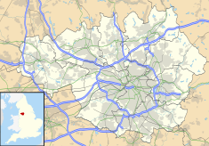
Rochdale is a town in Greater Manchester, England, and the administrative centre of the Metropolitan Borough of Rochdale. In the 2021 census the town had a population of 111,261, compared to 223,773 for the wider borough. Rochdale is in the foothills of the South Pennines and lies in the dale (valley) of the River Roch, 5 miles (8 km) northwest of Oldham, and 10 miles (16 km) northeast of Manchester.

<span class="mw-page-title-main">Middleton, Greater Manchester</span> Town in Greater Manchester, England

Middleton is a town in the Metropolitan Borough of Rochdale, Greater Manchester, England, on the River Irk 5 miles (8.0 km) southwest of Rochdale and 5 miles (8.0 km) northeast of Manchester. Middleton had a population of 42,972 at the 2011 Census. It lies on the northern edge of Manchester, with Blackley to the south and Moston to the south east.

<span class="mw-page-title-main">Heywood, Greater Manchester</span> Human settlement in England

Heywood is a town in the Metropolitan Borough of Rochdale, Greater Manchester, England, in the historic county of Lancashire. It had a population of 28,205 at the 2011 Census. The town lies on the south bank of the River Roch, 2 miles (3.2 km) east of Bury, 4 miles (6.4 km) southwest of Rochdale, and 8 miles (12.9 km) north of Manchester. Middleton lies to the south, whilst to the north is the Cheesden Valley, open moorland, and the Pennines. Heywood's nickname is Monkey Town.

<span class="mw-page-title-main">Wythenshawe</span> Human settlement in England

Wythenshawe is a town in the south of Manchester, Greater Manchester, England. Historically part of Cheshire, in 1931, Wythenshawe was transferred to the City of Manchester, which had begun building a large new housing estate there in the 1920s. With an area of approximately 11 square miles (28 km2), Wythenshawe became the largest council estate in Europe. Despite it not having town status, the Manchester Metrolink station which serves the main district centre is called Wythenshawe Town Centre tram stop.

<span class="mw-page-title-main">Pendlebury</span> Town in Greater Manchester, England

Pendlebury is a town in the City of Salford, Greater Manchester, England. The population at the 2011 Census was 13,069. It lies 4 miles (6 km) north-west of Manchester, 3 miles (5 km) north-west of Salford and 6 miles (10 km) south-east of Bolton.

<span class="mw-page-title-main">Heywood and Middleton (UK Parliament constituency)</span> Parliamentary constituency in the United Kingdom, 1983 onwards

Heywood and Middleton is a constituency in Greater Manchester represented in the House of Commons of the UK Parliament since 2019 by Chris Clarkson of the Conservative Party.

<span class="mw-page-title-main">Middlesbrough Council</span> English unitary authority council

Middlesbrough Council also known as Middlesbrough Borough Council, is the local authority for Middlesbrough, in the ceremonial county of North Yorkshire, England. Since 1996 it has been a unitary authority, providing both district-level and county-level services. The council is led by the directly elected Mayor of Middlesbrough.

<span class="mw-page-title-main">Alkrington</span> Human settlement in England

Alkrington Garden Village is a suburban area of Middleton, in the Metropolitan Borough of Rochdale, Greater Manchester, England.

<span class="mw-page-title-main">Mills Hill</span> Human settlement in England

Mills Hill is an industrial and residential area that lies on the common border of Middleton and Chadderton in Greater Manchester, England. It lies 1.3 miles east of Middleton town centre and 1.4 miles to the west of central Chadderton. It is contiguous with Middleton Junction, Moorclose, Firwood Park and Chadderton Park. Mills Hill lies along the course of the Rochdale Canal and the River Irk.

<span class="mw-page-title-main">Rochdale Town Hall</span> Municipal building in Rochdale, Greater Manchester, England

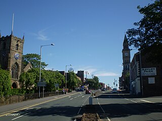
Rochdale Town Hall is a Victorian-era municipal building in Rochdale, Greater Manchester, England. It is "widely recognised as being one of the finest municipal buildings in the country", and is recorded in the National Heritage List for England as a designated Grade I listed building.

<span class="mw-page-title-main">Tonge Hall</span> Listed building in Greater Manchester, England

Tonge Hall is a Grade II* listed Elizabethan manor house in Tonge, Middleton, Greater Manchester, England.

<span class="mw-page-title-main">Warrington</span> Town in Cheshire, England

Warrington is an industrial town in the borough of the same name in Cheshire, England. The town sits on the banks of the River Mersey and until 1974, was part of Lancashire. It is 19 miles (31 km) east of Liverpool, and 18 miles (29 km) west of Manchester.

<span class="mw-page-title-main">Ashton-in-Makerfield Town Hall</span> Municipal building in Ashton-in-Makerfield, Greater Manchester, England

Ashton-in-Makerfield Town Hall, formerly Ashton-in-Makerfield Urban District Council Offices, was a municipal building in Bryn Street, Ashton-in-Makerfield, a town in Greater Manchester, England. The building, which served as the offices and meeting place of Ashton-in-Makerfield Urban District Council, was demolished in 2017.

References

  1. "Ordnance Survey Map". 1914. Retrieved 25 February 2024.
  2. 1 2 3 "Parkfield House". Parks and Gardens. Retrieved 25 February 2024.
  3. The Monthly C. T. C. Gazette and Official Record. Vol. 17. Cyclists' Touring Club. 1 February 1898.
  4. "Middleton MB". Vision of Britain. Retrieved 25 February 2024.
  5. "Changing face of Middleton". Manchester Evening News. 29 March 2006. Retrieved 25 February 2024.
  6. "Middleton". Imperial War Museum. Retrieved 25 February 2024.
  7. "Middleton Garden of Remembrance". War Memorials Online. Retrieved 25 February 2024.
  8. Forsyth, A.; Gray, D.F.; Brown, N.; Lyons Israel Ellis Gray (1988). Lyons Israel Ellis Gray: Buildings and Projects 1932–1983. Architectural Association: Works. Architectural Association. ISBN   978-0-904503-96-8.
  9. "Thomas Bickerstaff Harper "Tom" Ellis". Architects of Greater Manchester 1800–1940. Retrieved 24 February 2024.
  10. "No. 44962". The London Gazette . 24 October 1969. p. 10851.
  11. Local Government Act 1972. 1972 c.70. The Stationery Office Ltd. 1997. ISBN   0-10-547072-4.
  12. Statham, Nick (28 April 2023). "Former town hall could demolished to make way for new houses and 80-bed care home". Manchester Evening News. Retrieved 24 February 2024.
  13. "No. 51895". The London Gazette . 9 October 1989. p. 11547.
  14. "Concerns over Chubb's future". Manchester Evening News. 19 April 2010. Retrieved 24 February 2024.
  15. Wheelan, Dan (2 May 2023). "Middleton's Parkfield House in line for overhaul". Place North West. Retrieved 24 February 2024.
  16. "Three-acre site acquired for care home development". Insider Media. 18 January 2023. Retrieved 24 February 2024.
  17. "Parkfield House: former Rochdale Council Headquarters set to be replaced with new housing and care home". 1 May 2023. Retrieved 24 February 2024.
  18. "Muller submits Middleton care home planning application". The Planner. 3 May 2023. Retrieved 24 February 2024.
  19. "Parkfield House, Middleton". Asteer Planning. Retrieved 24 February 2024.