Parrish Creek

Last updated
Parrish Creek
Etymology Samuel Parrish
Country United States
Physical characteristics
Main source Spring in the Wasatch Range, Utah
8,580 feet (2,620 m)
40°56′48″N111°48′30″W / 40.94667°N 111.80833°W / 40.94667; -111.80833
River mouth Centerville, Utah
4,600 feet (1,400 m)
40°55′24″N111°51′56″W / 40.92333°N 111.86556°W / 40.92333; -111.86556 Coordinates: 40°55′24″N111°51′56″W / 40.92333°N 111.86556°W / 40.92333; -111.86556
Basin features
River system Parrish Canyon

Parrish Creek is a stream in Davis County, Utah, United States. [1]

Davis County, Utah County in the United States

Davis County is a county in northern Utah, United States. As of the 2010 United States Census, the population was 306,479, making it Utah's third-most populous county. Its county seat is Farmington, and its largest city is Layton.

Utah A state of the United States of America

Utah is a state in the western United States. It became the 45th state admitted to the U.S. on January 4, 1896. Utah is the 13th-largest by area, 30th-most-populous, and 11th-least-densely populated of the 50 United States. Utah has a population of more than 3 million according to the Census estimate for July 1, 2016. Urban development is mostly concentrated in two areas: the Wasatch Front in the north-central part of the state, which contains approximately 2.5 million people; and Washington County in Southern Utah, with over 160,000 residents. Utah is bordered by Colorado to the east, Wyoming to the northeast, Idaho to the north, Arizona to the south, and Nevada to the west. It also touches a corner of New Mexico in the southeast.

United States Federal republic in North America

The United States of America (USA), commonly known as the United States or America, is a country comprising 50 states, a federal district, five major self-governing territories, and various possessions. At 3.8 million square miles, the United States is the world's third or fourth largest country by total area and is slightly smaller than the entire continent of Europe's 3.9 million square miles. With a population of over 327 million people, the U.S. is the third most populous country. The capital is Washington, D.C., and the largest city by population is New York City. Forty-eight states and the capital's federal district are contiguous in North America between Canada and Mexico. The State of Alaska is in the northwest corner of North America, bordered by Canada to the east and across the Bering Strait from Russia to the west. The State of Hawaii is an archipelago in the mid-Pacific Ocean. The U.S. territories are scattered about the Pacific Ocean and the Caribbean Sea, stretching across nine official time zones. The extremely diverse geography, climate, and wildlife of the United States make it one of the world's 17 megadiverse countries.

Contents

The creek begins at a spring about 1.3 miles (2.1 km) south-southeast of Bountiful Peak in the Wasatch Range, at an elevation of approximately 8,580 feet (2,620 m). It flows southwest to a point in the foothills northeast of the eastern end of Parrish Lane (400 North) in Centerville.

Wasatch Range Mountain range in Utah, United States

The Wasatch Range is a mountain range that stretches approximately 160 miles (260 km) from the Utah-Idaho border, south through central Utah in the western United States. It is the western edge of the greater Rocky Mountains, and the eastern edge of the Great Basin region. The northern extension of the Wasatch Range, the Bear River Mountains, extends just into Idaho, constituting all of the Wasatch Range in that state.

Foothills hills before a mountain range

Foothills or piedmont are geographically defined as gradual increases in elevation at the base of a mountain range, higher hill range or an upland area. They are a transition zone between plains and low relief hills and the adjacent topographically higher mountains, hills, and uplands. Frequently foothills consist of alluvial fans, coalesced alluvial fans and dissected plateaus.

Centerville, Utah City in Utah, United States

Centerville is a city in southeastern Davis County, Utah, United States. It is part of the Ogden-Clearfield Metropolitan Statistical Area. The population was 15,335 at the 2010 census. It is located adjacent to the easternmost part of the Great Salt Lake.
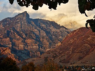
Parrish Creek was named after Samuel Parrish, a pioneer settler in the area. [2] [3] The creek and the community had originally been named Duel, after a pair brothers that were settlers in the area. (However, the name of the community was later changed to Cherry Creek, and then Centerville, while the name of the creek was changed to Parrish.) [4] After settling along the steam. Mr. Parrish built one of the first (albeit crude) mills in Davis County. [5]

A short way up a trail that roughly follows the stream bed there are some Native American pictographs. [6] [7] There is another trail that runs south of the creek (along the ridge which separates Parrish Canyon from Centerville Canyon) that is one of the recommended hiking routes to Bountiful Peak. The west end of that trail begins along the Bonneville Shoreline Trail and the east end connects with Skyline Drive. The trail (to the peak) is about 7.84 miles (12.62 km) with an elevation gain of 4,670 feet (1,420 m). [3] [8] [9] [10]

Stream bed channel bottom of a stream, river, or creek

A stream bed or streambed is the channel bottom of a stream or river, the physical confine of the normal water flow. The lateral confines or channel margins are known as the stream banks or river banks, during all but flood stage. Under certain conditions a river can branch from one stream bed to multiple stream beds. A flood occurs when a stream overflows its banks and flows onto its flood plain. As a general rule, the bed is the part of the channel up to the normal water line, and the banks are that part above the normal water line. However, because water flow varies, this differentiation is subject to local interpretation. Usually, the bed is kept clear of terrestrial vegetation, whereas the banks are subjected to water flow only during unusual or perhaps infrequent high water stages and therefore might support vegetation some or much of the time.

Native Americans in the United States Indigenous peoples of the United States (except Hawaii)

Native Americans, also known as American Indians, Indigenous Americans and other terms, are the indigenous peoples of the United States, except Hawaii. There are over 500 federally recognized tribes within the US, about half of which are associated with Indian reservations. The term "American Indian" excludes Native Hawaiians and some Alaska Natives, while Native Americans are American Indians, plus Alaska Natives of all ethnicities. Native Hawaiians are not counted as Native Americans by the US Census, instead being included in the Census grouping of "Native Hawaiian and other Pacific Islander".

Bonneville Shoreline Trail recreation trail in Utah

The Bonneville Shoreline Trail is a mixed use (biking/hiking) recreation trail in Utah that follows the shoreline of the ancient Lake Bonneville. Today, the Wasatch Front hosts to a growing region of outdoor enthusiasts. Some sections of the trail are complete while other parts are still being developed. The Bonneville Shoreline Trail hopes to one day stretch from the Idaho border North of Logan, Utah and run South all the way to Nephi, Utah. 150 miles (240 km) apart, the trail will weave in and out of many canyons of the Wasatch Mountains, totaling 305+ miles of dirt and paved trails. If completed the trail would be located within 20 miles (32 km) of 80% of the population of Utah.

See also

Related Research Articles

Salt Lake County, Utah County in the United States

Salt Lake County is a county in the U.S. state of Utah. As of the 2010 United States Census, the population was 1,029,655, making it the most populous county in Utah. Its county seat and largest city is Salt Lake City, the state capital. The county was created in 1850.

Bountiful, Utah City in Utah, United States

Bountiful is a city in Davis County, Utah, United States. As of the 2010 census, the city population was 42,552, a three percent increase over the 2000 figure of 41,301. The city grew rapidly during the suburb growth of the late 1940s, 1950s, and 1960s and was Davis County's largest city until 1985 when it was surpassed by Layton. Bountiful is Utah's 15th largest city.

Transportation in Salt Lake City consists of a wide network of roads, an extensive bus system, a light rail system, and a commuter rail line. Although Salt Lake City, Utah is a traditionally car-oriented city, the rapidly growing public transit system has a high number of riders for a city of its size, and public transit is widely supported by the populace.

City Creek (Utah) stream in Salt Lake City, Utah

City Creek is a small but historically important mountain stream that flows from City Creek Canyon and across part of Salt Lake City, Utah, and into the Jordan River which empties into the Great Salt Lake. City Creek's head is about 8 miles (13 km) up City Creek Canyon northeast of Downtown Salt Lake City. The entire stream measures only about 14.5 miles (23 km) long. Melting snow from adjacent mountains provides most of City Creek's currents, but the stream flows year-round because of natural springs at the head of the creek.

Wasatch-Cache National Forest national forest in Idaho, Utah, and Wyoming in the United States

Wasatch-Cache National Forest is a United States National Forest located primarily in northern Utah (81.23%), with smaller parts extending into southeastern Idaho (16.42%) and southwestern Wyoming (2.35%). The name is derived from the Ute word Wasatch for a low place in high mountains, and the French word Cache meaning to hide. The term cache originally referred to fur trappers, the first Europeans to visit the land. The Wasatch-Cache National Forest boundaries include 1,607,177 acres (6,504.01 km2) of land.

Davis School District

Davis School District is a school district serving Davis County, Utah, United States. Headquartered in the county seat of Farmington, it is the 61st largest school district in the United States and the 2nd largest school district in Utah with 68,342 students attending Davis schools as of 2015. It is located almost entirely within Davis County. Students attend elementary school from kindergarten to 6th grade, junior high from 7th grade-9th grade, and high school from 10th grade-12th grade.

Big Cottonwood Canyon canyon in Salt Lake County, Utah, United States

Big Cottonwood Canyon is a canyon in the Wasatch Range 12 miles (19 km) southeast of Salt Lake City in the U.S. state of Utah. The 15-mile (24 km)-long canyon provides hiking, biking, picnicking, rock-climbing, camping and fishing in the summer. Its two ski resorts, Brighton and Solitude, are popular among skiers and snowboarders. The canyon is accessed by The Big Cottonwood Canyon Scenic Byway (SR-190), which runs its length to Guardsman Pass at the top of the canyon, allowing travel to Park City in the summer months.

Emigration Canyon, Utah census-designated place in Salt Lake County, Utah, United States

Emigration Canyon is a census-designated place (CDP), township and canyon in Salt Lake County, Utah, United States, located east of Salt Lake City in the Wasatch Range. Beginning at the southern end of the University of Utah, the canyon itself heads east and northeast between Salt Lake City and Morgan County. The boundaries of the CDP and township are coextensive; they do not extend to the county line. As of the 2010 census, the population was 1,567.

Deseret Peak mountain

Deseret Peak is the highest peak in the Stansbury Mountains. It is located in the Deseret Peak Wilderness area west of Grantsville, Utah and east of Skull Valley Indian Reservation. The site is a popular destination for hikers as the area is a contrast of the alpine wilderness with the surrounding desert basin. The trail that leads to the peak is easily accessible from Salt Lake City. The mountain offers views of the Bonneville Salt Flats, the Great Salt Lake, and the surrounding towns and mountain ranges. On a clear day, it is possible to see Mount Nebo, the highest peak in the adjacent Wasatch Mountains.

Rock Canyon (Provo, Utah)

Rock Canyon is located in the Wasatch Mountains, in east Provo, Utah, United States. It is popular with rock climbers and hikers due to its unique and rugged geology as well as its proximity to Brigham Young University. The mouth of the canyon is located just behind the Provo Utah Temple.

Legacy Parkway state highway in Davis County in Utah, United States

Legacy Parkway is an 11.5-mile-long (18.5 km) four-lane controlled-access parkway located almost completely within Davis County in the northern part of the U.S. state of Utah. The parkway travels north from Interstate 215 (I-215) in northwestern Salt Lake City to an interchange named the Wasatch Weave in Farmington with two intermediate interchanges providing access to Woods Cross and Centerville. Wetlands of the nearby Great Salt Lake and nature preserves border the western side of the parkway while the eastern side roughly parallels Union Pacific and Utah Transit Authority rail lines and I-15.

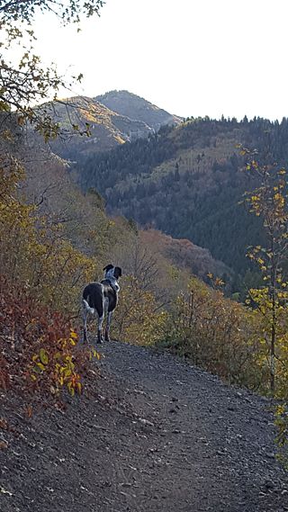
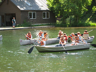
Millcreek Canyon is a canyon in the Wasatch Mountains and part of Millcreek City on the east side of the Salt Lake Valley, Utah. It is a popular recreation area both in the summer and in the winter. It was named after all the mills that were once located in the densely forested canyon. It is home to two restaurants and six Boy Scout Day Camps.

Francis Peak mountain in United States of America

Francis Peak, Elevation 9,560 feet (2,910 m), was named in honor of an early pioneer, Esther Charlotte Emily Weisbrodt Francis, who contributed to the colonization of the Morgan Valley in Morgan county in Utah. One of the taller peaks of the Wasatch Range, Francis Peak is located on the border between Morgan and Davis counties, approximately 18 miles (29 km) north of Salt Lake City, Utah, United States.

Big Cottonwood Creek river in the United States of America

Big Cottonwood Creek is one of the largest streams entering Salt Lake Valley from the east from the Wasatch Mountains. The creek flows through the Big Cottonwood Canyon in a westerly direction until it emerges into Salt Lake Valley about eighteen miles (29 km) from its highest source. Thence its course is northwesterly through Cottonwood Heights, Holladay, and Murray, Utah until it empties into the Jordan River about five miles (8.0 km) south of Salt Lake City. In the summer its waters are all used for irrigation purposes. From its source to its original outlet into the Jordan River is a distance of about twenty six miles.

Dalton Creek is a stream in Morgan County, Utah, United States. It is also located within the Uinta-Wasatch-Cache National Forest and its mouth is about 1.75 miles (2.82 km) southeast of Peterson.

Days Canyon is a canyon in the Wasatch Range in eastern Utah County, Utah, United States.

References

  1. U.S. Geological Survey Geographic Names Information System: Parrish Creek
  2. Barber, Clint (10 Apr 1948). "Mountain Streams Make This Utah Garden Spot". Deseret News . Salt Lake City. p. 2. Retrieved 7 May 2015.
  3. 1 2 mountaingazelle (29 Oct 2014). "Parrish Creek". summitpost.org. Retrieved 27 Mar 2016.
  4. "Joel Parrish". rootsweb.ancestry.com. Retrieved 27 Mar 2016.
  5. Tullidge, Edward William (1889). Tullidge's Histories. 2. Salt Lake City: Press of the Juvenile Instructor. p. 59. ISBN   1343533449 . Retrieved 27 Mar 2016.
  6. Johnson, Jeff (7 Feb 2015). "Parrish Creek Pictographs - Centerville, Utah". thetrekpalanner.com. Retrieved 27 Mar 2016.
  7. "Pictographs up Centerville Canyon". backyardexcursions.blogspot.com. Backyard Excursions. 24 Aug 2010. Retrieved 27 Mar 2016. Note: Blog incorrectly indicates that the pictographs are in Centerville Canyon rather than Parrish Canyon
  8. Baker, Steve (12 Nov 2009). "Hike of the week: Parrish Creek Trail — Davis County". Deseret News . Salt Lake City: Deseret Digital Media . Retrieved 27 Mar 2016.
  9. Staff (7 May 2013). "Utah Hike of the week: Parrish Canyon Trail overlooking Centerville". The Salt Lake Tribune . Salt Lake City: MediaNews Group . Retrieved 27 Mar 2016.
  10. "Parrish Creek Trail" (PDF). co.davis.ut.us. Davis County. 2011. Retrieved 27 Mar 2016.
YouTube video-sharing service owned by Google

YouTube is an American video-sharing website headquartered in San Bruno, California. Three former PayPal employees—Chad Hurley, Steve Chen, and Jawed Karim—created the service in February 2005. Google bought the site in November 2006 for US$1.65 billion; YouTube now operates as one of Google's subsidiaries.