The Gulf of St. Lawrence fringes the shores of the provinces of Quebec, New Brunswick, Nova Scotia, Prince Edward Island, Newfoundland and Labrador, in Canada, plus the islands Saint-Pierre and Miquelon, possessions of France, in North America.'
Banks Island is one of the larger members of the Arctic Archipelago. Situated in the Inuvik Region, and part of the Inuvialuit Settlement Region, of the Northwest Territories, it is separated from Victoria Island to its east by the Prince of Wales Strait and from the mainland by Amundsen Gulf to its south. The Beaufort Sea lies to its west, and to its northeast M'Clure Strait separates the island from Prince Patrick Island and Melville Island.

Akimiski Island is the largest island in James Bay, Canada, which is part of the Qikiqtaaluk Region of the territory of Nunavut. It has an area of 3,001 km2 (1,159 sq mi), making it the 163rd largest island in the world, and Canada's 29th largest island. Akimiski Island is 19 km (12 mi) from the province of Ontario. From the western side of the island, the Ontario coastline is visible.

Melville Island is an uninhabited member of the Queen Elizabeth Islands of the Arctic Archipelago. With an area of 42,149 km2 (16,274 sq mi), it is the 33rd largest island in the world and Canada's eighth largest island.

The Kivalliq Region is an administrative region of Nunavut, Canada. It consists of the portion of the mainland to the west of Hudson Bay together with Southampton Island and Coats Island. The regional centre is Rankin Inlet. The population was 11,045 in the 2021 Canadian census, an increase of 6.1% from the 2016 Census.

Southampton Island is a large island at the entrance to Hudson Bay at Foxe Basin. One of the larger members of the Arctic Archipelago, Southampton Island is part of the Kivalliq Region in Nunavut, Canada. The area of the island is stated as 41,214 km2 (15,913 sq mi) by Statistics Canada. It is the 34th largest island in the world and Canada's ninth largest island. The only settlement on Southampton Island is Coral Harbour, called Salliq in Inuktitut.

Bylot Island lies off the northern end of Baffin Island in Nunavut Territory, Canada. Eclipse Sound to the southeast and Navy Board Inlet to the southwest separate it from Baffin Island. Parry Channel lies to its northwest. At 11,067 km2 (4,273 sq mi) it is ranked 71st largest island in the world and Canada's 17th largest island. The island measures 180 km (110 mi) east to west and 110 km (68 mi) north to south and is one of the largest uninhabited islands in the world. While there are no permanent settlements on this Canadian Arctic island, Inuit from Pond Inlet and elsewhere regularly travel to Bylot Island. An Inuit seasonal hunting camp is located southwest of Cape Graham Moore.

Tuktut Nogait National Park is a national park located in the Northwest Territories of Canada that was established in 1998. Meaning "young caribou" in Inuvialuktun, the park is home to the calving grounds of the Bluenose-West caribou herd.

Sirmilik National Park is a national park located in Qikiqtaaluk, Nunavut, Canada, established in 1999. Situated within the Arctic Cordillera, the park is composed of three areas: most of Bylot Island with the exception for a few areas that are Inuit-owned lands, Kangiqłuruluk, and Baffin Island's Borden Peninsula. Much of the park is bordered by water.
Paulatuk Water Aerodrome is located in the Parry Peninsula's Darnley Bay near Paulatuk, Northwest Territories, Canada. It is open from July until October.

Paulatuk is a hamlet located in the Inuvik Region of the Northwest Territories, Canada. It is located adjacent to Darnley Bay, in the Amundsen Gulf. The town was named for the coal that was found in the area in the 1920s, and the Siglitun spelling is Paulatuuq, "place of coal".

Prince Leopold Island is an island in the Qikiqtaaluk Region of Nunavut, Canada. It is located in Lancaster Sound at the junction of Prince Regent Inlet and Barrow Strait. Somerset Island is situated 13 km (8.1 mi) to the southwest; Port Leopold, an abandoned trading post, is the closest landmark. The island is significant as a summer habitat and breeding ground for large populations of several arctic bird species.

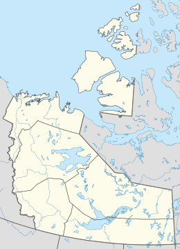
The Inuvialuit Settlement Region, abbreviated as ISR, located in Canada's western Arctic, was designated in 1984 in the Inuvialuit Final Agreement by the Government of Canada for the Inuvialuit people. It spans 90,650 km2 (35,000 sq mi) of land, mostly above the tree line, and includes several subregions: the Beaufort Sea, the Mackenzie River delta, the northern portion of Yukon, and the northwest portion of the Northwest Territories. The ISR includes both Crown Lands and Inuvialuit Private Lands.
The 4733d Air Defense Group is a discontinued United States Air Force organization. Its last assignment was with the 64th Air Division at Frobisher Bay, Baffin Island, Northwest Territories, Canada, where it was discontinued in 1958. The group was formed in 1957 when ADC assumed responsibility for air defense of Northern Canada from Northeast Air Command, including support for remote Distant Early Warning Line radar sites. It also controlled two squadrons operating radars at dispersed locations. It was discontinued in 1958 and its DEW Line support mission transferred to the 4601st Support Group and its radar squadrons to the 4732d Air Defense Group in Newfoundland.
Prince Alfred Bay is a waterway in Qikiqtaaluk Region, Nunavut, Canada. It lies off the western coast of Devon Island, forming a border of the Grinnell Peninsula, in the eastern high Arctic. Like Pioneer Bay to the south, it is an arm of Wellington Channel.

The Kendall Island Migratory Bird Sanctuary (KIBS) is a migratory bird sanctuary in the Northwest Territories, Canada. It is located on Kendall Island and its surrounding area in Mackenzie Bay at the northern tip of the Mackenzie River Delta. A seasonal sanctuary for more than 60,000 shorebirds, it is one of five bird sanctuaries within the Inuvialuit Settlement Region. The area that is now known as the KIBS is a traditional Inuvialuit whaling site.

Cape Parry is a headland in Canada's Northwest Territories. Located at the northern tip of the Parry Peninsula, it projects into Amundsen Gulf. The nearest settlement is Paulatuk, 100 km (62 mi) to the south, and Fiji Island is located 9 km (5.6 mi) to the west. Cape Parry was formerly accessible through Cape Parry Airport that was located at the Distant Early Warning Line. The airport was listed as abandoned after the closure of the DEW line site.

The Horton River is a river in Inuvik and Sahtu Regions, Northwest Territories and Kitikmeot Region, Nunavut, Canada. It is a tributary of the Beaufort Sea and hence part of the Arctic Ocean drainage basin. Only the first few kilometres from its source are within Nunavut.

The Canadian Arctic Rift System is a major North American geological structure extending from the Labrador Sea in the southeast through Davis Strait, Baffin Bay and the Arctic Archipelago in the northwest. It consists of a series of interconnected rifts that formed during the Paleozoic, Mesozoic and Cenozoic eras. Extensional stresses along the entire length of the rift system have resulted in a variety of tectonic features, including grabens, half-grabens, basins and faults.

The Anguniaqvia niqiqyuam Marine Protected Area (MPA) is located in the Inuvialuit Settlement Region in the Northwest Territories, Canada. The MPA was established in October 2016 to support habitat for important marine species, and to help protect the marine environment adjacent to the Cape Parry Migratory Bird Sanctuary. The area is culturally important to the Inuvialuit for subsistence hunting and fishing activities. The MPA was named in honour of Nelson Green, an Inuvialuit elder from Paulatuk.