Paso de los Libres

Last updated
Paso de los Libres
Iglesia San Jose, Paso de los Libres, Argentina.jpg
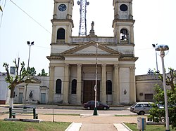
San José Church, Paso de los Libres
Argentina location map.svg
Red pog.svg
Paso de los Libres
Location of Paso de los Libres in Argentina
Coordinates: 29°43′S57°5′W / 29.717°S 57.083°W / -29.717; -57.083
Country Flag of Argentina.svg  Argentina
Province Bandera de la Provincia de Corrientes.svg  Corrientes
Department Paso de los Libres
FoundationSeptember 12, 1843
Founded by Joaquín Madariaga
Government
   Mayor Martín Ascúa (Frente de Todos (PJ))
Population
 (2010 census)
  Total
43,251
Demonym libreño/a
Time zone UTC−3 (ART)
CPA base
W3320
Dialing code +54 3772

Paso de los Libres is a city in the east of the province of Corrientes in the Argentine Mesopotamia. It had about 44,000 inhabitants at the 2010 census [INDEC], and is the head town of the department of the same name. The city is on the right-hand (western) shore of the Uruguay River, opposite the city of Uruguaiana, Rio Grande do Sul, Brazil, to which it is joined by a road and railway bridge (Paso de los Libres-Uruguaiana International Bridge). The area is served by Paso de los Libres Airport.

Contents

Climate

Climate data for Paso de los Libres (1991–2020, extremes 1961–present)
MonthJanFebMarAprMayJunJulAugSepOctNovDecYear
Record high °C (°F)42.5
(108.5)
41.8
(107.2)
39.6
(103.3)
36.7
(98.1)
34.4
(93.9)
31.5
(88.7)
31.4
(88.5)
35.9
(96.6)
36.4
(97.5)
38.3
(100.9)
41.6
(106.9)
42.0
(107.6)
42.5
(108.5)
Mean daily maximum °C (°F)32.2
(90.0)
31.1
(88.0)
29.5
(85.1)
26.0
(78.8)
21.8
(71.2)
19.6
(67.3)
19.0
(66.2)
21.8
(71.2)
23.2
(73.8)
25.8
(78.4)
28.6
(83.5)
31.0
(87.8)
25.8
(78.4)
Daily mean °C (°F)26.0
(78.8)
25.1
(77.2)
23.4
(74.1)
20.1
(68.2)
16.4
(61.5)
14.2
(57.6)
13.4
(56.1)
15.4
(59.7)
17.2
(63.0)
20.2
(68.4)
22.6
(72.7)
24.9
(76.8)
19.9
(67.8)
Mean daily minimum °C (°F)20.6
(69.1)
20.0
(68.0)
18.4
(65.1)
15.4
(59.7)
12.1
(53.8)
10.1
(50.2)
9.0
(48.2)
10.3
(50.5)
12.2
(54.0)
15.2
(59.4)
16.9
(62.4)
19.2
(66.6)
14.9
(58.8)
Record low °C (°F)10.2
(50.4)
8.7
(47.7)
5.5
(41.9)
3.2
(37.8)
−0.3
(31.5)
−4.0
(24.8)
−3.5
(25.7)
−3.0
(26.6)
0.2
(32.4)
2.8
(37.0)
6.0
(42.8)
8.1
(46.6)
−4.0
(24.8)
Average precipitation mm (inches)143.9
(5.67)
144.4
(5.69)
148.9
(5.86)
180.4
(7.10)
125.4
(4.94)
88.9
(3.50)
68.2
(2.69)
57.0
(2.24)
91.7
(3.61)
173.0
(6.81)
134.2
(5.28)
161.7
(6.37)
1,517.7
(59.75)
Average precipitation days (≥ 0.1 mm)7.67.97.48.38.17.66.75.77.69.77.58.092.1
Average relative humidity (%)69.772.574.677.581.582.679.774.973.273.568.468.174.7
Mean monthly sunshine hours 248.0209.1189.1174.0151.9120.0155.0170.5144.0182.9243.0244.92,232.4
Mean daily sunshine hours 8.07.46.15.84.94.05.05.54.85.98.17.96.1
Percent possible sunshine 56564751544340453448525048
Source 1: Servicio Meteorológico Nacional [1] [2] [3]
Source 2: UNLP (percent sun only 1971–1980) [4]

Consular representation

Monument to General Joaquin Madariaga and the 108 Valiants Monumento al General Madariaga, Paso de los Libres.jpg
Monument to General Joaquín Madariaga and the 108 Valiants

Brazil has a Consulate in Paso de los Libres. [5]

References

  1. "Estadísticas Climatológicas Normales - período 1991-2020" (in Spanish). Servicio Meteorológico Nacional. Retrieved 11 April 2023.
  2. Nacional, Servicio Meteorológico (2023). "Estadísticas Climatológicas Normales – período 1991–2020" (PDF) (in Spanish). Servicio Meteorológico Nacional. Archived from the original on 8 July 2023. Retrieved 31 July 2023.
  3. "Clima en la Argentina: Guia Climática por Paso de los Libres Aero". Caracterización: Estadísticas de largo plazo (in Spanish). Servicio Meteorológico Nacional. Retrieved 11 April 2023.
  4. "Datos bioclimáticos de 173 localidades argentinas". Atlas Bioclimáticos (in Spanish). Universidad Nacional de La Plata. Retrieved June 15, 2015.
  5. "Consulado do Brasil em Paso de los libres". Ministério das Relações Exteriores (in Portuguese). Retrieved 15 June 2022.