
Barpeta district {Pron:bə(r)ˈpeɪtə or bə(r)ˈpi:tə} is an administrative district in the state of Assam in India. The district headquarters are located at Barpeta. The district occupies an area of 3245 km² and has a population of 1,642,420
Cachardistrict is an administrative district in the state of Assam in India. After independence the undivided Cachar district was split into four districts in Assam: Dima Hasao district, Cachar district alongside Hailakandi and Karimganj.

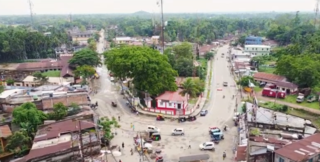
Nagaon, is a town and a municipal board in Nagaon district in the Indian state of Assam. It is situated 122.6 kilometres (76 mi) east of Guwahati.It is very beautiful and well developed town.
Lumding (Pron:/lʌmˈdɪŋ/) is a city with municipal board in Hojai district in the Indian state of Assam.
Rangia is a city and a municipal board in Kamrup rural district in the Indian state of Assam. It is the regional divisional headquarters of the Northeast Frontier Railway. It is situated 52 kilometres away from the state headquarters Dispur Guwahati and 39 kilometres from Jalukbari.

Jorhat is an administrative district of the Indian state of Assam situated in the central part of the Brahmaputra Valley. The district is bounded by Majuli on north, Nagaland state on the south, Charaideo on the east and Golaghat on the west. On the north of the district, the river Brahmaputra forms the largest riverine island of the world. The administrative seat is at Jorhat city.
Pandit Vishnu Narayan Bhatkhande was an Indian musicologist who wrote the first modern treatise on Hindustani classical music, an art which had been propagated for centuries mostly through oral traditions. During those earlier times, the art had undergone several changes, rendering the raga grammar documented in scant old outdated texts.

Dabra is town and a municipality in Gwalior district in the state of Madhya Pradesh, India located near NH-44 national highway. It serves the headquarters for both a tehsil and a coterminous community development block.

Baksa district is an administrative district in the Bodoland Territorial Region of Assam, one of the North-Eastern states of India. The administrative headquarters is at Mushalpur. Manas National Park is a part of this district.

Beauty Sharma Barua is a singer from Assam, India. She is one of the best-known and most respected Assamese folk music, Indian classical music, ghazal and bhajan singers of Assam. More popularly known as The Melody Queen of Assam and Beauty Baideu, she has recorded over a thousand songs for All India Radio, Doordarshan, albums and others. She has sung songs in over six regional Indian languages, though primarily in Assamese and Hindi. Beauty Barua married renowned writer and lyricist Dwijendra Mohan Sharma (1948–2006), called the Man with Melody in His Pen by The Daily Telegraph, in 1976.
Boko is a town located in Assam, in the Kamrup district in the Indian state of Assam. The town is composed of 139 villages. It is approximately 55 kilometers west of Guwahati.
Patharkandi is a township located in Karimganj district in the Indian state of Assam. It is 350 kilometres south of the state capital Guwahati and 32 kilometres south of the district headquarters Karimganj.
Teok is a small town situated in the Jorhat district of Assam, India. It is at a distance of about 20 kilometres from Jorhat city. The term 'Teok' is derived from the Tai languages. It literally means – ‘The place of milk and ghee’.
Agomani is a sub town area of Dhubri district (Assam) India. It is an area on the bank of Gangadhar River with historical significance. Agomani stands in a rural area, but it is not a revenue village. Some portions of the village of Kaldoba and Shernagar and total number of 41 villages in block formed the big area of Agomani. The area of Agomani is about 214 km2 Agomani is situated at a distance of 50 km to the North West of Dhubri, 12 km to the South of West Bengal border and 8 km to the North East of Bangladesh border. National Highway 17 passes through Agomani from North to South and the historical Gohain Kamal Ali (Road) runs from East to West. Both the roads crossed it the heart of Agomani. At the conjunction, there is a daily market and shops of all kinds are established. In 1963 a terrible Cyclone blew over Agomani and swept away many houses, lives and properties and the name of Agomani appeared on Newspaper, Radio & T.V and Agomani had been known to all over Assam.
Gyan Bharati Vidyalaya is one of the best English and Hindi medium & co-education school of North Kolkata. The school is located at 64 Nimtalla Ghat Street.
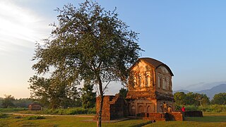
Sonai is a town in the Cachar district in the Indian state of Assam. It is also the name of a circle and block in the town. Government of Assam declared it as a municipal area on 2016 with 11 wards. The River Sonai flows through the town of Sonai joining with Barak River near Dungripar Village of Sonai. The Chandragiri Park and an Archeological site, a temple of Kachari Kingdom at Shivtilla (Changutilla) near Madhab Chandra Das College is a famous place to visit.

