Related Research Articles

Central Queensland is an imprecisely-defined geographical division of Queensland that centres on the eastern coast, around the Tropic of Capricorn. Its major regional centre is Rockhampton. The region extends from the Capricorn Coast west to the Central Highlands at Emerald, north to the Mackay Regional Council southern boundary, and south to Gladstone. The region is also known as Capricornia. It is one of Australia's main coal exporting regions.

Clermont is a rural town and locality in the Isaac Region, Queensland, Australia. In the 2021 census, the locality of Clermont had a population of 2,952 people.
Rolleston is a rural town and locality in the Central Highlands Region, Queensland, Australia. In the 2021 census, the locality of Rolleston had a population of 132 people.
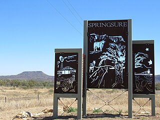
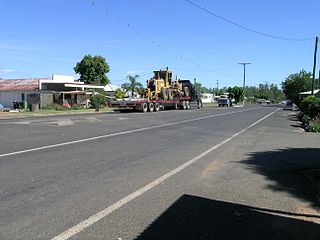
Springsure is a rural town and locality in the Central Highlands Region, Queensland, Australia. In the 2021 census, the locality of Springsure had a population of 950 people.

Capella is a rural town and locality in the Central Highlands Region, Queensland, Australia. In the 2021 census, the locality of Capella had a population of 974 people.
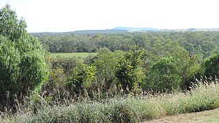
The Shire of Peak Downs was a local government area in the Central Highlands of Queensland, Australia, 320 km west of both Rockhampton and Mackay. On 15 March 2008 the shires of Duaringa, Emerald, Bauhinia and Peak Downs were amalgamated to form the Central Highlands Region.
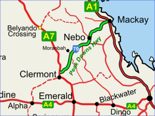
The Peak Downs Highway links the towns of Mackay and Clermont in the Australian state of Queensland. It represents the main link between Queensland's Whitsunday Coast and the Central West region of the state. The highway runs for a total length of 266 kilometres (165 mi), before joining the Gregory Highway south to Clermont, a total of 283 kilometres (176 mi). Major settlements served by this route include Walkerston, Nebo, Moranbah and Clermont.

Richmond is a rural town and locality in the Shire of Richmond, Queensland, Australia. In the 2021 census, the locality of Richmond had a population of 578 people.
Taroom is a town in the Shire of Banana and locality split between the Shire of Banana and the Western Downs Region in Queensland, Australia. In the 2021 census, Taroom had a population of 885 people.
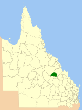
The Shire of Bauhinia was a local government area in Central Queensland, Queensland, Australia. The Shire, administered from the town of Springsure, covered an area of 23,649.6 square kilometres (9,131.2 sq mi), and existed as a local government entity from 1879 until 2008, when it was amalgamated with the Shires of Duaringa, Emerald and Peak Downs to form the Central Highlands Region.
The Shire of Belyando was a local government area in Central Queensland, Australia. The Shire, administered from the town of Clermont, covered an area of 30,281.3 square kilometres (11,691.7 sq mi), and existed as a local government entity from 1879 until 2008, when it was amalgamated with the Shires of Broadsound and Nebo to form the Isaac Region.

Nebo is a rural town and locality in the Isaac Region, Queensland, Australia. In the 2021 census, the locality of Nebo had a population of 857 people.

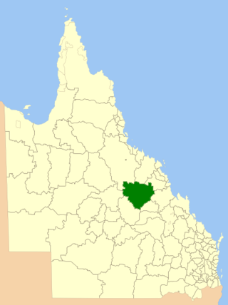
The Isaac Region is a local government area located in Central Queensland, Queensland, Australia created in March 2008 as a result of the report of the Local Government Reform Commission released in July 2007.

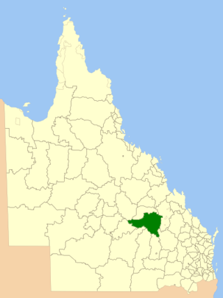
Central Highlands Region is a local government area in Queensland, Australia. In the 2021 census, the Central Highlands Region had a population of 27,836 people.

Kingsthorpe is a rural town and locality in the Toowoomba Region, Queensland, Australia. In the 2021 census, the locality of Kingsthorpe had a population of 2,159 people.

South West Queensland is a remote region in the Australian state of Queensland which covers 319,808 km2 (123,479 sq mi). The region lies to the south of Central West Queensland and west of the Darling Downs and includes the Maranoa district and parts of the Channel Country. The area is noted for its cattle grazing, cotton farming, opal mining and oil and gas deposits.

Winchester is a rural locality in the Isaac Region, Queensland, Australia. In the 2021 census, Winchester had "no people or a very low population".
Humboldt is a rural locality in the Central Highlands Region, Queensland, Australia. In the 2021 census, Humboldt had a population of 49 people.
Cheeseborough is a rural locality in the Central Highlands Region, Queensland, Australia. In the 2021 census, Cheeseborough had a population of 16 people.
Laglan is a rural locality in the Isaac Region, Queensland, Australia. In the 2021 census, Laglan had a population of 21 people.
References
- ↑ Whitworth, Robert Percy (1876). Baillière's Queensland gazetteer and road guide, containing the most recent and accurate information as to every place in the colony.
- ↑ de Satge, Oscar (1901). Pages from the journal of a Queensland squatter.
- ↑ "THE PEAK DOWNS STATIONS". The Brisbane Courier . Vol. XXVII, no. 4, 770. Queensland, Australia. 13 January 1873. p. 3. Retrieved 16 August 2024– via National Library of Australia.
- ↑ Kerr, James S. (1877). Geography of Queensland.
- ↑ "The Peak Range National Park". Isaac Regional Council. 2019.
- ↑ "Peak Range National Park Management Statement 2013" (PDF). Queensland Government (Department of National Parks, Recreation, Sport, and Racing). 2013.
- ↑ "ACME Mapper -- Satellite view".