Peary Channel (Greenland)

Last updated
Peary Channel
Peary Land map 1903.jpg
Robert Peary's 1903 Northern Greenland map section showing the Peary Channel and the geographical features he named in the area. [1]
Created by Robert E. Peary in 1892
In-universe information
Type Sound
Locations Nordenskiöld Fjord (Lincoln Sea)
Independence Fjord (Wandel Sea)

The Peary Channel (Danish : Peary-kanal) was a hypothetical sound or marine channel running from east to west separating Peary Land in northernmost Greenland from the mainland further south. [2]

Contents

The assumed existence of this channel and other errors in Peary's maps reportedly caused the tragic loss of the leading team of the Denmark expedition to Greenland's Northeast Coast 1906–1908. [3]

Geography

Robert Peary based his mapping of the area on observations he made in 1892 from Navy Cliff, located north of the Academy Glacier. From his perspective the channel allegedly connected the head of Independence Fjord in the east with the heads of Nordenskiöld Fjord and a parallel and misplaced "Chipp Inlet" in the west. There is a Chipp Sound that separates Sverdrup Island from smaller Elison Island, but it is located at the other end of Nordenskiöld Fjord, beyond its mouth. [4]

In Peary's map Independence Fjord was merely a short bay and further to the east Peary had drawn the coast of hypothetical "Academy Land" slanting southeastwards with the "East Greenland Sea" to the north. [1]

In the wake of the tragic outcome of the Denmark expedition's main team, many scholars were highly critical of Peary's cartographic errors, but Lauge Koch, who made detailed surveys of the area in the 1920s and 30s, took a more lenient view:

I would emphasize the high quality of Peary's sketch map, and the justification of his assumption of the insularity of the land he discovered — land which now properly bears his name. [5]

Map of Northern Ellesmere Island and far Northern Greenland. Operational Navigation Chart A-5, 3rd edition.jpg
Map of Northern Ellesmere Island and far Northern Greenland.

History

In 1907 Ludvig Mylius-Erichsen (1872–1907), the ill-fated leader of the Denmark expedition, searched in vain for the Peary Channel in 1907 and was misled to his death by existing maps. [6] Two years later Ejnar Mikkelsen (1880–1971), leader of the Alabama expedition, assumed that the channel existed, until he found Mylius-Erichsen's report in a cairn at the head of Danmark Fjord, where Mylius-Erichsen had written emphatically that:

... the Peary Channel does not exist. [7]

Finally Knud Rasmussen, during his First Thule Expedition, also realized in 1912 that Peary Land is a peninsula and corrections were made in the maps of northernmost Greenland printed after that date. [8]

Not knowing about the non-existence of the Peary Channel beforehand, the leaders of these three expeditions had planned eventually to use the Peary Channel to reach the NW coast of Greenland for their return journey. [8] Since 1892 it had taken a full twenty years after being put on the map to confirm that the Peary Channel had been a cartographic error. [9]

Related Research Articles

<span class="mw-page-title-main">Ludvig Mylius-Erichsen</span> Danish author, ethnologist, and explorer

Ludvig Mylius-Erichsen was a Danish author, ethnologist, and explorer, from Ringkøbing. He was most notably an explorer of Greenland.

<span class="mw-page-title-main">Danmark Fjord</span>

Danmark Fjord, also known as Denmark Sound, is a fjord in northeast Greenland. Administratively it belongs to the Northeast Greenland National Park.

<span class="mw-page-title-main">Peary Land</span> Peninsula in northern Greenland

Peary Land is a peninsula in northern Greenland, extending into the Arctic Ocean. It reaches from Victoria Fjord in the west to Independence Fjord in the south and southeast, and to the Arctic Ocean in the north, with Cape Morris Jesup, the northernmost point of Greenland's mainland, and Cape Bridgman in the northeast.

<span class="mw-page-title-main">Ejnar Mikkelsen</span> Danish polar explorer (1880–1971)

Ejnar Mikkelsen was a Danish polar explorer and writer. He is most known for his expeditions to Greenland.
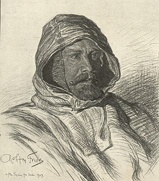
<span class="mw-page-title-main">Johan Peter Koch</span> Danish captain and explorer

Johan Peter Koch was a Danish captain and explorer of the Arctic dependencies of Denmark, born at Vestenskov. He was the uncle of the geologist Lauge Koch

<span class="mw-page-title-main">Independence Fjord</span>

Independence Fjord or Independence Sound is a large fjord or sound in the eastern part of northern Greenland. It is about 200 km (120 mi) long and up to 30 km (19 mi) wide. Its mouth, opening to the Wandel Sea of the Arctic Ocean is located at 82°15′N21°54′W.

Count Eigil Knuth was a Danish explorer, archaeologist, sculptor and writer. He is referred to as the Nestor of Danish polar explorers. His archaeological investigations were made in Peary Land and adjacent areas of High Arctic Greenland. Knuth was made a Knight of the Dannebrog.

<span class="mw-page-title-main">Frederick E. Hyde Fjord</span>

Frederick E. Hyde Fjord is a fjord in Peary Land, far northern Greenland.
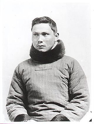
<span class="mw-page-title-main">Jørgen Brønlund</span> Greenlandic polar explorer

Jørgen Brønlund, was a Greenlandic polar explorer, educator, and catechist. He participated in two Danish expeditions to Greenland in the early 20th century.

Tobias Island is a small island off the northeastern coast of Greenland.
<span class="mw-page-title-main">King Frederick VI Coast</span> Region in Greenland

King Frederick VI Coast is a major geographic division of Greenland. It comprises the coastal area of Southeastern Greenland in Sermersooq and Kujalleq municipalities fronting the Irminger Sea of the North Atlantic Ocean. It is bordered by King Christian IX Land on the north and the Greenland Ice Sheet to the west.

<span class="mw-page-title-main">Denmark expedition</span>

The Denmark expedition, also known as the Denmark Expedition to Greenland's Northeast Coast, and as the Danmark Expedition after the ship, was an expedition to the northeast of Greenland in 1906–1908. Despite being overshadowed by the death in tragic circumstances of the main exploration team, including three of the expedition's leading members: Ludvig Mylius-Erichsen (1872–1907), Niels Peter Høeg Hagen (1877–1907) and Jørgen Brønlund (1877–1907), the Denmark expedition was not a failure. It achieved its main cartographic objectives and succeeded in exploring the vast region, drawing accurate charts of formerly unexplored coastlines and fjords, naming numerous geographic features, and gathering a wealth of scientific data.

<span class="mw-page-title-main">Cape Bridgman</span>

Cape Bridgman is a headland in the Wandel Sea, Arctic Ocean, northeast Greenland.
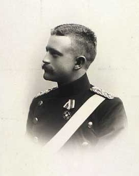
<span class="mw-page-title-main">Niels Peter Høeg Hagen</span> Danish military officer, polar explorer and cartographer

Niels Peter Høeg Hagen was a Danish military officer, polar explorer and cartographer. He participated and perished in the ill-fated Denmark expedition to NE Greenland in 1906.

<span class="mw-page-title-main">Mylius-Erichsen Land</span>

Mylius-Erichsen Land is a peninsula in King Frederick VIII Land, northeastern Greenland. Administratively it belongs to the NE Greenland National Park area.

Mount Wistar is a mountain in Peary Land, Northern Greenland. Administratively it is part of the Northeast Greenland National Park.
<span class="mw-page-title-main">Nordkrone</span> Mountain in Greenland

Nordkrone is a mountainous area in Peary Land, Northern Greenland. Administratively it is part of the Northeast Greenland National Park.

<span class="mw-page-title-main">Alabama Nunatak</span>

Alabama Nunatak is a nunatak in the King Frederick VIII Land area of northeastern Greenland. Administratively it is part of the Northeast Greenland National Park zone.

<span class="mw-page-title-main">Cape Clarence Wyckoff</span>

Cape Clarence Wyckoff, also known as Cape Wyckoff, is a broad headland in the Wandel Sea, Arctic Ocean, northernmost Greenland. Administratively it is part of the Northeast Greenland National Park.

<span class="mw-page-title-main">Cape Henry Parish</span>

Cape Henry Parish is a broad headland in the Wandel Sea, Arctic Ocean, northernmost Greenland. Administratively it is part of the Northeast Greenland National Park.

References

  1. 1 2 Robert Peary's 1900 explorations map "Polar Regions" published in 1903 in Robert E. Peary, Report of RE Peary, CE, USN, on Work Done in the Arctic in 1898–1902
  2. Koch, L. (1925). "The Question of Peary Channel". Geographical Review. 15 (4): 643–649. doi:10.2307/208628. JSTOR   208628.
  3. Spencer Apollonio, Lands That Hold One Spellbound: A Story of East Greenland, 2008 p. 85
  4. "Chipp Sund". Mapcarta. Retrieved 29 June 2019.
  5. Robert Edwin Peary Encyclopedia Arctica 15: Biographies
  6. G. Amdrup: Report on the Danmark Expedition to the North-East Coast of Greenland 1906–1908 . In: Meddelelser om Grønland 41, 1913, pp. 1–270
  7. Spencer Apollonio, Lands That Hold One Spellbound: A Story of East Greenland, 2008 p. 128
  8. 1 2 Spencer Apollonio, Lands That Hold One Spellbound: A Story of East Greenland, 2008 p. 139
  9. Iben Bjørnsson. The Misery of Peary's Elusive Channel, The Arctic Journal, 12 July 2016