
Peckham is a district of south London, England, within the London Borough of Southwark. It is 3.5 miles (5.6 km) south-east of Charing Cross. At the 2001 Census the Peckham ward had a population of 14,720.

The South Branch of the Ashuelot River is a 17.4-mile-long (28.0 km) river located in southwestern New Hampshire in the United States. It is a tributary of the Ashuelot River, itself a tributary of the Connecticut River, which flows to Long Island Sound.
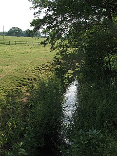
The River Croco is a small river in Cheshire in England. It starts as lowland field drainage west of Congleton, flows along the south edge of Holmes Chapel, and joins the River Dane at Middlewich. It is about 8 miles (13 km) long.

Peckham Rye is an open space and road in the London Borough of Southwark in London, England. The roughly triangular open space lies to the south of Peckham town centre. It is managed by Southwark Council and consists of two congruent areas, with Peckham Rye Common to the north and Peckham Rye Park to the south. The road Peckham Rye forms the western and eastern perimeter of the open space.
The Chepachet River is a river in the U.S. state of Rhode Island. It flows 5.2 miles (8.4 km). There are eight dams along the river's length.

The Nepaug River begins at the confluence of North Nepaug Brook and Cedar Swamp Brook about one mile (1.6 km) east of Bakerville, Connecticut.

Allen Mountain is located in Essex County, New York. It is part of the Marcy Group of the Great Range of the Adirondack Mountains, and is flanked to the north by Mount Skylight.

Lyon Mountain is a mountain located in Clinton County, New York, of which its peak is the highest point. The mountain is named for Nathaniel Lyon, an early settler of the area who moved from Vermont in 1803 and died circa 1850.

Otego Creek is a 32.7-mile-long (52.6 km) tributary of the Susquehanna River in Otsego County, New York. Otego Creek rises in the Town of Otsego and flows south through the Towns of Hartwick and Laurens, before joining the Susquehanna River southwest of the City of Oneonta.

Shrewsbury Peak is a mountain located in Rutland County, Vermont, in the Calvin Coolidge State Forest. The mountain is part of the Coolidge Range. Shrewsbury is flanked to the northwest by Little Killington.
The Passumpsic River is a 22.7-mile-long (36.5 km) tributary of the Connecticut River, in Vermont. Though primarily a Caledonia County river, it is the only river to flow through all three counties of the Northeast Kingdom.
Doubletop Mountain is a mountain located in Ulster County, New York. The mountain is part of the Catskill Mountains. Doubletop Mtn. is flanked to the northwest by Graham Mountain, to the east by Big Indian Mountain, and to the southwest by the Beaver Kill Range.
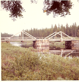
The Baker Branch Saint John River is a 48.0-mile-long (77.2 km) river. This river is a tributary of the Saint John River, flowing in the Maine North Woods, in Maine, in the Northeastern United States.

The Sebec River is a tributary of the Piscataquis River in Piscataquis County, Maine. From the outflow of Sebec Lake in Sebec, the river runs 10.0 miles (16.1 km) east and southeast to its confluence with the Piscataquis in Milo.

Spring Brook is a tributary of the Lackawanna River in Lackawanna County and Luzerne County, in Pennsylvania, in the United States. It is approximately 17 miles (27 km) long and flows through Covington Township, Spring Brook Township, and Moosic in Lackawanna County and Pittston Township in Luzerne County. The watershed of the stream has an area of 57.2 square miles (148 km2). It is designated as a High-Quality Coldwater Fishery and a Migratory Fishery above Interstate 476 and as a Coldwater Fishery and a Migratory Fishery below it. A section is also designated as Class A Wild Trout Waters. The stream's tributaries include Panther Creek, Plank Bridge Creek, Rattlesnake Creek, Green Run, Monument Creek, and Covey Swamp Creek. It has a relatively high level of water quality and is very slightly acidic, with a pH of 6.4 to 6.9.
Seboeis Lake extends from Lake View Plantation, Maine, north into Maine township 4, range 9. The lake is enclosed by rocky headlands and sandy beaches and contains several pine-covered islands. The inlet at the north end receives several tributaries from Long A township including Dean Brook, Jordan Brook, and West Seboeis Stream. Bear Brook flows into the northwest corner of the lake, and Northwest Pond overflows into the west side of the Lake. West Branch Sebois Stream overflows the east side of the lake through Dudley Rips into Endless Lake; and Endless Lake overflow reaches the Piscataquis River 15 miles (24 km) downstream, just 3 miles (4.8 km) upstream of the Piscataquis and Penobscot River confluence at Howland.

Millinocket Lake is 9 miles (14 km) northwest of Millinocket, Maine, and is drained by Millinocket Stream, which flows through the town of Millinocket into the West Branch Penobscot River 2 miles (3.2 km) south of town. The lake is fed by Sandy Stream, which drains the southeastern slopes of Mount Katahdin by tributaries including Roaring Brook, Avalanche Brook, Spring Brook, Beaver Brook, and Rum Brook. Sandy Stream is a good spawning habitat for rainbow smelt, which are a primary prey for lake trout and land-locked Atlantic salmon living in the lake.
Musquacook Stream is a tributary to the Allagash River in the North Maine Woods. The stream originates in a chain of lakes in Maine range 11 townships 10, 11 and 12. The flow sequence is from Clear Lake through Fifth Musquacook Lake into Fourth Musquacook Lake in Piscataquis County; and from Fourth Musquacook Lake through Third Musquacook Lake, Second Musquacook Lake, and First Musquacook Lake into the Allagash River Musquacook Deadwater in Aroostook County.
The Southeast Upsalquitch River is an eastern tributary of the Upsalquitch River in the northwest of New Brunswick, Canada, flowing through Northumberland County and Balmoral Parish and Addington Parish in Restigouche County.
