
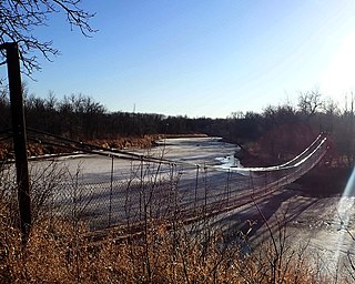
Lake Winnipeg is a very large, relatively shallow 24,514-square-kilometre (9,465 sq mi) lake in North America, in the province of Manitoba, Canada. Its southern end is about 55 kilometres (34 mi) north of the city of Winnipeg. Lake Winnipeg is Canada's sixth-largest freshwater lake and the third-largest freshwater lake contained entirely within Canada, but it is relatively shallow excluding a narrow 36 m (118 ft) deep channel between the northern and southern basins. It is the eleventh-largest freshwater lake on Earth. The lake's east side has pristine boreal forests and rivers that were in 2018 inscribed as Pimachiowin Aki, a UNESCO World Heritage Site. The lake is 416 km (258 mi) from north to south, with remote sandy beaches, large limestone cliffs, and many bat caves in some areas. Manitoba Hydro uses the lake as one of the largest reservoirs in the world. There are many islands, most of them undeveloped.
Lake Winnipegosis is a large (5,370 km2) lake in central North America, in Manitoba, Canada, some 300 km northwest of Winnipeg. It is Canada's eleventh-largest lake.

Lake of the Woods is a lake occupying parts of the Canadian provinces of Ontario and Manitoba and the U.S. state of Minnesota. Lake of the Woods is over 70 miles (110 km) long and wide, containing more than 14,552 islands and 65,000 miles (105,000 km) of shoreline. It is fed by the Rainy River, Shoal Lake, Kakagi Lake and other smaller rivers. The lake drains into the Winnipeg River and then into Lake Winnipeg. Ultimately, its outflow goes north through the Nelson River to Hudson Bay.

Northern Manitoba is a geographic and cultural region of the Canadian province of Manitoba. Originally encompassing a small square around the Red River Colony, the province was extended north to the 60th parallel in 1912. The region's specific boundaries vary, as "northern" communities are considered to share certain social and geographic characteristics, regardless of latitude.

Whiteshell Provincial Park is a provincial park in southeast Manitoba, approximately 120 kilometres (75 mi) east of the city of Winnipeg. The park is considered to be a Class II protected area under the IUCN protected area management categories. It is 275,210 hectares in size.
Beaver Creek Provincial Park is a provincial park on Lake Winnipeg near the mouth of Beaver Creek in the North Interlake Region of Manitoba, Canada.

Falcon Lake is located in the Whiteshell Provincial Park in southeastern Manitoba, Canada. The lake is about 152 kilometres east of Winnipeg on the Trans-Canada Highway near the Ontario border. The lake is named for Métis poet and songwriter Pierre Falcon (1793–1876). It appears on the Palliser map of 1865.
The Roseau River is a 214-mile-long (344 km) tributary of the Red River of the North, in southern Manitoba in Canada and northwestern Minnesota in the United States. Via the Red River, Lake Winnipeg and the Nelson River, it is part of the watershed of Hudson Bay.
Hollow Water First Nation is an Anishinaabe (Ojibwa) First Nation located on the east side of Lake Winnipeg, Canada, 75 km (47 mi) north of Pine Falls, Manitoba, and 217 km (135 mi) north of Winnipeg.
Sasagiu Rapids Provincial Park is a provincial park in Manitoba, Canada. It is located 85 kilometres south of Thompson on Highway 6, and covers all portions of unsubdivided Sections 10 and 15 Township 71 Range 7 W.P.M. shown on Plan 19853. It lies in the southwestern portion of the Mystery Lake Local Government District.

Split Lake is a lake on the Nelson River in Manitoba, Canada. The settlement of Split Lake is located on a peninsula on the northern shore. The lake is about 46 km long.
Camp Morton Provincial Park is a provincial park located on the west shore of Lake Winnipeg in Manitoba, Canada, about 6 kilometres (3.7 mi) north of Gimli. It is 250.23 hectares (0.9661 sq mi) in size. It was designated as a provincial park in 1974.
Bell Lake Provincial Park is a provincial park on the north shore of Bell Lake in the Porcupine Provincial Forest, Manitoba, Canada. It is 4 hectares in size. It was designated as a provincial park in 1974.
Manipogo Provincial Park is a provincial park on the shore of Lake Manitoba, approximately 50 km (31 mi), northeast of Dauphin, Manitoba. It is named after Manipogo, a lake monster reputed to live in the lake.
Long Point Ecological Reserve is an ecological reserve located on the west shore of Lake Winnipeg, Manitoba, Canada. It was established in 1987 under the Manitoba Ecological Reserves Act. It is 18.37 square kilometres (7.09 sq mi) in size.

Patricia Beach Provincial Park is a provincial park on the south-east shore of Balsam Bay on Lake Winnipeg in Manitoba, Canada. The park is located within the Rural Municipality of St. Clements and can be accessed by road from Manitoba Provincial Road 319. In the summer, people relax by the lake on the fine sand beach. During the winter, people using snowmobiles or quads to go ice fishing on Balsam Bay get on to the lake from the south parking lot.
Bernice Wildlife Management Area is a wildlife management area located northeast of Melita, Manitoba, Canada. It is 65 hectares (0.25 sq mi) in size.


