
Ballsbridge is an affluent neighbourhood of the city of Dublin, the capital of Ireland. The area is largely situated north and west of a three-arch stone bridge across the River Dodder, on the south side of the city. The sign on the bridge still proclaims it as "Ball's Bridge", in recognition of the fact that the original bridge on that location was built and owned by the Ball family, a well-known Dublin merchant family in the 1500s and the 1600s. The current bridge was built in 1791.

Blackrock is an affluent suburb of Dublin, Ireland, 3 km (1.9 mi) northwest of Dún Laoghaire. It is named after the local geological rock formation to be found in the area of Blackrock Park. In the late 18th century, the Blackrock Road was a common place for highway robberies. The Blackrock baths, provided for by the railway company in 1839, became popular in the 19th century but Blackrock is now a tourist destination.

Sandymount is a coastal suburb in the Dublin 4 district on the Southside of Dublin in Ireland.

The Local Government (Ireland) Act 1898 was an Act of the Parliament of the United Kingdom of Great Britain and Ireland that established a system of local government in Ireland similar to that already created for England, Wales and Scotland by legislation in 1888 and 1889. The Act effectively ended landlord control of local government in Ireland.

Galway City Council is the local authority of the city of Galway, Ireland. As a city council, it is governed by the Local Government Act 2001. The council is responsible for housing and community, roads and transportation, urban planning and development, amenity and culture, and environment. The council has 18 elected members. Elections are held every five years and are by single transferable vote. The head of the council has the title of mayor. The city administration is headed by a chief executive, Leonard Cleary. The council meets at City Hall, College Road, Galway.
Kilmainham is a south inner suburb of Dublin, Ireland, south of the River Liffey and west of the city centre. It is in the city's Dublin 8 postal district.

Ringsend is a southside inner suburb of Dublin, Ireland. It is located on the south bank of the River Liffey and east of the River Dodder, about two kilometres east of the city centre. It is the southern terminus of the East Link Toll Bridge. Areas included in Ringsend are the south side of the Dublin Docklands, and at the west end is the area of South Lotts and part of the Grand Canal Dock area. Neighbouring areas include Irishtown, Sandymount and the Beggars Bush part of Ballsbridge to the south, and the city centre to the west. A key feature of the area is the chimneys of Poolbeg power station.
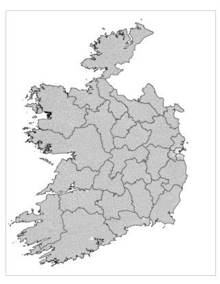
An electoral division is a legally defined administrative area in the Republic of Ireland, generally comprising multiple townlands, and formerly a subdivision of urban and rural districts. Until 1996, EDs were known as district electoral divisions in the 29 county council areas and wards in the five county boroughs. Until 1972, DEDs also existed in Northern Ireland. The predecessor poor law electoral divisions were introduced throughout the island of Ireland in the 1830s. The divisions were used as local-government electoral areas until 1919 in what is now the Republic and until 1972 in Northern Ireland.

Irishtown is an inner suburb of Dublin, Ireland. It is situated on the southside of the River Liffey, between Ringsend to the north and Sandymount to the south, and is to the east of the River Dodder.
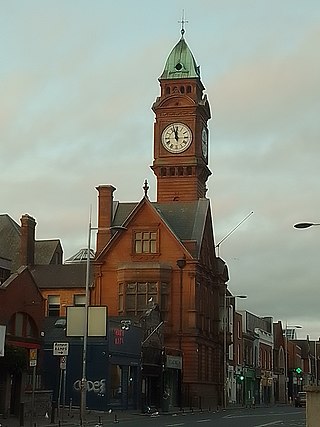
Town commissioners were elected local government bodies that existed in urban areas in Ireland from the 19th century until 2002. Larger towns with commissioners were converted to urban districts by the Local Government (Ireland) Act 1898, with the smaller commissions continuing to exist beyond partition in 1922. The idea was a standardisation of the improvement commissioners established in an ad-hoc manner for particular towns in Britain and Ireland in the eighteenth century. The last town commissioners in Northern Ireland were abolished in 1962. In the Republic of Ireland, the remaining commissions became town councils in 2002, and abolished in 2014.
Dublin Townships was a parliamentary constituency represented in Dáil Éireann, the lower house of the Irish parliament or Oireachtas from 1937 to 1948. The constituency elected 3 deputies to the Dáil, using proportional representation by means of the single transferable vote (PR-STV).
Rathmines and Rathgar is a former second-tier local government area within County Dublin. It was created as the Township of Rathmines in 1847. In 1862, its area was expanded and it became the Township of Rathmines and Rathgar. In 1899, it became an urban district. It was abolished in 1930, and its area absorbed into the city of Dublin.
Drumcondra, Clonliffe and Glasnevin is a former second-tier local government area within County Dublin. It was created as a township in 1878. In 1899, it briefly became an urban district, before being abolished in 1900, with its area absorbed into the city of Dublin.
The Local Government (Dublin) Act 1930 is an Act of the Oireachtas which altered the administration of County Dublin and Dublin City.
Killiney and Ballybrack is a former second-tier local government area within County Dublin. It was created as a township in 1866. In 1899, it became an urban district. It was abolished in 1900, with its area becoming part of the borough of Dún Laoghaire.
Local government in Dublin, the capital city of Ireland, is currently administered through the local authorities of four local government areas. The historical development of these councils dates back to medieval times.
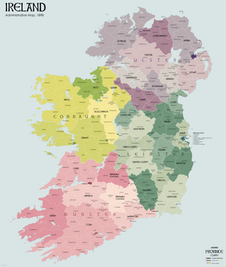
Urban and rural districts were divisions of administrative counties in Ireland created in 1899. These local government areas elected urban district councils (UDCs) and rural district councils (RDCs) respectively which shared responsibilities with a county council. They were established when all of Ireland was part of the United Kingdom.

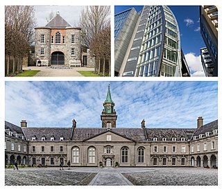
Pembroke Town Hall is a municipal building in Merrion Road, Ballsbridge, Dublin, Ireland. The building currently accommodates the offices of the City of Dublin Vocational Education Committee.

Blackrock Town Hall, Library and Technical Institute, is a municipal complex in Main Road, Blackrock, Dublin, Ireland. The complex consists of a series of buildings formerly known individually as Blackrock Town Hall, Blackrock Library and Blackrock Technical Institute, but now accommodates the Blackrock Further Education Institute as well as an enlarged public library.

Dalkey Castle, formerly known as Goat Castle, is a medieval structure in Castle Street, Dalkey, Dublin, Ireland. The complex currently accommodates the Dalkey Heritage Centre, which is in the castle itself, and Dalkey Town Hall, which is formed by a single storey extension behind the original building.


