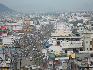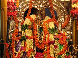
East Godavari is a district in the Coastal Andhra region of Andhra Pradesh, India. Its district headquarters is at Rajamahendravaram.

Rajahmundry, officially known as Rajamahendravaram, is a city in the Indian state of Andhra Pradesh and district headquarters of East Godavari district. It is the seventh most populated city in the state. During British rule, the district of Rajahmundry was created in the Madras Presidency in 1823. It was reorganised in 1859 and bifurcated into the Godavari and Krishna districts. Rajahmundry was the headquarters of Godavari district, which was further bifurcated into East Godavari and West Godavari districts in 1925. It is administered under Rajahmundry revenue division of the East Godavari district. The city is known for its floriculture, history, culture, agriculture, economy, tourism, and its heritage. It is known as the "Cultural Capital of Andhra Pradesh".

Kovvur is a town in the East Godavari district of the Indian state of Andhra Pradesh. It is a municipality and the mandal headquarters of Kovvur mandal in Kovvur revenue division.

Gajuwaka is a major residential area of Visakhapatnam City, India. This neighborhood of Visakhapatnam is considered the biggest shopping district in Andhra Pradesh by revenue. Though conceived as a residential locality, it is now one of the principal shopping districts of the city. The Gajuwaka area of Visakhapatnam has the highest per capita income in Andhra Pradesh.
Mandapeta was originally called "Mandavyapuram", which came from Sage Mandukya. Mandapeta is a second-grade municipality established on October 1, 1958 in Dr. B.R. Ambedkar Konaseema district in the Indian state of Andhra Pradesh. It is located at mean elevation of about 15.48 msl at 16.520 N, 81.560 E.

Rampachodavaram is a census town in Alluri Sitharama Raju district of the Indian state of Andhra Pradesh. It is located in Rampachodavaram mandal of Rampachodavaram revenue division. Rampachodavaram is known for its dense jungle and waterfalls which can be accessed by road transport only.

Narasapuram is a town in West Godavari district of the Indian state of Andhra Pradesh. It is a municipality and mandal headquarters of Narasapuram mandal in Narasapuram revenue division. The city is situated on the banks of the Vasista Godavari River. The lace industry is prevalent in the city and its surroundings.
Kankipadu is a suburb of Vijayawada and a in Krishna District of the Indian state of Andhra Pradesh. It is also the mandal headquarters of Kankipadu mandal in Vuyyuru revenue division.
Kotabommali is a mandal in the Srikakulam district of the Indian state of Andhra Pradesh.

Narasannapeta is a census town in Srikakulam district of the Indian state of Andhra Pradesh. It is the mandal headquarters of Narasannapeta mandal in Srikakulam revenue division. 43 villages are there under the administrative division of Narasannapeta.

Pathapatnam is a town in Srikakulam district of the Indian state of Andhra Pradesh. It is located in Pathapatnam mandal of Palakonda revenue division. Pathapatnam is located on the border of Srikakulam district of Andhra Pradesh and Gajapati district of Odisha. Parlakhemundi, the headquarters of Gajapati District, can be considered as twin town of Pathapatnam because of its close proximity. It is located around 65 km from srikakulam. It was the old capital of Paralakhemundi Gajapati Maharajah of his erstwhile kingdom.
Alamuru is a village in Dr. B.R. Ambedkar Konaseema district in the state of Andhra Pradesh in India.
Chintalapudi is a town municipality, constituency and mandal headquarters in Eluru District of the Indian state of Andhra Pradesh. Chintalapudi is one of oldest town in the Andhra Pradesh, but still it is under developed. There is no proper road and transport to the town. People of the town still struggling to reach the nearest cities. There is lot of history around this town, dates back to 600BC to 300BC.The human movement here from 2300 years ago. The village named Jeelakargudem is located 15 km away from here and contains some of the oldest ancient monuments in Buddhism. The carvings on the Sandrock hill are really surprising. According to the ASI and some historians the historical site belongs to Ashoka reign. The historical site is one of the best tourist attraction in the locality, but lack of proper care from government and people the site is ruining. This region is also famous for cultivation of Oil Plam. It's nearly contributes 50% to 60% of total district cultivation of Oil Palm. According to some sources this region contains a vast coal reserves in the country. Your can find more on this in some popular news journals.
Peravali is a village in East Godavari district of the Indian state of Andhra Pradesh. The nearest railway station is Tanuku (TNKU) located at a distance of 7.25 Km. Postal index code of this village is 534328
Khandavalli is a village in Peravali mandal in West Godavari district, Andhra Pradesh. Postal Index Code of this village is 534330.
Garikaparru is a village in Thotlavalluru mandal, located in Krishna district of Andhra Pradesh, India. The main occupation in the village is agriculture. Paddy and sugarcane are the most grown crops.

Denduluru is a village in the Eluru district of the Indian state of Andhra Pradesh. It is located on the north-east side of district headquarters Eluru at a distance of 11 km. It is a member of the Eluru revenue division. The Bhimalingadibba or the mounds are one of the centrally protected monuments of national importance.
Alamuru Mandal is one of the 22 mandals in Dr. B.R. Ambedkar Konaseema district of Andhra Pradesh. As per census 2011, there are 16 villages.
Mandapeta Mandal is one of the 22 mandals in Dr. B.R. Ambedkar Konaseema districtof Andhra Pradesh. As per census 2011, there are 1 town and 13 villages.
Ravulapalem mandal is one of the 22 mandals in Dr. B.R. Ambedkar Konaseema district of Andhra Pradesh. As per census 2011, there are 11 villages in this mandal.


