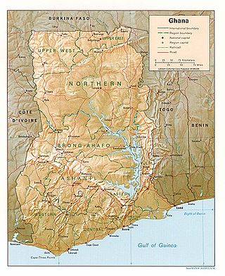
Ghana is a West African country in Africa, along the Gulf of Guinea.

Transport in Ghana is accomplished by road, rail, air and water. Ghana's transportation and communications networks are centered in the southern regions, especially the areas in which gold, cocoa, and timber are produced. The northern and central areas are connected through a major road system.

Accra is the capital and largest city of Ghana, located on the southern coast at the Gulf of Guinea, which is part of the Atlantic Ocean. As of 2021 census, the Accra Metropolitan District, 20.4 km2 (7.9 sq mi), had a population of 284,124 inhabitants, and the larger Greater Accra Region, 3,245 km2 (1,253 sq mi), had a population of 5,455,692 inhabitants. In common usage, the name "Accra" often refers to the territory of the Accra Metropolitan District as it existed before 2008, when it covered 199.4 km2 (77.0 sq mi). This territory has since been split into 13 local government districts: 12 independent municipal districts and the reduced Accra Metropolitan District (20.4 km2), which is the only district within the capital to be granted city status. This territory of 199.4 km2 contained 1,782,150 inhabitants at the 2021 census, and serves as the capital of Ghana, while the district under the jurisdiction of the Accra Metropolitan Assembly proper (20.4 km2) is distinguished from the rest of the capital as the "City of Accra".

Kotoka International Airport is an international airport in Accra, the capital of Ghana. The airport is operated by Ghana Airports Company Limited (GACL), which has its offices on the airport property. It is the sole international airport in Ghana.

Tamale, officially called Tamale Metropolitan Area is the capital city of the Northern Region of Ghana. Tamale is Ghana's third largest city. It has a projected population of 950,124 according to the Tamale Metropolitan Assembly Official Website. It is the fastest-growing city in West Africa. It is located 600 km (370 mi) north of Accra. Most residents of Tamale are Muslims and Dagombas by tribe, as reflected by the multitude of mosques in Tamale, most notably the Central Mosque, Afa Ajura Mosque, Afa Basha mosque and The Ahmadiyyah Muslim mission Mosque.
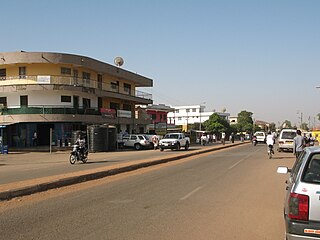
Wa is a town and the capital of Wa Municipal District and the Upper West Region of northern Ghana. Wa had a 2012 settlement population of 102,446. Features of the town include several churches and mosques, the Wa-Na Palace, the St. Andrew's Catholic cathedral, the University for Development Studies (UDS), a museum, a nearby hippopotamus sanctuary in Wicheau, the mushroom rock In Jirapa and the ants hill at Nanvielle. The geography of Wa is notable for the dramatic monadnock Ombo Mountain, which is located around Kaleo and visible from much of the Wa town. Other notable towns around Wa region include Naaha and Ga.

The Eastern Region is located in south Ghana and is one of the sixteen administrative regions of Ghana. Eastern region is bordered to the east by the Lake Volta, to the north by Bono East Region and Ashanti region, to the west by Ashanti region, to the south by Central region and Greater Accra Region. Akans are the dominant inhabitants and natives of Eastern region and Akan, Ewe, Krobo, Hausa and English are the main spoken languages. The capital town of Eastern Region is Koforidua.The Eastern region is the location of the Akosombo dam and the economy of the Eastern region is dominated by its high-capacity electricity generation. Eastern region covers an area of 19,323 square kilometres, which is about 8.1% of Ghana's total landform.

The Greater Accra Region has the smallest area of Ghana's 16 administrative regions, occupying a total land surface of 3,245 square kilometres. This is 1.4 per cent of the total land area of Ghana. It is the most populated region, with a population of 5,455,692 in 2021, accounting for 17.7 per cent of Ghana's total population.
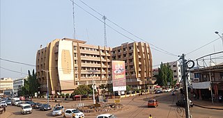
Sunyani is a city and the capital town of the Bono Region and the Sunyani Municipal of Ghana. Sunyani had a population of 74,240 at the 2010 population and housing census. The city consists mainly of the Bonos by tribe.

Donkorkrom is a town in south Ghana and is the capital of Kwahu Afram Plains North district, a district in the Eastern Region of Ghana.
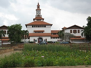
Legon, a suburb of the Ghanaian city Accra, is situated about 12 kilometres (7.5 mi) north-east of the city center in the Ayawaso West Municipal District, a district in the Greater Accra Region of Ghana. Legon is home to the main campus of the University of Ghana. Ghanaians loosely refer to the University of Ghana simply as "Legon". Legon is also home to a few of Ghana's well known educational institutions such as Presbyterian Boys' Secondary School (PRESEC-Legon), Ghana Institute of Management and Public Administration and the Institute of Professional Studies. Legon is adjacent to one of the most prestigious residential suburbs of Accra - East Legon and only about 20 minutes drive from the Kotoka International Airport.
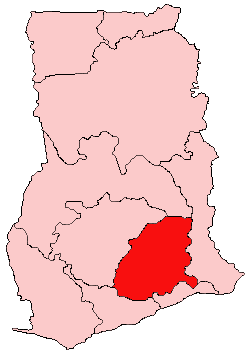
Kwahu refers to an area and group of people that live in Ghana and are part of the Twi-speaking Akan group. The area has been dubbed Asaase Aban, or the Natural Fortress, in view of its position as the highest habitable elevation in the country. Kwahu lies in the Eastern Region of Ghana, on the west shore of Lake Volta. The Kwahus share the Eastern Region with their fellow Akans: the Akyem and Akuapem, as well as the Adangbe-Krobos. A significant migrant population from the Northern and Volta Regions and some indigenous Guans from the bordering Oti and Brong East Regions live in the Afram Plains area. They work as traders, farm-hands, fisherfolk, and caretakers in the fertile waterfront 'melting pot'.

Nkawkaw is a town in southern Ghana and is the capital of Kwahu East District, an area in the Eastern Region of south Ghana. Nkawkaw has a 2013 settlement population of 61,785 people. Nkawkaw is also described as a city in a valley as it the gateway to ascend the Kwahu mountains

South Dayi District is one of the eighteen districts in Volta Region, Ghana. Originally it was formerly part of the then-larger Kpando District on 10 March 1989, until the southern part of the district was split off by a decree of president John Agyekum Kufuor on 19 August 2004 to create South Dayi District; thus the remaining part has been retained as Kpando District. The district assembly is located in the western part of Volta Region and has Kpeve as its capital town.
Articles related to Ghana include:

The city of Accra, capital of Ghana, is officially divided into five geographical regions: North, West, East, Central and south - and eleven sub-metropolitan areas: Osu Klottey, Ablekuma North, Ablekuma South, Ayawaso Central, Ayawaso East, Ayawaso North, Ayawaso West, La, Okaikoi North, Okaikoi South, Abossey Okai, and Ashiedu Keteke. The word "neighbourhood" can take on various official and unofficial meanings. There are, however, 50 official neighbourhoods within the city limits of Accra.
East Legon is a town in the Accra Metropolitan district, a district of the Greater Accra Region of Ghana.
Mark Assibey-Yeboah is a Ghanaian politician and member of the Sixth and Seventh Parliaments of the Fourth Republic of Ghana, representing the New Juaben South Constituency in the Eastern Region on the ticket of the New Patriotic Party (NPP).

Fodoa Community Day Senior High School also known as FOSEC is a public senior high school located in Kwahu West Municipal, in the Eastern Region of Ghana. Fodoa Community Day Senior High School was commissioned on Wednesday, 26 October 2016. The school has been in existence for nearly seven years now. Since its inception, the school has been a purely day school and single track with no boarding facilities. However, there are private hostel facility that accommodates most of the students of the school: one boys' hotel and one girls' hostel. The school is located along the Kumasi-Accra high way about 34 km from Nkawkaw. The school is one of the centers for BECE in the Kwahu West Municipal

Mövenpick Ambassador Hotel, formerly known as the Ambassador Hotel, is a five-star luxury hotel located in Accra, the capital of Ghana, set in West Ridge, seven kilometres (4.3 mi) from Kotoka International Airport.


