Eastern Region | |
---|---|
![]() Tourists enjoying themselves at Umbrella Rock | |
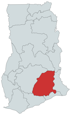
![]() Location of Eastern Region in Ghana | |
Country | Ghana |
Capital | Koforidua |
Districts | 26 |
Government | |
• Regional Minister | Rita Akosua Adjei Away [1] |
Area | |
• Total | 19,323 km2 (7,461 sq mi) |
• Rank | Ranked 6th |
Population (2021 Census) | |
• Total | 2,925,653 |
• Rank | Ranked 3rd |
• Density | 150/km2 (390/sq mi) |
GDP (PPP) | |
• Year | 2013 |
• Per capita | $5,150 |
GDP (Nominal) | |
• Year | 2013 |
• Per capita | $2,500 |
Time zone | GMT |
Area code | 034 |
ISO 3166 code | GH-EP |
HDI (2022) | 0.649 [2] medium · 2th |
The Eastern Region is located in the Eastern part of Ghana and is one of the sixteen administrative regions of Ghana. Eastern region is bordered to the east by the Lake Volta, to the north by Bono East Region and Ashanti region, to the west by Ashanti region, to the south by Central region and Greater Accra Region. Akans are the dominant inhabitants and natives of Eastern region and Akan, Ewe, Krobo, Hausa and English are the main spoken languages. The capital town of Eastern Region is Koforidua. The Eastern region is the location of the Akosombo dam and the economy of the Eastern region is dominated by its high-capacity electricity generation. Eastern region covers an area of 19,323 square kilometres, which is about 8.1% of Ghana's total landform. [3]
High-capacity electricity generation Akosombo Hydroelectric Project contains three main tributaries: the Black Volta; the White Volta and the Red Volta and the Akosombo Hydroelectric Project flows into the Gulf of Guinea on the Atlantic Ocean. [4] The Akosombo Dam was completed in 1965 as part of the Volta River Project. [5] The dam measures at 440 ft (134 m) above ground level. The large electric power generating capacity is 912 megawatts. The dam helps supplies electricity to an economically important town called Tema. [6]
The region also boasts of some quality basic schools one which is Hecta School Complex, established in 1962, and others.
Achiase District was carved out of the existing Birim South District and inaugurated on 22 February 2019. [7] The Afram Plains District has since been split into two and renamed as Kwahu Afram Plains North District with its capital being Donkorkrom and Kwahu Afram Plains South District with its capital also being Tease.[ citation needed ] [8] [9] The Akuapim South District, East Akim District and Kwahu West Districts have been upgraded to Municipal status with the addition of Birim Central Municipal District which is entirely new. Other new districts include Akyemansa District and Kwahu East District. The Manya Krobo District has been split into Lower Manya Krobo District and Upper Manya Krobo District. [10]
The political administration of the region is through the local government system. Under this administration system, the region is divided into 33 MMDA's (mMDAsMd by a presiding member elected from among the members themselves. The MMDA's were increased from 9 to 15 in 1988; then from 15 to 17 in 2004; then from 17 to 21 in 2008; then from 21 to 26 in 2012; and recently from 26 to 33 in 2018. The current list is as follows:
![]() | This section needs expansion. You can help by adding to it. (July 2021) |
# | Citizen | Settlement |
---|---|---|
1 | Nana Akufo-Addo | Kibi |
2 | Seth Terkper | Krobo Odumase |
3 | George Boateng | Nkawkaw |
4 | Dr. J. B. Danquah | Kibi |
5 | Samuel Wilberforce Awuku-Darko | Suhum |
6 | Frederick W. K. Akuffo | Akropong |
7 | Thomas Teye Partey | Krobo Odumase |
8 | Okyehemaa Nana Dokua Adutwumwaa | Kibi |
9 | Osagyefuo Amoatia Ofori Panin | Kibi |
10 | Ken Ofori-Atta | Kibi |
11 | Samuel Atta Akyea | Kibi |
12 | Hackman Owusu Agyemang | Koforidua |