
Ghana is a West African country in Africa, along the Gulf of Guinea.

Tamale, officially called Tamale Metropolitan Area is the capital city of the Northern Region of Ghana. Tamale is Ghana's third largest city. It has a projected population of 950,124 according to the Tamale Metropolitan Assembly Official Website. It is the fastest-growing city in West Africa. It is located 600 km (370 mi) north of Accra. Most residents of Tamale are Muslims and Dagombas by tribe, as reflected by the multitude of mosques in Tamale, most notably the Central Mosque, Afa Ajura Mosque, Afa Basha mosque and The Ahmadiyyah Muslim mission Mosque.

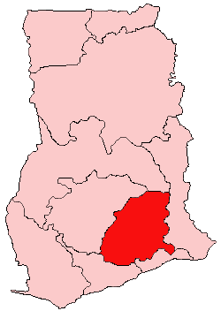
The Eastern Region is located in south Ghana and is one of the sixteen administrative regions of Ghana. Eastern region is bordered to the east by the Lake Volta, to the north by Bono East Region and Ashanti region, to the west by Ashanti region, to the south by Central region and Greater Accra Region. Akans are the dominant inhabitants and natives of Eastern region and Akan, Ewe, Krobo, Hausa and English are the main spoken languages. The capital town of Eastern Region is Koforidua.The Eastern region is the location of the Akosombo dam and the economy of the Eastern region is dominated by its high-capacity electricity generation. Eastern region covers an area of 19,323 square kilometres, which is about 8.1% of Ghana's total landform.

The Greater Accra Region has the smallest area of Ghana's 16 administrative regions, occupying a total land surface of 3,245 square kilometres. This is 1.4 per cent of the total land area of Ghana. It is the second most populated region, before the Ashanti Region, with a population of 5,455,692 in 2021, accounting for 17.7 per cent of Ghana's total population.
Kwahu refers to an area and group of people that live in Ghana and are part of the Twi-speaking Akan group. The area has been dubbed Asaase Aban, or the Natural Fortress, in view of its position as the highest habitable elevation in the country. Kwahu lies in the Eastern Region of Ghana, on the west shore of Lake Volta. The Kwahus share the Eastern Region with their fellow Akans: the Akyem and Akuapem, as well as the Adangbe-Krobos. A significant migrant population from the Northern and Volta Regions and some indigenous Guans from the bordering Oti and Brong East Regions live in the Afram Plains area. They work as traders, farm-hands, fisherfolk, and caretakers in the fertile waterfront 'melting pot'.

Afram Plains District is a former district that was located in Eastern Region, Ghana. Originally created as an ordinary district assembly in 1988 when it was known as Kwahu North District, which was created from the former Kwahu District Council, until it was later renamed to become Afram Plains District in 1993. However on 19 June 2012, it was split off into two new districts: Kwahu Afram Plains North District and Kwahu Afram Plains South District. The district assembly was located in the northern part of Eastern Region and had Donkorkrom as its capital town.
Agogo is a town in the Asante Akim North Municipal District of the Ashanti Region of Ghana. Agogo is approximately 80 kilometers east of Kumasi, the capital of the Ashanti Region, and had a population of 28,271 in the 2000 census. Computer projections estimate that the 2007 population was 32,859.
The Roman Catholic Diocese of Keta–Akatsi is a suffragan Latin diocese in the Ecclesiastical province of Accra in Ghana, yet still depends on the missionary Roman Congregation for the Evangelization of Peoples.
Pepease is the second largest town in the Kwahu East District, in the Eastern Region of Ghana.

St. Peter's Senior High School, or PERSCO, is a Roman Catholic boys' senior high school in the Eastern Region of Ghana. The school was established in 1957 by the Divine Word Missionaries (SVD). The school is located in the town of Nkwatia Kwahu on the Kwahu Ridge.

Kwahu Afram Plains North District is one of the thirty-three districts in Eastern Region, Ghana. Originally it was formerly part of the then-larger Kwahu North District in 1988, until the western part of the district was split off to create Kwahu Afram Plains South District on 19 June 2012; thus the remaining part has been renamed as Kwahu Afram Plains North District. The district assembly is located in the northern part of Eastern Region and has Donkorkrom as its capital town.
Kwahu West Municipal District is one of the thirty-three districts in Eastern Region, Ghana. Originally it was formerly part of the then-larger Kwahu South District in 1988, which was created from the former Kwahu District Council, until the southwest part of the district was split off to create Kwahu West District in August 2004; which it later was elevated to municipal district assembly status on 1 July 2007 to become Kwahu West Municipal District. The municipality is located in the western part of Eastern Region and has Nkawkaw as its capital town.

Dansoman is a suburban town in the Greater Accra Region of Ghana, located near Accra and Takoradi district of the Accra Metropolitan Area. The town is known for being one of the largest estates in West Africa.
The Apostolic Vicariate of Donkorkrom is a Latin Catholic missionary pre-diocesan jurisdiction in Eastern Ghana.
Ita was an ancient city and former bishopric in Roman North Africa, now a Latin Catholic titular see in Algeria.
Adeemmra is a village in the Eastern Region of Ghana. The village is part of the Kwahu Afram Plains North District with Donkorkrom as the capital. Honourable Betty Krosby Mensah is the member of Parliament for the constituency. The population of Adiemmra according to the 2010 census was 1039.

Fodoa Community Day Senior High School also known as FOSEC is a public senior high school located in Kwahu West Municipal, in the Eastern Region of Ghana. Fodoa Community Day Senior High School was commissioned on Wednesday, 26 October 2016. The school has been in existence for nearly four years now. Since its inception, the school has been a purely day school and single track with no boarding facilities. However, there is a private girls-hostel facility that accommodates most of the female students of the school. The school is located along the Kumasi-Accra high way about 34 km from Nkawkaw. The school is one of the centers for BECE in the Kwahu West Municipal
Erasmus Isaac Kwesi Preko was a Ghanaian politician. He was a minister of state and a member of parliament during the first republic. He was the Minister of Fuel and Power from 1965 to 1966, the member of parliament for the Kwahu North constituency from 1954 to 1965, and later the member of parliament for the Afram constituency from 1965 to 1966.

Opare Leticia, known by her stage name Gyaldem Tish is a Ghanaian Afropop, dancehall and reggae singer.
Kwahu District is a former district council that was located in Eastern Region, Ghana. Originally created as an ordinary district assembly in 1975. However, on 10 March 1989, it was split off into two new district assemblies: Kwahu South District and Kwahu North District. The district assembly was located in the northern part of Eastern Region and had Mpraeso as its capital town.

