
Eagle Pass is a mountain pass through the Gold Range of the Monashee Mountains in British Columbia, Canada. It divides the Columbia River drainage basin from that of the Fraser River.

The Columbia-Shuswap Regional District is a regional district in the Canadian province of British Columbia, located in the Southern Interior region on the Trans-Canada Highway between Vancouver and Calgary, Alberta. The regional district borders the Province of Alberta across the Rocky Mountains.

Shuswap Lake is a lake located in south-central British Columbia, Canada that drains via the Little River into Little Shuswap Lake. Little Shuswap Lake is the source of the South Thompson River, a branch of the Thompson River, a tributary of the Fraser River. It is at the heart of a region known as the Shuswap Country or "the Shuswap", noted for its recreational lakeshore communities including the city of Salmon Arm. The name "Shuswap" is derived from the Shuswap or Secwepemc First Nations people, the most northern of the Interior Salish peoples, whose territory includes the Shuswap. The Shuswap call themselves /ʃǝxwépmǝx/ in their own language, which is called /ʃǝxwepmǝxtʃín/, but the ethnonym’s original meaning is now lost.

Sicamous is a district municipality in British Columbia located adjacent to the Trans-Canada Highway at the Highway 97A junction, where Mara Lake empties into Shuswap Lake via a short narrows. Sicamous is a resort town about halfway between Calgary and Vancouver and is the eastern gateway to the Apple Country. With 341 km (212 mi) of shoreline, it styles itself as the houseboat capital of Canada. It has a population of 3,166.
The basin of the Shuswap River lies northeast of the Okanagan Valley in British Columbia, originating in the central Monashee Mountains. It is the upper part of the drainage better known to British Columbians as belonging to Shuswap Lake and the South Thompson River. The river's drainage basin is over 1,969 square kilometres (760 sq mi) in area.
Mabel Lake Provincial Park is a provincial park in the Monashee Mountains of British Columbia, Canada, located on the east side of Mabel Lake, which is part of the Shuswap River system. Created on December 21, 1972, at approximately 182 ha., the park was expanded in 2000 to approximately 187 ha.

Monashee Provincial Park is a provincial park in British Columbia, Canada. It is located in the central Monashee Mountains between the Arrow Lakes and the upper Shuswap River drainage, just east of Sugar Lake. It is a remote Grizzly habitat that is a walk-in only. Mount Fosthall is the highest peak in the area and can be hiked in a day. In addition to hiking and alpinism other activities include fishing.
Shuswap Lake Marine Provincial Park is an 896-hectare provincial park in British Columbia, Canada, comprising 991 ha. The Park has a variety of amenities including boat launch ramps, picnic areas, and 27 campsites around the perimeter of Shuswap Lake. The lake's name and that of the surrounding Shuswap Country is from the Shuswap people (Secwepemc), the most northern of the Salishan speaking people.
Shuswap River Islands Provincial Park is a provincial park in British Columbia, Canada. The park was established as a result of the Okanagan-Shuswap Land and Resource Management Plan. Size: 1.85 km².
Skookumchuck Rapids Provincial Park is a provincial park in British Columbia, Canada, located on the Shuswap River just below the outlet of Mabel Lake. This park was established as a result of the Okanagan-Shuswap Land and Resource Management Plan.
The Skeetchestn Indian Band is a member of the Secwepemc (Shuswap) Nation, located in the Central Interior region of the Canadian province of British Columbia. Its main Indian reserve is located at Savona, British Columbia. The reserve was set up in the 1860s when the government of the then-Colony of British Columbia established an Indian Reserve system. The Skeetchestn is a member government of the Shuswap Nation Tribal Council.
The Quesnel Highland is a geographic area in the Central Interior of the Canadian province of British Columbia. As defined by BC government geographer in Landforms of British Columbia, an account and analysis of British Columbia geography that is often cited as authoritative, the Highland is a complex of upland hill and plateau areas forming and defined as being the buffer between the Cariboo Plateau and the Cariboo Mountains, as a sort of highland foothills along the eastern edge of the Interior Plateau running southeast from a certain point southeast of the city of Prince George to the Mahood Lake area at the southeast corner of the Cariboo. Beyond Mahood Lake lies another separately classified area dubbed by Holland the Shuswap Highland which spans similar terrain across the North Thompson and Shuswap Lake-Adams River drainage basins, forming a similar upland-area buffer between the Thompson Plateau and the Monashee Mountains. A third area, the Okanagan Highland, extends from the southern end of the Shuswap Highland in the area of Vernon and Enderby in the northern Okanagan region into Washington State, and also abuts the Monashee Mountains.

The Shuswap Highland is a plateau-like hilly area of 14,511 km2 (5,603 sq mi) in British Columbia, Canada. It spans the upland area between the Bonaparte and Thompson Plateaus from the area of Mahood Lake, at the southeast corner of the Cariboo Plateau, southeast towards the lower Shuswap River east of Vernon in the Okanagan. The highland is not a unified range, but a combination of small uplands broken up by the valleys of the Clearwater, North Thompson and Adams Rivers and also by the lowlands in the southwest flanking Shuswap Lake. In that area of the valley are the towns of Falkland, Westwold, and Monte Creek along Highway 97. This area also includes the Spa Hills, and the other isolated pockets of hills and mini-plateaus between the Thompson Plateau proper and Shuswap Lake. The highest point of the Highland is Matterhorn Peak in the Dunn Peak massif at 2636 meters.
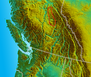
The Gold Range is a subrange of the Monashee Mountains in the southern British Columbia Interior. This range originally applied to all of the Monashees between the Arrow Lakes and the Okanagan but today only applies to a narrow stretch of the Monashee Mountains' eastern flank adjoining Upper Arrow Lake, west of the upper Shuswap River.
The Shuswap Country, or simply the Shuswap is a term used in the Canadian province of British Columbia to refer to the environs of Shuswap Lake. The upper reaches of the Shuswap basin, southeast of Shuswap Lake and northeast of the Okanagan, are generally considered to be part of Okanagan or of the Monashee Country rather than "the Shuswap". Roughly defined, the Shuswap Country begins on its west at the town of Chase, located on Little Shuswap Lake, west of which is the South Thompson area of the Thompson Country, and includes Adams Lake to the northwest of Shuswap Lake as well as communities in the Eagle River area as far as Craigellachie and/or Three Valley Gap, which is at the summit of Eagle Pass, beyond which eastwards is the Columbia Country.
The Sawtooth Range is a subrange of the Shuswap Highland area of the central Monashee Mountains in the Southern Interior of British Columbia, Canada. It is located between Mabel Lake (W) and Sugar Lake (E) and bounded on the south by the upper Shuswap River. Its northern boundary is just south of the Three Valley Gap area of Eagle Pass, which is the route of the Canadian Pacific Railway mainline and the Trans-Canada Highway. To the east, across the uppermost Shuswap River above Sugar Lake, is the Gold Range of the main spine of the Monashees, to which it is connected by the col of Joss Pass. To the west, it is adjoined by the rest of the Shuswap Highland, of which it is a part and is an intermediary mountainous plateau between the Monashees and the northeastern Thompson Plateau.
Joss Pass, 1345 m (4413 ft), is a mountain pass in the central Monashee Mountains of the Southern Interior of British Columbia, Canada. Located just south of the Three Valley Gap area of Eagle Pass, which is the route of the Trans-Canada Highway and the mainline of the Canadian Pacific Railway. It forms the divide between the headwaters of the Shuswap River and those of its eventual tributary Wap Creek, which joins the Shuswap via Mabel Lake. It forms the prominence col for Tsuius Mountain, the highest mountain of the Sawtooth Range, which is part of the Shuswap Highland. It is located just east of Joss Mountain, which is the northernmost peak of the Sawtooths.
Scotch Creek is a stream in the British Columbia Interior of Canada, located on the north side of Shuswap Lake. It is part of the Thompson River watershed, which is a tributary to the Fraser River. It flows from the Shuswap Highlands into Shuswap Lake just west of the community of Scotch Creek. It was named for Scottish gold prospectors who worked the creek with placer mining operations in the 1860s. The creek's headwaters are near Pukeshun Mountain, and flow southwest and south for 56.5 kilometres (35.1 mi). The creek supports sockeye salmon, which breed in the creek during a small salmon run in the autumn.
The Anstey River is a 30 kilometer long river in the Interior region of British Columbia, Canada. It flows roughly north to south from the Monashee range of the Columbia Mountains, and drains into Anstey Arm on Shuswap Lake. The Anstey River drainage covers 24,000 hectares and is uninhabited. The river was named for Francis Senior Anstey, who operated one of the first major logging operations in the area. The lower river and its delta are protected within Anstey Hunakwa Provincial Park.


