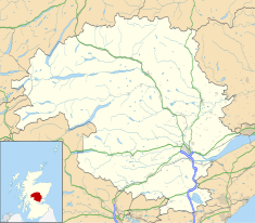
Perth is a centrally located Scottish city, on the banks of the River Tay. It is the administrative centre of Perth and Kinross council area and is the historic county town of Perthshire. It had a population of about 47,430 in 2018.

Wigtown is a town and former royal burgh in Wigtownshire, of which it is the county town, within the Dumfries and Galloway region in Scotland. It lies east of Stranraer and south of Newton Stewart. It is known as "Scotland's National Book Town" with a high concentration of second-hand book shops and an annual book festival.

The Carse of Gowrie is a stretch of low-lying country in the southern part of Gowrie, Perth and Kinross, Scotland. It stretches for about 20 miles along the north shore of the Firth of Tay between Perth and Dundee. The area offers high-quality agricultural land and is well known as a major area for strawberry, raspberry and general fruit growing. Fruit is easy to cultivate in the area because of its southerly aspect and low rainfall. It has been suggested that monks brought new varieties of apples and pears to the area in the Middle Ages and there may have been vineyards growing on slopes near the River Tay.

The Canongate is a street and associated district in central Edinburgh, the capital city of Scotland. The street forms the main eastern length of the Royal Mile while the district is the main eastern section of Edinburgh's Old Town.

A mercat cross is the Scots name for the market cross found frequently in Scottish cities, towns and villages where historically the right to hold a regular market or fair was granted by the monarch, a bishop or a baron. It therefore served a secular purpose as a symbol of authority, and was an indication of a burgh's relative prosperity. Historically, the term dates from the period before 1707, when the Kingdom of Scotland was an independent state, but it has been applied loosely to later structures built in the traditional architectural style of crosses or structures fulfilling the function of marking a settlement's focal point. Historical documents often refer simply to "the cross" of whichever town or village is mentioned. Today, there are around 126 known examples of extant crosses in Scotland, though the number rises if later imitations are added.

Fingask Castle is a country house in Perth and Kinross, Scotland. It is perched 200 feet (61 m) above Rait, three miles (5 km) north-east of Errol, in the Braes of the Carse, on the fringes of the Sidlaw Hills. Thus it overlooks both the Carse of Gowrie and the Firth of Tay and beyond into the Kingdom of Fife. The name derives from Gaelic fionn-gasg: a white or light-coloured appendage.

Glasgow Cross is at the hub of the ancient royal burgh and now city of Glasgow, Scotland, close to its first crossing over the River Clyde. It marks the notional boundary between the city centre and the East End

Castlegate is a small area of Aberdeen, Scotland, located centrally at the east end of the city's main thoroughfare Union Street. Generally speaking, locals consider it to encompass the square at the end of Union Street where the Mercat Cross and Gallowgate are located.

Perth Bridge is a toll-free bridge in the city of Perth, Scotland. A Category A listed structure, it spans the River Tay, connecting Perth, on the western side of the river, to Bridgend, on its eastern side, carrying both automotive and pedestrian traffic of West Bridge Street. An earlier bridge was demolished at the same location in 1621, and many unsuccessful attempts were made to replace it. A subscription was started by James VI and several noblemen to help with the construction cost, but the king's death in 1625 suspended the scheme and a series of ferryboats were instead used.
Kinnoull is a parish in Perth, Perth and Kinross, Scotland, approximately half a mile northeast of Perth city centre. Beginning at the level of the River Tay, which separates the parish from Perth, Kinnoull's terrain continues to rise as it continues southeast, culminating in Kinnoull Hill, the summit of which is at 728 feet (222 m).

North Inch is a large public park in Perth, Scotland. About 57 hectares in size, it is one of two "Inches" in Perth, the other being the smaller, 31-hectare South Inch, located half a mile across the city. The inches were granted to the city, when it was a royal burgh, by King Robert II in 1374. Both inches were once islands in the River Tay; today, they are connected by Tay Street, part of the A989.
The Mercat Cross of Edinburgh is a market cross, which stands in Parliament Square next to St Giles' Cathedral, facing the High Street in the Old Town of Edinburgh.

Perth City Hall is a civic building in King Edward Street, Perth, Scotland. Built in 1914, it is a Category B listed building.

The Municipal Buildings are a municipal facility at Nos. 1, 3 and 5 High Street, Perth, Scotland. The facility is a Category B listed building.

South Inch is a large public park in Perth, Scotland. About 31 hectares in size, it is one of two "Inches" in Perth, the other being the larger, 57-hectare (140-acre) North Inch, located half a mile across the city. The Inches were granted to the city, when it was a royal burgh, by King Robert II in 1374. Both Inches were once islands in the River Tay. The two Inches are connected by Tay Street.

The vennels of Perth are a collection of small medieval streets in the city of Perth, Scotland. Similar to York's Snickelways, vennels are a public right-of-way passageway between the gables of buildings which can, in effect, be a minor street. In Scotland, the term originated in royal burghs created in the twelfth century, the word deriving from the Old French word venelle meaning "alley" or "lane". Unlike a tenement entry to private property, known as a "close", a vennel was a public way leading from a typical high street to the open ground beyond the burgage plots. The Latin form is venella, related to the English word "funnel".
Tay Street is a street, part of the A989, in the Scottish city of Perth, Perth and Kinross. Planned in 1806 and completed around 1885, it is named for the River Tay, Scotland's longest river, on the western banks of which it sits. The street runs from the confluence of West Bridge Street and Charlotte Street in the north to a roundabout at Marshall Place and Shore Road in the south. Three of the city's four bridges that cross the Tay do so in this stretch : Perth Bridge, Queen's Bridge and the single-track Tay Viaduct, carrying Perth and Dundee trains to and from Perth railway station, located 0.5 miles (0.80 km) to the north-west.

St John's Shopping Centre is a shopping mall in Perth, Scotland. Situated between South Street, King Edward Street, Scott Street and the pedestrianised section of the High Street, it was built between 1985 and 1987. It cost around £20 million. Its main entrance is that facing the Category B listed Perth City Hall on King Edward Street, with Perth mercat cross standing between the two.

South Street is a prominent street in the Scottish city of Perth, Perth and Kinross. Established in at least the 15th century, it runs for about 0.5 miles (0.80 km), from the Dundee Road in the east to County Place in the west, passing through the entire breadth of the city. Queen's Bridge, completed in 1960 and opened by Queen Elizabeth II, carries South Street across the River Tay to and from Kinnoull.

King Edward Street is a street in the city of Perth, Scotland. Constructed in the early 20th century, it runs for about 510 feet (170 yd) between High Street to the north and South Street to the south. St John's Place, which surrounds the ancient St John's Kirk, are the only junctions on King Edward Street. King Edward Street bounds the kirk on its western side; St John Street bounds it to the east.