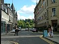
A 2022 view, looking west to St Paul's Church | |
 | |
| Length | 0.50 mi (0.80 km) |
|---|---|
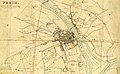
| Location | Perth, Perth and Kinross, Scotland |
| East end | Tay Street (A989) |
| West end | Caledonian Road (A989) |
High Street is a street and the primary retail area of the Scottish city of Perth. Established in at least the 15th century, its central section has been both modernised and pedestrianised, while its two ends are mainly Victorian in terms of their composite buildings. It runs for about 0.5 miles (0.80 km), from Tay Street (the A989) in the east to Caledonian Road (also the A989) in the west.