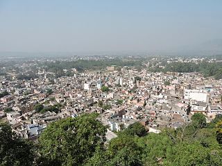
Khagaria is a town in Indian state of Bihar and the administrative headquarters of Khagaria district. Khagaria is a part of Munger division. It is located at 25.5°N 86.48°E and has an average elevation of 36 metres (118 feet). The Khagaria Junction railway station serves the town.It is situated about 25 km north of Munger.

Nalagarh is a city and a municipal committee, near the city of Solan in Solan district in the Indian state of Himachal Pradesh.

Birwadi is a census town in Raigad district in the state of Maharashtra, India.

Bommasandra is located at Bangalore in the state of Karnataka, India.
Chimbel is a census town in North Goa district in the state of Goa, India.

Desur is a Town panchayat in Tiruvanamalai district in the Indian state of Tamil Nadu.
Dhanuha is a census town in Jaunpur district in the state of Uttar Pradesh, India.
Ezhudesam is a town panchayat in Kanniyakumari district in the state of Tamil Nadu, India.

Gajapathinagaram is a census town in Vizianagaram district of the Indian state of Andhra Pradesh. It is located in Gajapathinagaram mandal of Vizianagaram revenue division. It is located on National Highway 26 between Vizianagaram and Ramabhadrapuram.
Handia is a town, near the city of Prayagraj and a nagar panchayat in the Prayagraj district of the Indian state of Uttar Pradesh.

Injambakkam is a locality in the south of Chennai in the Indian state of Tamil Nadu. Being a part of the Walajabad block of the district, its panchayat is part of Walajabad panchayat union. Injambakkam is located along the ECR.
Jasdan is a city and a municipality in Rajkot district in the Indian state of Gujarat. Jasdan is the biggest sub district in the Rajkot district. Jasdan city has its own Municipality that is known as "Jasdan Municipality" JMP.
Kothnur is a census town in Bangalore district in the Indian state of Karnataka.
Uzhavarkarai is a city, a municipality and a taluk in Puducherry district in the union territory of Puducherry. The enclaves of Kalapet and Alankuppam are parts of Uzhavarkarai municipality. Uzhavarkarai is also the only sub-taluk (firka) in Uzhavarkarai Taluk of Pondicherry district.
Peerkankaranai is a neighborhood in the city of Tambaram, situated within the Chennai Metropolitan Area, Tamil Nadu, India.
Shrirampur is a city and a municipal council located in the Ahmednagar district of the Indian state of Maharashtra.
Thevaram is a town in Theni district in the Indian state of Tamil Nadu. Thevaram is located in Tamil Nadu near on border of Kerala at the Eastern side foot-hill of the Western Ghats. It is connected with State Highway SH100.
Vengathur is a census town in Thiruvallur district in the Indian state of Tamil Nadu.
Jafarabad is a town and nagar panchayat in Jaunpur district in the Indian state of Uttar Pradesh.
Banki is a town, a nagar panchayat and a block panchayat in Barabanki district in the state of Uttar Pradesh, India.


