Kallai is a small town on the banks of Kallai River which links with the Chaliyar river on the south by a man-made canal. It is in the Kozhikode district of Kerala in south India and is noted for timber trading.

Muthuthala is a village and gram panchayat. It lies northwest of Pattambi in Palakkad district, of the state of Kerala, India. It is located on the banks of the Bharathapuzha River. The infrastructure of the panchayath is divided into Kodumunda and Muthuthala.Muthuthala, Kodumunda and Karakkuth are important centres. The adjacent villages to Muthuthala are Pallippuram, Koppam and Pattambi.The major institutions are GOHSS Pattambi, GHSS Kodumunda, GLPS Kodumunda AMLP Kodumunda, Aups muthuthala, Aups perumudiyoor, SBI muthuthala etc.Also there are temples such as sree muthassiyar kavu, ayappan kavu, Ganapthi temple muthuthala. Siva temple perumudiyoor, kozhikottii temple etc. The main Islamic symbol of this village is Muhyidheen Juma Masjid located at Muthuthala centre. An Islamic educational institution named as Thanveerul Islam Madrassa is also running near to this. Thes agnostoma somayagam is conducted at perumudiyoor on 2016. Lakhs of people visited there. Major cultivation is paddy here .Banana and rubber plantations are also abundant here.
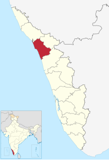
Mavoor is a town situated in Kozhikode district in Kerala, India. It is 20 km away from Kozhikode city.

Palazhi is a suburb of Kozhikode city in India. It has risen to prominence quite recently because of the creation of a township called Hilite Mall here. Palazhi town is four kilometres from Thondayad junction in Kozhikode city. Metro International Cardiac Center and the Cradle Maternity hospital are situated at Palazhi.
Mankavu is a suburb of Kozhikode, in Kerala, India. It is known as the site of the Zamorin's kovilakam and it is called Mankavu Padinhare Kovilakam. Mankavu derives its name from the Zamorin's Mango Orchard that was in the area some historic records says that earlier was known as "Manavedan kavu" and got shortened into "Mankave". The community is primarily residential, and is a common residential location for students from the local Zamorin's Guruvayurappan College. Krishna Varma and Ravi Varma, famous rebels of Calicut were born and brought up in Mankavu.

Kodiyathur is a gram panchayat in Kozhikode district in the state of Kerala, India.

Nanminda is a village in Kozhikode district in the state of Kerala, India. Nanminda is also written as "Nanmanda".

Narikkuni is a town in Kozhikode district in the state of Kerala, India. According to Census 2011 information the location code or village code of Narikkuni town is 627402. Narikkuni town is located in Kozhikode Tehsil of Kozhikode district in Kerala, India. It is situated 20 km away from Kozhikode, which is both the district & the sub-district headquarters of Narikkuni village.

Cheruvannur is a census town in Cheruvannur-Nallalam Municipality in Kozhikode district of the Indian state of Kerala.

Cherukavu or Pulikkal is a village in Malappuram district in the state of Kerala, India.

Kovoor Town is a suburb of Kozhikode city on the eastern side.

Mavoor Road is the busiest High street of Kozhikode city in Kerala, India. This road connects the Mananchira pond area with the Kozhikode Medical College. After the medical college, the road is extended further to the little village of Mavoor but the term 'Mavoor Road' refers to the section between the city and the Medical college.

Kozhikode Beach or Calicut Beach is a beach on the western side of Kozhikode, situated on the Malabar Coast of India. The beach is accessible through four road overbridges in the city. The beach has paved stones and illumination. There is one Lions Park for the children and an acquarium. Kozhikode beach has always been a prominent place for conducting public meetings. The beach road was renamed 'Gandhi Road' in 1934 after Gandhi visited Calicut in 1934.

Chevarambalam is a suburb of Kozhikode city. This residential layout lies between the Mavoor Road and the Wayanad Road.
Arayidathupalam Junction is the busiest road intersection of Kozhikode city in India.
Thondayad Junction is an important intersection of Kozhikode city, India. Thondayad Junction. This junction connects the city to the eastern town of Kozhikode District and so the traffic is heavy. The junction also connects to the northern and southern cities of Kerala by express roads.

Kozhikode East is a suburb of Kozhikode city in India. Kozhikode East includes areas outside the city jurisdiction but they are still closely associated with the city in terms of commerce and everyday life.
Airport Road, Kozhikode begins at Thondayad Junction and ends at Calicut Airport, about 20 km away. The road passes through Palazhi, Pantheeramkavu, Ramanattukara and Kondotty Thurakkal towns before reaching the airport.