Related Research Articles

Uluṟu-Kata Tjuṯa National Park is a protected area in the Northern Territory of Australia. The park is home to both Uluru and Kata Tjuta. It is located 1,943 kilometres (1,207 mi) south of Darwin by road and 440 kilometres (270 mi) south-west of Alice Springs along the Stuart and Lasseter Highways. The park covers 1,326 square kilometres (512 sq mi) and includes the features it is named after: Uluru and, 40 kilometres (25 mi) to its west, Kata Tjuta. The location is listed as a UNESCO World Heritage Site for natural and cultural landscape.
Watarrka National Park is a protected area in the Northern Territory of Australia located about 1,316 kilometres south of the territory capital of Darwin and 323 km (201 mi) southwest of Alice Springs.

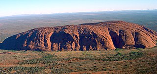
Uluru, also known as Ayers Rock and officially gazetted as Uluru / Ayers Rock, is a large sandstone formation in the centre of Australia. It is in the southern part of the Northern Territory, 335 km (208 mi) southwest of Alice Springs.

The Australian Alps is a mountain range in southeast Australia. It comprises an interim Australian bioregion, and is the highest mountain range in Australia. The range straddles the borders of eastern Victoria, southeastern New South Wales, and the Australian Capital Territory. It contains Australia's only peaks exceeding 2,000 m (6,600 ft) in elevation, and is the only bioregion on the Australian mainland in which deep snow falls annually. The range comprises an area of 1,232,981 ha.

Augustus Heinrich Petermann was a German cartographer.

Mount Conner, also known as Atila, Artilla, or Fool-uru, is a mountain located in the southwest corner of the Northern Territory of Australia, 75 kilometres (47 mi) southeast of Lake Amadeus, in the locality of Petermann. It lies within the Curtin Springs cattle station in Pitjantjatjara country, close to the site of the Kungkarangkalpa Dreaming. Its height reaches 859 metres (2,818 ft) above sea level and 300 metres (984 ft) above ground level.

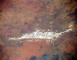
Lake Amadeus is a large salt lake in the southwest corner of Northern Territory of Australia, about 50 kilometres (31 mi) north of Uluru. The smaller Lake Neale is adjacent to the northwest. It is part of the Amadeus Basin that was filled with the erosion products of the Petermann Orogeny.

The Sydney Basin is an interim Australian bioregion and is both a structural entity and a depositional area, now preserved on the east coast of New South Wales, Australia and with some of its eastern side now subsided beneath the Tasman Sea. The basin is named for the city of Sydney, on which it is centred.

The Tanami Desert is a desert in northern Australia, situated in the Northern Territory and Western Australia.

The Petermann Orogeny was an Australian intracontinental event that affected basement rocks of the northern Musgrave Province and Ediacaran (Proterozoic) sediments of the (now) southern Amadeus Basin between ~550-535 Ma. The remains are seen today in the Petermann Ranges.

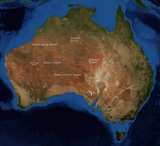
The deserts of Australia or the Australian deserts cover about 2,700,000 km2 (1,000,000 sq mi), or 18% of the Australian mainland, but about 35% of the Australian continent receives so little rain, it is practically desert. Collectively known as the Great Australian desert, they are primarily distributed throughout the Western Plateau and interior lowlands of the country, covering areas from South West Queensland, Far West region of New South Wales, Sunraysia in Victoria and Spencer Gulf in South Australia to the Barkly Tableland in Northern Territory and the Kimberley region in Western Australia.

The Great Central Road is a mostly unsealed Australian outback highway that runs 1,126 km (700 mi) from Laverton, Western Australia to Yulara, Northern Territory. It passes through a number of small communities on the way.
Hallett Cove Conservation Park is a protected area in the Australian state of South Australia located in the suburb of Hallett Cove on the coast of Gulf St Vincent about 22 kilometres south of the centre of the state capital of Adelaide.
Kaltukatjara is a remote Indigenous Australian community in the Northern Territory of Australia. It is southwest of Alice Springs, west of the Stuart Highway, near the Western Australia and Northern Territory border. At the 2006 census, Kaltukatjara had a population of 355.

An Indigenous Protected Area (IPA) is a class of protected area used in Australia; each is formed by voluntary agreement with Indigenous Australians, and declared by Aboriginal Australians and Torres Strait Islander representative organisations. Each is formally recognised by the Australian Government as being part of its National Reserve System. The areas may comprise land and sea, and are managed by Indigenous groups for the conservation of biodiversity. Managing IPAs also helps to protect the cultural values of their country for future generations, and has benefits for Indigenous health, education, economic and social cohesion.

Melaleuca faucicola commonly known as desert bottlebrush, is a plant in the myrtle family, Myrtaceae and is endemic to the Northern Territory in Australia. It is a shrub or small tree growing only in protected gorges in the ranges of Central Australia such as the Petermann Ranges and has red, cream or white spikes of flowers.

Australia's monuments take on many distinct forms, including statues, fountains, natural landmarks and buildings. Whilst some monuments of Australia hold a national significance, many are constructed and maintained by local community groups, and are primarily significant on a local scale. Although Australia's monuments have many roles, including as tourist attractions, their primary purpose is to "safeguard, prolong or preserve social memory into the future". This social memory may relate to anything from colonisation to local industry to sports. The monuments of Australia reflect the nation's social and political history and by memorialising select moments, contribute to shaping how Australian history is told. Although a significant portion of Australia is desert, the population is highly urbanised and the cities contain some noteworthy monuments.
The Mann Ranges are a mountain range in central Australia. It is located in the far northwest of South Australia, with a small section running over the border into the Northern Territory. It is part of the geological region known as the Musgrave Block, which also includes the Petermann and Musgrave Ranges. Mountains in this region were formed in the Petermann Orogeny.
Bloods Range is a mountain range in central Australia, stretching roughly east to west across the border between the Northern Territory and Western Australia. It consists of several sets of hills, separated by valleys; the two main valleys are formed by the Hull and Docker Rivers. There are numerous ravines and gorges all throughout the hills. Bloods Range connects with the Petermann Ranges at its western end. In the centre are Mounts Harris (840 m) and Carruthers (1000 m), which are the highest peaks. Further east, the range splits into several branches, including the Rowley Range, McNichol's Range and the Pinyinna Range.
Petermann is a locality in the Northern Territory of Australia located about 1,427 kilometres (887 mi) south of the territory capital of Darwin in the territory’s south-western corner adjoining the states of South Australia and Western Australia.
References
- 1 2 "Petermann Ranges and surrounds" (PDF). Sites of Conservation Significance. Northern Territory Government, Department of Natural Resources, Environment, the Arts and Sport. Retrieved 14 March 2012.
- ↑ "Geology". Australian Government, Department of Sustainability, Environment, Water, Population and Communities. Archived from the original on 28 October 2007. Retrieved 14 March 2012.
- ↑ "Lifting the Veil from the Unknown". The Mail (Adelaide) . Vol. 15, no. 747. South Australia. 18 September 1926. p. 1. Retrieved 23 August 2016– via National Library of Australia.
- ↑ "Australia: The Time Traveller's Guide". Essential Media and Entertainment . Archived from the original on 22 October 2019.
Coordinates: 25°00′S129°46′E / 25.000°S 129.767°E