(from the mouth) Outlet of Lac du Camp, outlet of lac des Feuilles, Cabanage River, Portage River (Petit-Saguenay River tributary), ruisseau Dallaire, ruisseau à l'Eau Froide, outlet of lac Brossard, outlet of lac Cast, outlet of lac Germaine, outlet of a set of lakes such Mailloux, Crochu, "de la Gosse" and à Ti-Jos, outlet of lac Aimé and "des Harvey", outlet of "Lac à Jacinthe" (via "lac Emmuraillé"), ruisseau Pilote (via le lac Pilote et Emmuraillé), lac Armand (via "Lac au Bouleau"), ruisseau Bazile (via "Lac au Sable"), ruisseau au Sable (via "Lac au Sable"), outlet of Petit lac au Sable, outlet of Lac Pierrot.
•right
(from the mouth) Outlet of Lac à Léon, cours d'eau Simard, outlet of lac Tom, outlet of Lac de l'Oeuf, outlet of Lac à David et du lac Luc, rivière Deschênes, outlet of lacs Croche, Noir and "à la Bombe", outlet of lac du Chicot and lac Onésime, outlet of Lac des Abeilles (via le Lac au Sable).
The Petit Saguenay River is a watercourse flowing in Quebec, Canada, in:
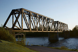
The lower part of this river is served by Quai Street (West Bank) from the mouth, rue Tremblay and rue Eugène-Morin. The route 170 passes on the east bank between the village of Petit-Saguenay and the confluence of the Deschênes River. The intermediate section is served by Lac Victor Road and Ovila-Lavoie Road. The upper part is served by various secondary forest roads.
Forestry is the first economic activity in the sector; recreational tourism activities, second.
The surface of the Petit Saguenay River is usually frozen from the beginning of December to the end of March, however, safe ice circulation is generally from mid-December to mid-March.
Hydrology
With 88.4km (54.9mi) long, the "Petit Saguenay River" drains a watershed of 789.94km (490.85mi) including 441km (274.02mi)[3] for the basin upstream of the "Petit Saguenay" water measurement station located 1km downstream of the confluence with the outlet of David Lake. At this measuring station, the average flow of the river reaches 16m (52.493ft).[4]
The Petit Saguenay River is a river of white water, with a bed of pebbles, gravel and sand.
Geography
The main hydrographic slopes near the Petit Saguenay River are:
The Petit Saguenay River has its source in the "Troisième lac des Marais" (Third Marsh Lake) (length: 1.9km (1.2mi); altitude: 608m (1,995ft)) of various bodies of water in the zec du Lac-au-Sable, then flows east to Sagard. From its source ("Troisième lac des Marais"), the course of the Petit Saguenay River descends on 84.8km (52.7mi) according to the following segments:
Upper course of the Petit Saguenay River (segment of 20.0km (12.4mi))
5.3km (3.3mi) to the north by collecting the Pierrot Lake discharge (coming from the southwest), to the outlet (coming from the west) of "Petit lac au Sable";
3.9km (2.4mi) northwesterly, forming a hook to the east, to the east shore of Lac au Sable;
2.7km (1.7mi) north across the Lac au Sable (elevation: 449m (1,473ft)) along its full length to its mouth. Note: this lake receives, on the west bank, Bazile Brook and Sable Creek;
4.3km (2.7mi) north across Lac au Bouleau (Birtch Lake) (length: 4.3km (2.7mi); altitude: 449m (1,473ft)) on its full length to its mouth;
2.0km (1.2mi) northerly, westerly to the east bank, then north across the Emmuraillé Lake (length: 1.8km (1.1mi) altitude: 436m (1,430ft)) on 0.6km (0.37mi) to its mouth;[5]
Upper course of the Petit Saguenay River, downstream from Lake Emmuraillé (segment of 18.7km (11.6mi))
2.6km (1.6mi) northerly, forming a large loop to the east and then to the northeast, including crossing Petit Saguenay Lake (length: 0.9km (0.56mi); altitude: 382m (1,253ft)) on its full length to its mouth;
1.8km (1.1mi) to the northwest by collecting the discharge (coming from the north) of an unidentified lake, to the dump (coming from the south-east) of Lake Chicot, the lake Onesime and McLagan Lake;
3.8km (2.4mi) northerly in a valley sometimes enclosed, to the outlet (coming from the west) of Lake Ti-Jos;
2.3km (1.4mi) east, then north, to a river bend;
8.2km (5.1mi) easterly forming a long curve to the south, collecting the outlet of Pichetoune Lake and the outlet of Beaver Lake, until the confluence of the Deschênes River (from the south);[5]
Intermediate course of the Petit Saguenay River (segment of 19.4km (12.1mi))
2.3km (1.4mi) northerly passing through the village of Sagard, to the outlet (coming from the west) of an unidentified lake;
9.3km (5.8mi) northerly along the west side of route 170 and winding through a few marsh areas to the dump (coming from West) of Red Pine Lake;
2.2km (1.4mi) to the east forming a large S in marsh area, to the outlet (from the east) of Lake David;
5.6km (3.5mi) north, crossing four sets of rapids, to a river bend corresponding to the dump (coming from the southeast) of Lac de l'Oeuf;[5]
Lower course of the Petit Saguenay River (segment of 26.7km (16.6mi))
7.2km (4.5mi) southwesterly, first northwesterly to form a large misshapen loop, then south to a marsh zone, to a bend in the river;
3.8km (2.4mi) northwesterly, collecting the Cold Water Creek and forming large streamers in the marsh zone, to Dallaire Creek (coming from the southwest);
3.2km (2.0mi) northerly crossing a swamp area, to the outlet of Tom Lake (coming from the east);
3.3km (2.1mi) northwesterly, distancing itself to 1.0km (0.62mi) west of route 170 to the west at the confluence of the Portage River (coming from the southwest);
1.0km (0.62mi) northerly in a steep valley, to a bend in the river corresponding to a creek (coming from the east);
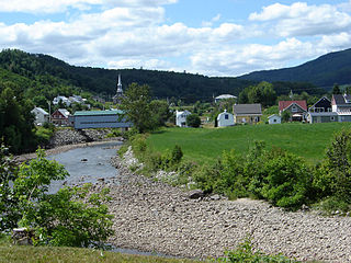
5.4km (3.4mi) northwesterly, forming a hook to the southeast and along the southwestern side of Highway 170, to the center of the village of Petit-Saguenay;
2.8km (1.7mi) northwesterly in a straight line to its mouth.[5]
The mouth of the Petit Saguenay River flows into a narrow bay on the south shore of the Saguenay River, partially closed by a jetty. This berry provides protection from boating in the event of a windstorm. This confluence is located at:
7.9km (4.9mi) north-east of the village center of L'Anse-Saint-Jean;
2.4km (1.5mi) northwest of the village center of Petit-Saguenay;
The name of the river was mentioned by James McKenzie in the legislature of Lower Canada in 1824.[6] The occupation of the region dates back to the late 1830s. In 1842, a sawmill was built near the mouth of the Petit Saguenay River. William Price (1789-1867) bought it in 1844 and established a model farm there which also became the headquarters of his activities in the area. As a result, river salmon became scarce due to the presence of sawmills and overfishing.
The fire of Mr. Price's sawmill in 1870 resulted in the displacement of upstream dwellings on the present site of the village of Petit-Saguenay.
Fishing
Salmon fishing rights in the Petit Saguenay River were first held by William Price. At the end of the 19th century, they passed into the hands of several rich English speakers, before being granted to clubs and associations. In 1950, a group of Americans acquired land bordering the river, upstream of the village, and built fishing lodges. This complex (land and construction), known as the "Gentlemen's Club", is now managed under the name of "Petit-Saguenay River Site".[7]
Since 1999, the territory has been established in controlled harvesting zone (zec) and the "Petit-Saguenay River Association" has been managing Atlantic salmon sport fishing since 1966. The organization is recognized for its role in the sustainable development of salmon resources by being the founder of the Atlantic Salmon Protective Charter.[8]
Thirteen of the 88.4 kilometers are open to salmon fishing, including one on the Portage River, a tributary of Petit-Saguenay. For the salmon fishery, the river has 24 pits in 1 open access area and 2 restricted access areas.
Toponymy
The name "Petit Saguenay River" was originally mentioned in 1824 by James McKenzie, at the House of Assembly of Lower Canada who wanted to know more about this sector. McKenzie then refers to the "Little River named Petit Saguenay on which we also take salmon."[9] Surveyor William Tremblay, in his report on the canton of Saint-Jean, in 1893, mentions the "Petit Saguenay River" to identify this watercourse.[10]
In Quebec toponymy, we often find duplicates in diminutive of the main watercourse (ex.: "Saguenay river" versus "Petit Saguenay river").
↑ Quoted by Russel Bouchard, in "Ghost Villages, Missing or Unknown Places in the Bas-Saguenay", Société historique du Saguenay, 1991, page 10.
↑ Published in Regions of Quebec, Lac-Saint-Jean, Chicoutimi and the North Shore of the St. Lawrence, Description of the surveyed townships, explorations of territories and surveys of rivers and lakes, from 1889 to 1908, published by the Ministry of Lands and Forests, Quebec, 1908, page 11.
↑ "Petit Saguenay River". Commission de toponymie du Québec. Bank of Quebec Place Names. Retrieved December 11, 2019.
The Metabetchouan River is a tributary of Lac Saint-Jean in the centre of the province of Quebec, Canada. The course of this river successively crosses the regional county municipalitys (MRC) of:
Zec de la Rivière-Petit-Saguenay is a "zone d'exploitation contrôlée" (zec) located in the municipality of Petit-Saguenay, in Le Fjord-du-Saguenay Regional County Municipality, in administrative region of Saguenay–Lac-Saint-Jean, in Quebec, in Canada.
The Ha! Ha! River is a watercourse in Saguenay–Lac-Saint-Jean, Quebec, Canada.
The rivière du Gouffre is a tributary of the left bank of the Saint-Laurent river, flowing into the Capitale-Nationale administrative region, Quebec (Canada). This watercourse flows through Regional County Municipality from:
The rivière Noire du Milieu is a tributary of the south shore of the Noire River, flowing entirely into the unorganized territory of Mont-Élie, Quebec, in the Charlevoix-Est Regional County Municipality, in Capitale-Nationale, in Quebec, Canada. The upper part is in the zec des Martres, around Plongeon Lake.
The Saint-Étienne River is a tributary of the south shore of the Saguenay River flowing into the municipality of Petit-Saguenay in the Saguenay Fjord, Quebec, Canada. In the end, this river crosses the Saguenay Fjord National Park.
The Saint-Athanase River is a tributary of the south shore of the Saguenay River flowing into the municipality of Petit-Saguenay in the Le Fjord-du-Saguenay Regional County Municipality, Quebec, Canada.
The River Portage, a tributary of the southwestern shore of the Petit Saguenay River flowing successively in the municipalities of L'Anse-Saint-Jean and Petit-Saguenay in the Le Fjord-du-Saguenay Regional County Municipality, in the administrative region of Saguenay-Lac-Saint-Jean, in Quebec, in Canada. The upper part of this river crosses the Zec de l'Anse-Saint-Jean.
The Deschênes River is a tributary of the south shore of the Petit Saguenay River flowing into the unorganized territory of Sagard in the Charlevoix-Est Regional County Municipality, Quebec, Canada.
The Saint-Jean River is a river crossing the municipalities of Rivière-Éternité and L'Anse-Saint-Jean in the Le Fjord-du-Saguenay Regional County Municipality, in the administrative region of Saguenay-Lac-Saint-Jean, Quebec, Canada.
The Cami river is a tributary of the Saint-Jean River, flowing in the municipality of Lalemant, Hébertville-Station and Rivière-Éternité, in the Fjord-du-Saguenay, in the administrative region of Saguenay-Lac-Saint-Jean, in the province of Quebec, in Canada. The course of the Cami river crosses the zec du Lac-au-Sable.
The Brébeuf Lake is a body of water tributary of the Saint-Jean River. It is in the municipality of Rivière-Éternité, Quebec, Canada.
The Éternité Lake is a body of water tributary of the Éternité River and the Saguenay River. It is located in the municipality of Rivière-Éternité, in the Le Fjord-du-Saguenay Regional County Municipality of the administrative region of Saguenay–Lac-Saint-Jean, in the province of Quebec, in Canada. The Éternité Lake straddles the townships of Brébeuf and Hébert. This lake is integrated into the zec du Lac-au-Sable, a controlled exploitation zone.
The rivière à la Catin is a tributary of the Cami River, flowing in the municipality of L'Anse-Saint-Jean and Rivière-Éternité, in the Fjord-du-Saguenay, in the administrative region of Saguenay–Lac-Saint-Jean, in the province from Quebec, to Canada. The course of the Catin river crosses the zec du Lac-Brébeuf.
The "ruisseau Épinglette" is a tributary of the Cami River, flowing in the municipality of L'Anse-Saint-Jean, in the Fjord-du-Saguenay, in the administrative region of Saguenay-Lac-Saint-Jean, in the province of Quebec, in Canada. The course of the "Épinglette steam" crosses the zec du Lac-Brébeuf.
The Rivière Pierre is a tributary of Brébeuf Lake, flowing in the municipality of Ferland-et-Boilleau and ivière-Éternité, in the Fjord-du-Saguenay, in the administrative region of Saguenay-Lac-Saint-Jean, in the province of Quebec, in Canada. The lower part of the Pierre river valley is integrated into the zec du Lac-Brébeuf.
The Bras de Ross is a tributary of Brébeuf Lake, flowing in the municipality of Ferland-et-Boilleau and Rivière-Éternité, in the Le Fjord-du-Saguenay Regional County Municipality, in the administrative region of Saguenay–Lac-Saint-Jean, in the province of Quebec, in Canada. The lower part of the Ross Valley is integrated into the zec du Lac-Bébeuf.
The Emmuraillé Lake is a body of water crossed in its eastern part by the Petit Saguenay River, in the unorganized territory of Sagard, in the Charlevoix-Est Regional County Municipality of the administrative region of Capitale-Nationale, in Quebec, in Canada.
The Lac au Sable is a body of water crossed from south to north by the Petit Saguenay River, in the unorganized territory of Mont-Élie, in the Charlevoix-Est Regional County Municipality of the administrative region Capitale-Nationale, in Quebec, Canada.
The Rivière à Mars is a tributary of the Baie des Ha! Ha! Crossing the borough La Baie, in Saguenay (city), in the administrative region of Saguenay–Lac-Saint-Jean, in Quebec, in Canada. The "rivière à Mars" is a tributary of the Saguenay River and has its source in the Laurentides Wildlife Reserve. This river to salmons was badly affected by the Saguenay Flood which occurred from July 19 to 21, 1996.
This page is based on this Wikipedia article Text is available under the CC BY-SA 4.0 license; additional terms may apply. Images, videos and audio are available under their respective licenses.


