Related Research Articles

The Axel Heiberg Glacier in Antarctica is a valley glacier, 30 nautical miles long, descending from the high elevations of the Antarctic Plateau into the Ross Ice Shelf between the Herbert Range and Mount Don Pedro Christophersen in the Queen Maud Mountains.
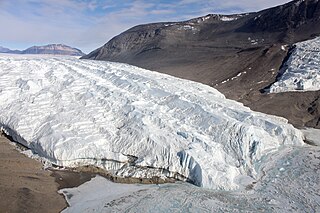
The Taylor Glacier is a glacier in Antarctica about 35 nautical miles long, flowing from the plateau of Victoria Land into the western end of Taylor Valley, north of the Kukri Hills. It flows to the south of the Asgard Range. The middle part of the glacier is bounded on the north by the Inland Forts and on the south by Beacon Valley.
The Betekhtin Range is a mountain range about 14 nautical miles long, forming the southern arm of the Humboldt Mountains in Queen Maud Land, Antarctica.
Simpson Glacier is a glacier, 6 nautical miles, in the Admiralty Mountains, Antarctica. It flows northward to the coast between Nelson Cliff and Mount Cherry-Garrard where it forms the Simpson Glacier Tongue.
Aurdalen Valley is a small moraine-covered valley between Grakammen Ridge and Aurdalsegga Ridge, in the Petermann Ranges of the Wohlthat Mountains. It was discovered and plotted from air photos by the Third German Antarctic Expedition, 1938–39, re-plotted from air photos and from surveys by the Sixth Norwegian Antarctic Expedition, 1956–60, and named "Aurdalen".
Jutulstraumen Glacier is a large glacier in Queen Maud Land, Antarctica, about 120 nautical miles (220 km) long, draining northward to the Fimbul Ice Shelf between the Kirwan Escarpment, Borg Massif and Ahlmann Ridge on the west and the Sverdrup Mountains on the east. It was mapped by Norwegian cartographers from surveys and air photos by the Norwegian–British–Swedish Antarctic Expedition (1949–52) and air photos by the Norwegian expedition (1958–59) and named Jutulstraumen. More specifically jutulen are troll-like figures from Norwegian folk tales. The ice stream reaches speeds of around 4 metres per day near the coast where it is heavily crevassed.

Robertson Bay is a large, roughly triangular bay that indents the north coast of Victoria Land between Cape Barrow and Cape Adare. Discovered in 1841 by Captain James Clark Ross, Royal Navy, who named it for Dr. John Robertson, surgeon on HMS Terror.

Asimutbreen Glacier is a small, steep tributary glacier to Vangengeym Glacier, descending southeast and then northeast between Solhogdene Heights and Skuggekammen Ridge, in the eastern Gruber Mountains of the Wohlthat Mountains, Queen Maud Land. It was discovered and plotted from air photos by the Third German Antarctic Expedition, 1938–39, replotted from air photos and from surveys by the Sixth Norwegian Antarctic Expedition, 1956–60, and named Asimutbreen.
Bystrov Rock is a prominent rock lying 1 nautical mile (2 km) south-southeast of Isdalsegga Ridge in the Südliche Petermann Range of the Wohlthat Mountains. It was mapped from air photos and surveys by the Sixth Norwegian Antarctic Expedition, 1956–60; remapped by the Soviet Antarctic Expedition, 1960–61, and named after Soviet paleontologist A.P. Bystrov.

The Gruber Mountains are a small group of mountains consisting of a main massif and several rocky outliers, forming the northeast portion of the Wohlthat Mountains in Queen Maud Land, Antarctica. They were discovered and plotted from air photos by the Third German Antarctic Expedition (GerAE), 1938–39, under Alfred Ritscher. The mountains were remapped by the Sixth Norwegian Antarctic Expedition, 1956–60, who named them for Otto von Gruber, the German cartographer who compiled maps of this area from air photos taken by the GerAE. This feature is not to be confused with "Gruber-Berge," an unidentified toponym applied by the GerAE in northern the Mühlig-Hofmann Mountains.
Welch Mountains is a group of mountains that dominate the area, the highest peak rising to 3,015 metres (9,892 ft), located 25 nautical miles north of Mount Jackson on the east margin of the Dyer Plateau of Palmer Land, Antarctica
Sverre Peak is a small peak 0.5 nautical miles (0.9 km) off the north end of Pettersen Ridge in the Conrad Mountains of Queen Maud Land. Discovered and photographed by the German Antarctic Expedition, 1938–39. Mapped by Norway from air photos and surveys by the Norwegian Antarctic Expedition, 1956–60, and named for Sverre Pettersen, steward with Norwegian Antarctic Expedition, 1957–58.
Kubbestolen Peak is a bare rock peak, 2,070 metres (6,800 ft) high, at the northwest end of Vinten-Johansen Ridge in the Kurze Mountains of Queen Maud Land, Antarctica. It was mapped from surveys and air photos by the Sixth Norwegian Antarctic Expedition (1956–60) and named Kubbestolen.

The Goodenough Glacier is a broad sweeping glacier to the south of the Batterbee Mountains, flowing from the west shore of Palmer Land, Antarctica, into George VI Sound and the George VI Ice Shelf.
Livdebotnen Cirque is a cirque formed in the northeast side of Mount Flånuten and the west side of Botnfjellet Mountain, in the Humboldt Mountains of Queen Maud Land, Antarctica.
Sandhø Heights is a bare rock heights forming the summit area in the central Conrad Mountains, in Queen Maud Land. Discovered and photographed by the German Antarctic Expedition of 1938-39 and mapped by Norway from air photos and surveys by Norwegian Antarctic Expedition, 1956–60, and named Sandhø.
Sagbladet Ridge is a rock ridge at the east side of the mouth of the Austreskorve Glacier, in the Muhlig-Hofmann Mountains of Queen Maud Land. Plotted from surveys and air photos by Norwegian Antarctic Expedition (1956–60) and named Sagbladet.
The Holtedahl Peaks are a group of peaks and ridges lying northward of Steinskaret Gap and forming the northern portion of the Kurze Mountains, in Queen Maud Land, Antarctica. The name "Holtedahlfjella" was applied to the entire extent of the Kurze Mountains on a Norsk Polarinstitutt map of 1966, but the name Kurze has priority, having been given by the Third German Antarctic Expedition under Alfred Ritscher, 1938–39. For the sake of historical continuity, Kurze Mountains has been retained as applied by Ritscher; the name Holtedahl Peaks is recommended for the elevations northward of Steinskaret Gap in these mountains. The name is for Professor Olaf Holtedahl, a noted Norwegian geologist who worked in the South Shetland Islands and the Palmer Archipelago area in 1927–28.

Read Mountains is a group of rocky summits, the highest being Holmes Summit at 1,875 metres (6,152 ft), lying east of Glen Glacier in the south-central part of the Shackleton Range.
References
- ↑ "Peterson Ridge Trail » BendTrails". Bend Trails. Retrieved 2022-02-04.
![]() This article incorporates public domain material from "Pettersen Ridge". Geographic Names Information System . United States Geological Survey.
This article incorporates public domain material from "Pettersen Ridge". Geographic Names Information System . United States Geological Survey.