Phillips Pass

Last updated
Phillips Pass
USA Wyoming location map.svg
Red pog.svg
Elevation 8,932 ft (2,722 m) [1]
Traversed byTeton Crest Trail
Location Teton County, Wyoming, US
Range Teton Range,
Rocky Mountains
Coordinates 43°32′54″N110°55′56″W / 43.54833°N 110.93222°W / 43.54833; -110.93222 [2]
Topo map USGS Rendezvous Peak, WY

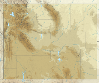
Phillips Pass is a pedestrian mountain pass located in the Teton Range in the U.S. state of Wyoming. [1] The pass is along the crest of the range and the borders between Bridger-Teton National Forest to the east and Caribou-Targhee National Forest to the west. The pass is traversed by the Teton Crest Trail and can be accessed via trails from Teton Pass to the southwest or the Phillips Canyon Trail to the east.
Related Research Articles

<span class="mw-page-title-main">Grand Teton National Park</span> United States National Park in northwestern Wyoming

Grand Teton National Park is an American national park in northwestern Wyoming. At approximately 310,000 acres (1,300 km2), the park includes the major peaks of the 40-mile-long (64 km) Teton Range as well as most of the northern sections of the valley known as Jackson Hole. Grand Teton National Park is only 10 miles (16 km) south of Yellowstone National Park, to which it is connected by the National Park Service–managed John D. Rockefeller Jr. Memorial Parkway. Along with surrounding national forests, these three protected areas constitute the almost 18-million-acre (73,000-square-kilometer) Greater Yellowstone Ecosystem, one of the world's largest intact mid-latitude temperate ecosystems.

<span class="mw-page-title-main">Pacific Crest Trail</span> Long-distance hiking and equestrian trail in the western US

The Pacific Crest Trail (PCT), officially designated as the Pacific Crest National Scenic Trail, is a long-distance hiking and equestrian trail closely aligned with the highest portion of the Cascade and Sierra Nevada mountain ranges, which lie 100 to 150 miles east of the U.S. Pacific coast. The trail's southern terminus is next to the Mexico–United States border, just south of Campo, California, and its northern terminus is on the Canada–US border, upon which it continues unofficially to the Windy Joe Trail within Manning Park in British Columbia; it passes through the states of California, Oregon, and Washington.

<span class="mw-page-title-main">Wind River Range</span> Mountain subrange of the Rocky Mountains in Wyoming, United States

The Wind River Range is a mountain range of the Rocky Mountains in western Wyoming in the United States. The range runs roughly NW–SE for approximately 100 mi (160 km). The Continental Divide follows the crest of the range and includes Gannett Peak, which at 13,802 ft (4,207 m), is the highest peak in Wyoming; and also Fremont Peak at 13,750 ft (4,191 m), the third highest peak in Wyoming. There are more than 40 other named peaks in excess of 12,999 ft (3,962 m). With the exception of the Grand Teton in the Teton Range, the next 19 highest peaks in Wyoming after Gannett are also in the Winds.

<span class="mw-page-title-main">Togwotee Pass</span> Mountain pass in Absaroka Mountains, United States

Togwotee Pass is a high mountain pass in the western United States, at an elevation of 9,655 feet (2,943 m) above sea level. On the Continental Divide in the Absaroka Mountains of northwestern Wyoming in Teton County, it is between Dubois and Moran Junction in the Jackson Hole valley.

<span class="mw-page-title-main">Caribou–Targhee National Forest</span>

Caribou–Targhee National Forest is located in the states of Idaho and Wyoming, with a small section in Utah in the United States. The forest is broken into several separate sections and extends over 2.63 million acres (10,600 km2). To the east the forest borders Yellowstone National Park, Grand Teton National Park and Bridger–Teton National Forest. Most of the forest is a part of the 20-million-acre (81,000 km2) Greater Yellowstone Ecosystem.

<span class="mw-page-title-main">Rendezvous Mountain</span>

Rendezvous Mountain is a large mountain massif located in the southern Teton Range in the U.S. state of Wyoming. The highest point on Rendezvous Mountain is Rendezvous Peak. The west and northern flanks of the mountain are in Grand Teton National Park, Wyoming, while much of the remainder of the massif is in Bridger-Teton National Forest. The mountain massif extends for a distance of 5 miles (8.0 km) between Granite Canyon to the north and Phillips Canyon to the south. Though there are numerous summits above 10,000 feet (3,000 m), the one that is most commonly visited is the North Peak, where the Jackson Hole Mountain Resort aerial tram provides access to the summit for skiers in the winter and sightseerings and hikers in the summer. The hike down the Rendezvous Mountain Trail to the Granite Canyon Trail has a descent of 4,100 feet (1,200 m) over 12.3 miles (19.8 km).

<span class="mw-page-title-main">Paintbrush Canyon</span>

Paintbrush Canyon is located in Grand Teton National Park, in the U. S. state of Wyoming. The canyon was formed by glaciers which retreated at the end of the last glacial maximum approximately 15,000 years ago. The canyon lies between Rockchuck Peak and Mount Saint John to the south and Mount Woodring to the north. Leigh Lake is at the base of the canyon to the east and the alpine Holly Lake is located mid canyon. Popular with hikers, the canyon is part of a popular circuit hike of 19.2 miles (30.9 km) which is rated as very strenuous and includes a total elevation change of 3,845 feet (1,172 m) due to the ascent to Paintbrush Divide 10,720 feet (3,270 m). Views from Paintbrush Divide include Lake Solitude and of Mount Moran to the north and the Cathedral Group including Grand Teton to the south. An ice axe may be necessary for hikes in the early summer. The Paintbrush Canyon Trail is part of the Teton Crest Trail, which spans the southern section of the Teton Range from Teton Pass along Wyoming Highway 22 to String Lake, a total distance of 39 miles (63 km).

Spearhead Peak is located in the Teton Range, Caribou-Targhee National Forest in the U.S. state of Wyoming. The peak is situated near the head of Death Canyon and the Teton Crest Trail is immediately west of the peak.

<span class="mw-page-title-main">Teton Crest Trail</span>

The Teton Crest Trail is a 40-mile (64 km) long hiking trail in the U.S. state of Wyoming that extends from Phillips Pass, on the border of Bridger Teton and Caribou-Targhee National Forests, to String Lake in Grand Teton National Park. Backpacker Magazine calls the Trail one of the "Best Hikes Ever," with "mesmerizing and constant views of jagged peaks."

Paintbrush Divide is a pedestrian mountain pass located in the Teton Range, Grand Teton National Park, in the U.S. state of Wyoming. Situated at approximately 10,720 ft (3,270 m) above sea level, the pass can be accessed from the east by way of the Paintbrush Canyon or Cascade Canyon Trails and involves a nearly 4,000 ft (1,200 m) elevation gain.

<span class="mw-page-title-main">Hurricane Pass</span>

Hurricane Pass is a pedestrian mountain pass located in the Teton Range, Grand Teton National Park, in the U.S. state of Wyoming. Situated at approximately 10,338 ft (3,151 m) above sea level, the pass can be accessed from the south by way of the Teton Crest Trail or from the north via the South Fork Cascade Canyon Trail. From Jenny Lake the roundtrip hike is 24.8 mi (39.9 km) with a 4,500 ft (1,400 m) elevation gain. Schoolroom Glacier is 100 yd (91 m) from the pass. Views of the west slopes of several of the highest Teton Range peaks as well as Alaska Basin and Battleship Mountain in Caribou-Targhee National Forest are available at the pass.

Mount Meek Pass is a pedestrian mountain pass located in the Teton Range, Grand Teton National Park, in the U.S. state of Wyoming. The pass is situated at 9,718 ft (2,962 m) above sea level and is accessed by way of the Teton Crest Trail and is immediately east of Mount Meek. Mount Meek Pass is more than 12 mi (19 km) from the nearest trailhead. To the south of the pass lies Death Canyon Shelf within Grand Teton National Park, while to the north can be found the region known as Alaska Basin, which is in Caribou-Targhee National Forest.

Fox Creek Pass is a pedestrian mountain pass located in the Teton Range, Grand Teton National Park, in the U.S. state of Wyoming. The pass is situated at 9,570 ft (2,920 m) above sea level and is at the head of Death Canyon. Fox Creek Pass can be accessed by way of the Teton Crest Trail or the Death Canyon Trail from the east. To the north lies the Death Canyon Shelf in Grand Teton National Park while Fossil Mountain and Caribou-Targhee National Forest are to the west and south, respectively.

The Berry Creek Trail is a 12-mile (19 km) long hiking trail in the far northern region of Grand Teton National Park in the U.S. state of Wyoming. The trail begins at the National Park Service patrol cabin north of Wilcox Point on Jackson Lake and extends to Jackass Pass at the border between the park and Caribou-Targhee National Forest. Located in the remote northern backcountry of Grand Teton National Park, the trail is not connected to maintained trails in the southern part of the park and must be accessed from the Glade Creek trailhead in the John D. Rockefeller, Jr. Memorial Parkway. From Glade Creek, it is a 7.5 mi (12.1 km) hike to the Berry Creek Trail and then another 6.7 mi (10.8 km) to Jackass Pass. The Berry Creek Trail provides the easiest access to Survey Peak. The trail requires numerous stream crossings which can be dangerous during spring melt.

Jackass Pass is a pedestrian mountain pass located in the Teton Range and on the border of Grand Teton National Park and Bridger-Teton National Forest in the U.S. state of Wyoming. Access to Jackass Pass from Grand Teton National Park involves a 6.7 mi (10.8 km) hike up the Berry Creek Trail or even greater distances if coming from the National Forest side.

<span class="mw-page-title-main">Alaska Basin Trail</span>

The Alaska Basin Trail is a 7.5 mi (12.1 km) long hiking trail in Grand Teton National Park and Bridger-Teton National Forest in the U.S. state of Wyoming. The trail begins at a junction on the Death Canyon Trail near the Death Canyon Barn and climbs steeply to Static Peak Divide. From the divide, the trail soon splits with a western branch descending into Alaska Basin and the eastern trail continuing north to junction with the Teton Crest Trail. There are no camping zones on the trail within Grand Teton National Park, however in National Forest lands within Alaska Basin, camping is permitted anywhere more than 200 ft (61 m) away from lakes, though no open fires are allowed. The Alaska Basin Trail is oftentimes used by climbers attempting to make ascents of Buck Mountain and Veiled Peak.

The Signal Mountain Trail is a 6.8-mile (10.9 km) long roundtrip hiking trail in Grand Teton National Park in the U.S. state of Wyoming. The trail begins near Signal Mountain Lodge on Jackson Lake and provides hiking access to the summit of Signal Mountain. The trail passes through Lodgepole Pine forests most of the way and the view from the summit of Signal Mountain provide sweeping views of the entire Teton Range and much of Jackson Hole.

<span class="mw-page-title-main">Alaska Basin</span>

Alaska Basin is a subalpine basin on the west slopes of the Teton Range, in the U.S. state of Wyoming. Located on the western border of Grand Teton National Park, Alaska Basin is within the Jedediah Smith Wilderness of Caribou-Targhee National Forest. The drainage for the basin is to the northwest along Teton Creek through Teton Canyon. Access into the basin is by trail only and the basin is bisected by the Teton Crest Trail which connects Mount Meek Pass to the south with Hurricane Pass to the north. The Alaska Basin Trail also enters Alaska Basin and connects with the Teton Crest Trail near Sunset Lake. Alaska Basin can also be accessed from the west by starting at the Teton Canyon campground. From there the hike to the summit of Table Mountain is 12 miles (19 km) roundtrip with a total elevation gain of 4,150 feet (1,260 m).

<span class="mw-page-title-main">South Fork Cascade Canyon Trail</span>

The South Fork Cascade Canyon Trail is a 5.6-mile (9.0 km) long hiking trail in Grand Teton National Park in the U.S. state of Wyoming. The trail begins at the Forks of Cascade Canyon and extends to Hurricane Pass. A short connector trail just before Hurricane Pass leads to Schoolroom Glacier. From the Forks of Cascade Canyon and most of the way through South Cascade Canyon, backcountry camping is allowed with a permit. The South Fork Cascade Canyon Trail is also part of the Teton Crest Trail its entire length and to the south beyond Hurricane Pass lies Alaska Basin.

References

  1. 1 2 Rendezvous Peak, WY (Map). Topoquest (USGS Quads). Retrieved 2012-02-13.
  2. "Phillips Pass". Geographic Names Information System . United States Geological Survey, United States Department of the Interior . Retrieved 2012-02-13.