
Phran Nok, also spelled Pran Nok or Prannok (Thai : พรานนก, pronounced [pʰrāːnnók] ) is a name of the street in Ban Chang Lo and Siri Rat Subdistricts, Bangkok Noi District, Bangkok's Thonburi side. The name is also the surrounding area.
Phran Nok, also spelled Pran Nok or Prannok (Thai : พรานนก, pronounced [pʰrāːnnók] ) is a name of the street in Ban Chang Lo and Siri Rat Subdistricts, Bangkok Noi District, Bangkok's Thonburi side. The name is also the surrounding area.
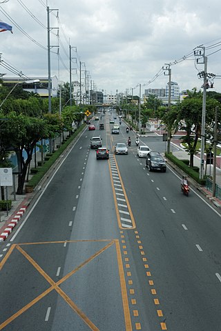
Phran Nok Road is about two km (about one mi) long. It begins in front of the Prannok Pier on the bank of Chao Phraya River, runs a short distance passing Siriraj Hospital. This part of the road was officially renamed Wang Lang Road (ถนนวังหลัง, pronounced [tʰā.nǒnwāŋlǔaŋ] ) in 2012 following a cabinet resolution to reflect its history, where the road passed was once a rear palace (Wang Lang) in the early Rattanakosin period. Then it continues running to meet Charan Sanitwong Road at Fai Chai Intersection. According to the policy of Field Marshal Plaek Phibunsongkhram, the late Prime Minister who wanted to name the roads in Thonburi Province following the name of the importance battling places where King Taksin the Great fought for Siam independent in order to commemorate and honour the King. According to the policy of Field Marshal Plaek Phibunsongkhram, the late Prime Minister who wanted to name the roads in Thonburi Province following the name of the importance battling places where King Taksin the Great fought for Siam independent in order to commemorate and honour the King. Thereby, this road is named Phran Nok to follow the name of the first battlefield, Ban Phran Nok (currently in Uthai District, Phra Nakhon Si Ayutthaya Province), where Phraya Vajiraprakarn (his highest title before becoming the King) defeated the Burmese army on January 4, 1767 before the second fall of Ayutthaya in the same year. [1] [2]
Phran Nok Intersection, where the road cuts across Itsaraphap Road, and where Wang Lang Road originate. It is a source of many southern Thai restaurants, which lined up on the both sides of the road all the way to Wang Lang Market. Many of which are old. This is because in the vicinity is the Thonburi railway station, which was originally the destination of the southern railway. Moreover, in the nearby area, Fai Chai Intersection was also the location of the Southern Bus Terminal. As a result, Phran Nok and Wang Lang neighbourhoods are residential areas for southerners. [3] [4]

Bang Rak is one of the fifty districts (khet) of Bangkok, Thailand. It lies on the eastern bank of the Chao Phraya River, beyond Khlong Phadung Krung Kasem, which marked the old city boundary. Originating from riverside settlements dating from before the city's foundation, Bang Rak grew inland as new roads and canals were constructed through the area during the second half of the nineteenth century and the early twentieth, attracting communities of expatriates and developing into a major commercial district. Bangkok's rapid economic growth in the late twentieth century saw the areas along Si Lom and Sathon roads transformed into one of the city's main business districts, teeming with skyscrapers. The district, officially recognised at least since 1908, covers an area of 5.54 square kilometres (2.14 sq mi), and has a registered population of 48,227. Today, Bang Rak is known for the financial activity of its commercial offices, as well as its vibrant nightlife scenes. Diverse historic and religious sites, most significantly concentrated in Bang Rak Subdistrict on the waterfront, reflect the district's multicultural history.

Khlong San is one of the 50 districts (khet) of Bangkok, Thailand. On the west bank of Chao Phraya River, its neighboring districts across the river are Phra Nakhon, Samphanthawong, Bang Rak, Sathon, and Bang Kho Laem. On the west side of the river, the only land neighbor is Thon Buri district.

Phraya Phichai, or popularly known as Phraya Phichai Dap Hak was a historic Siamese nobleman of Mon descent who served as a military leader under King Taksin of Thonburi. He legendarily became known for fighting with a sword in each hand until one was broken.

Sathon Road is a major road that passes through the districts of Bang Rak and Sathon in central Bangkok, Thailand. It is an important transportation link between Phra Nakhon and Thonburi sides of Bangkok.

Bang Lamphu or spelled Banglampoo and Banglamphu is a neighbourhood in Bangkok located in Phra Nakhon District. The history of the Bang Lamphu community dates to the establishment of the Rattanakosin Kingdom, or earlier. Bang Lamphu covers an area north of Phra Nakhon both inside and outside Rattanakosin Island from Phra Athit to Samsen Roads, which leads toward Dusit District. Most of the area of Bang Lamphu is in Talat Yot Subdistrict, some have spread to various nearby subdistricts including Chana Songkhram, Bowon Niwet, Ban Phan Thom up till Wat Sam Phraya.

Tha Din Daeng is a market and one of the oldest neighbourhoods in Bangkok. It is in the Somdet Chao Phraya and Khlong San Subdistricts of Khlong San District on the Thonburi side.

Wang Lang Market is a daily market in Bangkok Noi district next to Chao Phraya river.

Si Kak Phraya Si is an intersection in area of Wang Burapha Phirom sub-district, Phra Nakhon district, Bangkok. It is the intersection of Charoen Krung, Fueang Nakhon and Ban Mo roads. It is considered to be the second intersection of Charoen Krung, the first official street in Thailand, after nearby Saphan Mon.

Song Wat Road is a historic road in the area of Bangkok's Samphanthawong district. It has its origins by separating from Chak Phet road near Chakkrawat police station and foot of Phra Pok Klao bridge on the borderline of Chakkrawat sub-district, Samphanthwong district and Wang Burapha Phirom sub-district, Phra Nakhon district, then cuts across Ratchawong road in the area near Ratchawong pier, as far as ending at Khao Lam cycle, where it combines Khao Lam and Charoen Krung roads in Talat Noi sub-district in the area known as Sieng Kong (เซียงกง) or officially Soi Wanit 2. The distance is 1,196 m alongside Chao Phraya river almost all the length.

Rama I Road is a road in Bangkok. It starts from the end of Bamrung Mueang Road where it intersects Krung Kasem Road at the border between the districts of Pom Prap Sattru Phai and Pathum Wan. From this point, it crosses Kasat Suek Bridge, also known as Yotse Bridge, which runs above Khlong Phadung Krung Kasem and the railway running from nearby Hua Lamphong railway station. Continuing east, it ends at Ratchaprasong intersection, a four-way intersection of Ratchadamri Road, Rama I Road and Phloen Chit Road. The total distance is 2.8 kilometres (1.7 mi).

Krom Phra Thephamat, also known as Iang (เอี้ยง) or Nok-iang (นกเอี้ยง), was a royal woman of the Thonburi dynasty, Siam. She was the mother of Taksin, the founder of Thonburi kingdom. She was of Mon-Thai descent.

Ban Chang Lo is one of five subdistricts (khwaeng) and namesake historic neighbourhood in Bangkok Noi District, Bangkok's Thonburi side.

Prannok Pier, also known as the Siriraj Pier or Wang Lang Pier with designated pier number N10, is a pier on the Chao Phraya River located at the Siriraj Subdistrict, Bangkok Noi District in the area adjacent Siriraj Hospital and Wang Lang Market.

Rama II Road or Highway 35 is a road in Thailand heading towards the south. Rama II Road starts from Chom Thong District in the Thonburi side of Bangkok, passing through Bang Khun Thian District into Samut Sakhon Province. It then enters Samut Songkhram Province and terminates at a junction with Phet Kasem Road in Ratchaburi Province, with a total distance of 84.041 kilometres (52.221 mi). The road is maintained by the Department of Highways.

Ratchawong Pier is a pier on Chao Phraya River in Bangkok.
Itsaraphap Road is a main road in Bangkok's Thonburi side. It is also the location of the Itsaraphap MRT station, the Blue Line extension station and the only underground station on the Thonburi side.

Charan Sanit Wong Road is a main road in Bangkok's Thonburi side, it is named in honour of Luang Charan Sanit Wong, the former Permanent Secretary, Ministry of Transport. Its name has been misspelled as จรัลสนิทวงศ์ in Thai according to the 1999 Royal Institute Dictionary.

Banthat Thong Road is a street in Bangkok. It runs 2.2 kilometres (1.4 mi) from its junction with Rama IV Road at Saphan Lueang Intersection, through Pathum Wan and Ratchathewi districts, north to Phet Phra Ram Intersection, where it meets Phetchaburi Road. It crosses Rama I Road at Charoen Phon Intersection, near the National Stadium, and the area is home to a large number of sporting goods shops. The southern section of the road runs parallel to the canal Khlong Suan Luang, which also gives its name to the neighbourhood. The area's land is owned by Chulalongkorn University, whose Office of Property Management (PMCU) redeveloped most of the neighbourhood in the 2010s.
Bang Rak is a khwaeng (subdistrict) and historic neighbourhood in Bangkok's Bang Rak District. It lies between the Chao Phraya River and Charoen Krung Road, and was home to communities of European expatriates who settled in the area mostly during the second half of the 19th century as Siam opened up to the West. Among them were the Portuguese, French and British, whose embassies occupied extensive grounds in the area, Danes who founded shipping companies as well as the historic Oriental Hotel, and Catholic missionaries who established some of the first schools in the country on the grounds surrounding Assumption Cathedral.