Pieczyska, Inowrocław County

Last updated
Pieczyska
Village
Country Flag of Poland.svg  Poland
Voivodeship Kuyavian-Pomeranian
County Inowrocław
Gmina Dąbrowa Biskupia

Pieczyska [pjɛˈt͡ʂɨska] is a village in the administrative district of Gmina Dąbrowa Biskupia, within Inowrocław County, Kuyavian-Pomeranian Voivodeship, in north-central Poland. [1]

Gmina Dąbrowa Biskupia is a rural gmina in Inowrocław County, Kuyavian-Pomeranian Voivodeship, in north-central Poland. Its seat is the village of Dąbrowa Biskupia, which lies approximately 20 kilometres (12 mi) east of Inowrocław and 29 km (18 mi) south of Toruń.

Inowrocław County County in Kuyavian-Pomeranian, Poland

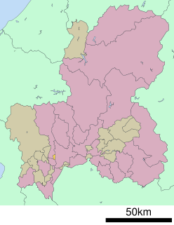
Inowrocław County is a unit of territorial administration and local government (powiat) in Kuyavian-Pomeranian Voivodeship, north-central Poland. It came into being on January 1, 1999, as a result of the Polish local government reforms passed in 1998. Its administrative seat and largest town is Inowrocław, which lies 36 km (22 mi) south-west of Toruń and 40 km (25 mi) south-east of Bydgoszcz. The county contains four other towns: Kruszwica, lying 14 km (9 mi) south of Inowrocław, Janikowo, lying 12 km (7 mi) south-west of Inowrocław, Gniewkowo, 16 km (10 mi) north-east of Inowrocław, and Pakość, 13 km (8 mi) west of Inowrocław.

Kuyavian-Pomeranian Voivodeship Voivodeship in Poland

Kuyavian-Pomeranian Voivodeship, also known as Cuiavian-Pomeranian Voivodeship or simply Kujawsko-Pomorskie, or Kujawy-Pomerania Province, is one of the 16 voivodeships (provinces) into which Poland is divided. It is situated in mid-northern Poland, on the boundary between the two historic regions from which it takes its name: Kuyavia and Pomerania. Its two chief cities, serving as the province's joint capitals, are Bydgoszcz and Toruń.

Related Research Articles

Motosu District, Gifu district of Japan

Motosu District is a district located in Gifu Prefecture, Japan.

Chaowai Subdistrict subdistrict in Chaoyang District, Beijing

Chaowai is a part of the city of Beijing. It refers to the area to the east Chaoyangmen Gate of Ming city wall.

Fira village in Greece

Firá is the modern capital of the Greek Aegean island of Santorini. A traditional settlement, "Firá" derives its name from an alternative pronunciation of "Thíra", the ancient name of the island itself.

Cefn Rhigos is a hamlet (place) to the west of the village of Rhigos, Wales. Despite being eight (8) miles from the town centre, for postal purposes it comes under Aberdare.

Hažín municipality of Slovakia

Hažín is a village and municipality in Michalovce District in the Kosice Region of eastern Slovakia.

Kami-Shinjō Station railway station in, Osaka, Osaka prefecture, Japan

Kami-Shinjō Station is a railway station on the Hankyu Kyoto Line located in Higashiyodogawa-ku, Osaka Prefecture, Japan. It is one of two nearest stations to Osaka University of Economics as well as Zuiko Yonchome Station on the Osaka Metro Imazatosuji Line.

Świerzna is a village in the administrative district of Gmina Oleśnica, within Oleśnica County, Lower Silesian Voivodeship, in south-western Poland. Prior to 1945 it was in Germany.

Karjagi is a village in the southern state of Karnataka, India. It is located in the Haveri taluk of Haveri district in Karnataka.

Kōfūdai Station is a train station in Toyono, Toyono District, Osaka Prefecture, Japan.

Ksar El Boukhari District District in Médéa Province, Algeria

Ksar El Boukhari District is a district of Médéa Province, Algeria.

Little Rincon Mountains

The Little Rincon Mountains are a small range of mountains, lying to the east of the Rincon Mountains, at Tucson, of eastern Pima County, Arizona. The range is located in northwest Cochise County and is part of the western border of the San Pedro River and Valley, the major valley and river of western Cochise County. The river is northward flowing to meet the Gila River; its headwaters are south of the US-Mexico border in northern Sonora. A small part of the Little Rincon range's southwest lies in Pima County.

Donje Punoševce is a village in the municipality of Vranje, Serbia. According to the 2002 census, the village has a population of 21 people.

Nsaba is a town in the Central Region. The Nsaba Presbyterian Secondary School is located in the town. The school is a second cycle institution.

Alaunbach river in Germany

Alaunbach is a river of North Rhine-Westphalia, Germany.

Çamlıca is a village in the District of Merzifon, Amasya Province, Turkey.

Sverrefjellet is a mountain in Haakon VII Land at Spitsbergen, Svalbard, at the western side of Bockfjorden. It has a height of 507 m.a.s.l., and is an extinct volcano. Sverrefjellet is named after Sverre Sigurdsson.

Dacres Wood

Dacres Wood is a small local nature reserve in Forest Hill in the London Borough of Lewisham. It is owned and managed by Lewisham Council.

Frisby and Kirby was a civil parish in the English county of Leicestershire that was abolished in 2005.

Samodiva is a village in Kirkovo Municipality, Kardzhali Province, southern Bulgaria.

Vangede Battery ancient monument in Gentofte Municipality (190109)

Vangede Battery, located in Vangede, Gentofte Municipality, is a former military structure and current park in the northern suburbs of Copenhagen, Denmark.

References


Coordinates: 52°45′03″N18°25′54″E / 52.7508°N 18.4317°E / 52.7508; 18.4317

Geographic coordinate system Coordinate system

A geographic coordinate system is a coordinate system that enables every location on Earth to be specified by a set of numbers, letters or symbols. The coordinates are often chosen such that one of the numbers represents a vertical position and two or three of the numbers represent a horizontal position; alternatively, a geographic position may be expressed in a combined three-dimensional Cartesian vector. A common choice of coordinates is latitude, longitude and elevation. To specify a location on a plane requires a map projection.