Piesau

Last updated
Piesau
Wappen Piesau.png
Coat of arms
Location of Piesau
Germany adm location map.svg
Red pog.svg
Piesau
Thuringia location map.svg
Red pog.svg
Piesau
Coordinates: 50°30′52″N11°13′08″E / 50.51444°N 11.21889°E / 50.51444; 11.21889 Coordinates: 50°30′52″N11°13′08″E / 50.51444°N 11.21889°E / 50.51444; 11.21889
Country Germany
State Thuringia
District Sonneberg
Town Neuhaus am Rennweg
Area
  Total7.86 km2 (3.03 sq mi)
Elevation
640 m (2,100 ft)
Population
(2017-12-31)
  Total715
  Density91/km2 (240/sq mi)
Time zone CET/CEST (UTC+1/+2)
Postal codes
98739
Dialling codes 036701
Vehicle registration SON
Website www.piesau.de

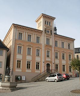
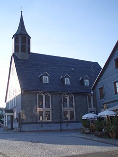
Piesau is a village and a former municipality in the district of Sonneberg in Thuringia, Germany, close to the Thuringian Rennsteig. Formerly in the district Saalfeld-Rudolstadt, it is part of the town Neuhaus am Rennweg since January 2019.

Sonneberg (district) District in Thuringia, Germany

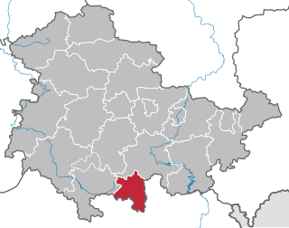
Sonneberg is a Kreis (district) in the south of Thuringia, Germany. Neighboring districts are the districts Hildburghausen, Saalfeld-Rudolstadt, and the Bavarian districts Kronach and Coburg.

Thuringia State in Germany

Thuringia, officially the Free State of Thuringia, is a state of Germany.

Germany Federal parliamentary republic in central-western Europe

Germany, officially the Federal Republic of Germany, is a country in Central and Western Europe, lying between the Baltic and North Seas to the north, and the Alps, Lake Constance and the High Rhine to the south. It borders Denmark to the north, Poland and the Czech Republic to the east, Austria and Switzerland to the south, France to the southwest, and Luxembourg, Belgium and the Netherlands to the west.

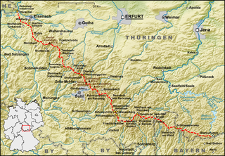
It has a glass factory and is known as glass-maker village. The first time glass was made in Piesau was in 1622. Up until today glass is the main reason of existence in Piesau. Carl Heinz Glass still produces glass, for instance for the cosmetics industry. The inventor of the first usable röntgenglass (Carl Heinrich Florenz Müller) descends from the village. Piesau lies next to the "Rennsteig", a hiking path of more than 160 kilometres throughout Thüringen.

Before 2019, it was part of the municipal association Lichtetal am Rennsteig, which consists of the municipalities Lichte, Piesau, Reichmannsdorf, and Schmiedefeld.

Lichtetal am Rennsteig municipal association in Thuringia, Germany

Lichtetal am Rennsteig is a former municipal association in the district of Saalfeld-Rudolstadt, in Thuringia, Germany. The seat of government was in Lichte. It was disbanded in January 2019.

Reichmannsdorf Ortsteil of Saalfeld in Thuringia, Germany

Reichmannsdorf is a village and a former municipality in the district Saalfeld-Rudolstadt, in Thuringia, Germany. Since 1 January 2019, it is part of the town Saalfeld. Before, it belonged to the municipal association Lichtetal am Rennsteig, which consisted of the municipalities Lichte, Piesau, Reichmannsdorf, and Schmiedefeld.

Schmiedefeld (Lichtetal) Ortsteil of Saalfeld in Thuringia, Germany

Schmiedefeld is a village and a former municipality in the district Saalfeld-Rudolstadt, in Thuringia, Germany close to the Thuringian Rennsteig. Since 1 January 2019, it is part of the town Saalfeld. Before, it belonged to the municipal association Lichtetal am Rennsteig, which consisted of the municipalities Lichte, Piesau, Reichmannsdorf, and Schmiedefeld.

Related Research Articles

Blankenstein Ortsteil of Rosenthal am Rennsteig in Thuringia, Germany

Blankenstein is a village and a former municipality in the district Saale-Orla-Kreis, in Thuringia, Germany. Since 1 January 2019, it is part of the municipality Rosenthal am Rennsteig.

Gräfenroda Ortsteil of Geratal in Thuringia, Germany

Gräfenroda is a village and a former municipality in the Ilm-Kreis district, in Thuringia, Germany. Since 1 January 2019, it is part of the municipality Geratal. It was the administrative seat of the former Verwaltungsgemeinschaft Oberes Geratal.

Gräfenthal Place in Thuringia, Germany

Gräfenthal is a town in the district of Saalfeld-Rudolstadt in Thuringia, Germany.

Lauscha Place in Thuringia, Germany

Lauscha is a town in the district of Sonneberg, in Thuringia, Germany. It is situated 13 km north of Sonneberg, and 24 km southwest of Saalfeld. Lauscha is known for its glassblowing, especially for Christmas tree decorations like baubles.

Neustadt am Rennsteig Ortsteil of Großbreitenbach in Thuringia, Germany

Neustadt am Rennsteig is a village and a former municipality in the district Ilm-Kreis, in Thuringia, Germany. Since 1 January 2019, it is part of the town Großbreitenbach. Its history can be traced back to the 15th century. Due to its location at 805 metres above sea level, there is scarcely another Thuringian locality located this high.

Schmiedefeld am Rennsteig Ortsteil of Suhl in Thuringia, Germany

Schmiedefeld am Rennsteig is a village and a former municipality in Thuringia, Germany. Formerly in the district Ilm-Kreis, it is part of the town Suhl since January 2019.

Blankenberg, Thuringia Ortsteil of Rosenthal am Rennsteig in Thuringia, Germany

Blankenberg is a village and a former municipality in the district Saale-Orla-Kreis, in Thuringia, Germany. Since 1 January 2019, it is part of the municipality Rosenthal am Rennsteig.

Neundorf bei Lobenstein Ortsteil of Rosenthal am Rennsteig in Thuringia, Germany

Neundorf bei Lobenstein is a village and a former municipality in the district Saale-Orla-Kreis, in Thuringia, Germany. Since 1 January 2019, it is part of the municipality Rosenthal am Rennsteig.

Schlegel, Thuringia Ortsteil of Rosenthal am Rennsteig in Thuringia, Germany

Schlegel is a village and a former municipality in the district Saale-Orla-Kreis, in Thuringia, Germany. Since 1 January 2019, it is part of the municipality Rosenthal am Rennsteig. Olympian Harry Köcher was born here.

Birkenhügel Ortsteil of Rosenthal am Rennsteig in Thuringia, Germany

Birkenhügel is a village and a former municipality in the district Saale-Orla-Kreis, in Thuringia, Germany. Since 1 January 2019, it is part of the municipality Rosenthal am Rennsteig.

Harra Ortsteil of Rosenthal am Rennsteig in Thuringia, Germany

Harra is a village and a former municipality in the district Saale-Orla-Kreis, in Thuringia, Germany. Since 1 January 2019, it is part of the municipality Rosenthal am Rennsteig.

Pottiga Ortsteil of Rosenthal am Rennsteig in Thuringia, Germany

Pottiga is a village and a former municipality in the district Saale-Orla-Kreis, in Thuringia, Germany. Since 1 January 2019, it is part of the municipality Rosenthal am Rennsteig.

Mutzenberg mountain in Germany

The Mutzenberg is a 770.0 m high mountain located in the Thuringian Highland, Thuringia (Germany).

Mittelberg (Thuringian Highland)

The Mittelberg is an 803.6 m high mountain located in the Thuringian Highland, Thuringia (Germany).

Hahnberg (Thuringian Highland) mountain

The Hahnberg is a 685.3 m high slightly undulatory tableland located in the Thuringian Highland, Thuringia (Germany).

Piesau (river) river in Germany

The Piesau is a right tributary of the river Lichte in Thuringia, Germany. It is approximately 7 km (4.3 mi) long. The name is derived from the municipality of Piesau.

References