Piethorne Brook

Last updated

Piethorne Brook
Piethorne Brook.jpg
Looking upstream to Ogden from Newhey
Location
Country England
Physical characteristics
Source 
  location Windy Hill
Mouth  
  location
River Beal, Newhey
  coordinates
53°35′56.57″N2°05′44.31″W / 53.5990472°N 2.0956417°W / 53.5990472; -2.0956417

Piethorne Brook is a watercourse in Greater Manchester. It is a tributary of the River Beal.

Contents

Sources

Piethorne Brook and its feeder streams originate on the area of high moorland at Windy Hill on the south side of the M62 motorway close to its summit near the old boundary between Lancashire and Yorkshire. The source of the brook, and its immediate feeder stream, is beside Rock Stones Hill, at 415 metres above sea level (1360 ft.), to the south west of the telecommunications mast beside the A672 Oldham-Ripponden road. The brook has ten other feeder streams including two from Axletree Edge beyond Bleakedgate Moor, which rises to 425 metres (1400 ft), two from Millstone Moss between Green Hole Hill and Readycon Hill, rising at 445 metres (1450 ft.) and flowing down Great Whinning Gulf and Little Whinning Gulf, via Culvert Clough, into Cold Greave Brook. [1]

Course

Piethorne Brook feeds and flows through a series of reservoirs constructed during the 19th century. From its source, they are Norman Hill Reservoir, Piethorne Reservoir, into which Cold Greave Brook and Tom Brook flow, Kitcliffe Reservoir, and Ogden Reservoir, into which Rag Hole Brook flows. The reservoirs and Hanging Lees Reservoir and Rooden Reservoir are in the Piethorne Valley. Below Ogden Reservoir, close to Lanebottom, the brook is joined by Wickenhall Brook. It then flows under Peppermint Bridge to Haugh Lane and is culverted under the tram line (the former railway line) to its confluence with the River Beal at Two Bridges in Newhey. [2]

History

A Celtic spearhead unearthed during excavations for Piethorne Reservoir provides evidence of habitation in the Bronze Age. Binns Farm dated from the 13th century was demolished to make way for the reservoir. [3] Other farms including Piethorn and Norman Hill were mentioned in court documents or leases of 1606 and 1608. [4] The ancient packhorse route, Rapes Highway (named after Rapes Hill) passed across the brook and its feeder streams. [5] In the hamlet of Haugh near Newhey, residents were said to have panned for gold in the brook until the 19th century. [6] The brook marked the end of the Shaw to Featherstall (Littleborough) turnpike road after funding from mill-owners in Crompton and Two Bridges was withdrawn. In 1851 the Piethorne Brook bridge on Shaw Road was shown as a wooden bridge, whereas the adjacent Beal bridge had been improved. [7] In the 19th century, the brook was used in the creation of several reservoirs in the area including Norman Hill, Piethorne, Kitcliffe, Ogden, Rooden and Hanging Lees. The importance of the brook to the locality was recognized by the Oldham historian Edwin Butterworth, circa 1837, when he marked the brook as the River Haugh in one of his early maps of the Oldham district. [8]

Name

One explanation of the brook's name is that "pie" is short for magpie, and "thorne" for hawthorn, both bird and bush re common in the area. [9] The lowest mill on the brook was called Salt Pye Cotton Mill in the 19th century. [10] The name "salt pye" is connected to the old packhorse routes and signifies a building, on or near a packhorse route, used for the distribution of salt from Cheshire. [11]

Mills

Butterworth, writing in 1828, described the area above Newhey, where Piethorne Brook enters the River Beal; he wrote that "there are many woollen mills, supplied with numerous streams of water". [12] The earliest woollen mills were established at farmhouses; Kitcliffe Farm had a fulling mill, powered by a wooden waterwheel, and some of the mill structure can still be seen. [13] In the 19th century, larger mills were built below the brook's confluence with Wickenhall Brook, to use the waters for processing rather than power. The mills were Ogden Mill (bleaching and finishing), Wood Mill (fellmongering), [14] Haugh Mill (woollen), Haugh Mill (cotton), and Salt Pye Mill (cotton waste spinning). Each mill, apart from Haugh Mill, had a reservoir or millpond fed by the brook; Ogden Mill had a reservoir and millpond. Another mill, Lower Two Bridges Mill, took water from the River Beal and also from the brook via the discharge from the Salt Pye Mill reservoir. The latter mill subsequently changed its name to Two Bridges Mill and, after 1919, to Coral Mill. [15]

Reservoirs

Oldham Corporation began work on Piethorne Reservoir, to be fed by the brook and Cold Greave Brook, in 1858, and it was completed and filled ten years later. It was found that the brooks carried moorland silt into the reservoir and Hanging Lees Reservoir was built as a (silt) settling reservoir, and Norman Hill Reservoir as a higher reservoir. A stone-step cascade, or man-made waterfall, was built for the brook to pass from Norman Hill into Piethorne Reservoir. Diverting the brooks' waters resulted in a significant reduction of flow into the lower brook. In consequence, and as a result of the Gas and Water Works Facilities Act 1870, Kitcliffe Reservoir and Ogden Reservoir were built below Piethorne Reservoir and Oldham Corporation Waterworks was required to discharge one million gallons a day into the brook. [16]

Lower tributaries

Rag Hole Brook, whose name derives from the Lancashire dialect word "rag", meaning hoar frost, [17] enters Ogden Reservoir. Wickenhall Brook is the major lower tributary. Its source is in high moorland near the A640 Huddersfield Road, in Little Rochdale Parish. After passing beneath the road, it flows down a deep clough, feeds two former mill ponds, is culverted beneath the site of a former mill and print works, and is finally culverted at Lanebottom, before flowing down to join Piethorne Brook before Ogden Mill. An overflow drain arcs round to Ogden Reservoir. It falls 200 m (610 ft.) in a little over 2 km (1.3 miles). [18]

Wickenhall Brook is named after the Lancashire dialect word "wicken", meaning rowan or mountain ash, found in its Clough at a place called Wicken Hole. [19]

Tributaries

See also

Related Research Articles

<span class="mw-page-title-main">Rochdale</span> Town in Greater Manchester, England

Rochdale is a town in Greater Manchester, England, and the administrative centre of the Metropolitan Borough of Rochdale. In the 2021 census the town had a population of 111,261, compared to 223,773 for the wider borough. Rochdale is in the foothills of the South Pennines and lies in the dale (valley) of the River Roch, 5 miles (8 km) northwest of Oldham, and 10 miles (16 km) northeast of Manchester.

<span class="mw-page-title-main">Milnrow</span> Human settlement in England

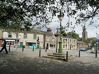
Milnrow is a town within the Metropolitan Borough of Rochdale, in Greater Manchester, England. It lies on the River Beal at the foothills of the South Pennines, and forms a continuous urban area with Rochdale. It is 2 miles (3.2 km) east of Rochdale town centre, 10 miles (16.1 km) north-northeast of Manchester, and spans from Windy Hill in the east to the Rochdale Canal in the west. Milnrow is adjacent to junction 21 of the M62 motorway, and includes the village of Newhey, and hamlets at Tunshill and Ogden.

<span class="mw-page-title-main">River Roch</span> River in Greater Manchester, England

The River Roch is a river in Greater Manchester in North West England, a tributary of the River Irwell.

<span class="mw-page-title-main">Littleborough, Greater Manchester</span> Town in Rochdale, England

Littleborough is a town in the Metropolitan Borough of Rochdale, Greater Manchester, England, in the upper Roch Valley by the foothills of the South Pennines, 3 miles (4.8 km) northeast of Rochdale and 13 miles (20.9 km) northeast of Manchester; Milnrow and the M62 motorway are to the south, and the rural uplands of Blackstone Edge to the east. According to the 2001 census, Littleborough, and its suburbs of Calderbrook, Shore and Smithy Bridge, had a population of 13,807.

<span class="mw-page-title-main">River Hyndburn</span> River in Lancashire, England

The River Hyndburn is a minor river in Lancashire, England. Beginning as Woodnook Water on the slopes of Goodshaw Hill, it passes through Stone Fold, Rising Bridge and Baxenden where it is augmented by streams from Thirteen Stone Hill and continues to the Woodnook area of Accrington. Near St James Church, it collects Broad Oak Water, becoming the River Hyndburn. It heads northward through the town centre, collecting Pleck Brook and turning west, flowing under the East Lancashire railway line viaduct and continuing to Church.

<span class="mw-page-title-main">Blackstone Edge</span> Gritstone escarpment in the Pennine Hills, England

Blackstone Edge is a gritstone escarpment at 472 metres (1,549 ft) above sea level in the Pennine hills surrounded by moorland on the boundary between Greater Manchester and West Yorkshire in England.

<span class="mw-page-title-main">River Spodden</span> River in North West England

The River Spodden is a watercourse in North West England, one of two major tributaries of the River Roch. It rises in the Lancashire South Pennine hills north of Whitworth and flows south through what is now known as the Whitworth Valley to Rochdale, Greater Manchester, where the river merges with the River Roch. Nestled within the picturesque wooded valley is Healey Dell Nature Reserve.

<span class="mw-page-title-main">Newhey</span> Human settlement in England

Newhey is a village near the town of Milnrow in the Metropolitan Borough of Rochdale, in Greater Manchester, England. It lies at the foot of the South Pennines, by Junction 21 of the M62 motorway and on the River Beal, 3 miles (4.8 km) east-southeast of Rochdale, 10 miles (16.1 km) northeast of Manchester.

<span class="mw-page-title-main">River Beal</span> River in Greater Manchester, England

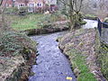
The Beal is a small river in Greater Manchester, England, and is a tributary of the River Roch. It rises in the Beal Valley in green space between Sholver and Royton, before continuing northwards through Shaw and Crompton, Newhey, Milnrow and Belfield.

<span class="mw-page-title-main">Butterworth (ancient township)</span> Ancient township in England

Butterworth was a township occupying the southeastern part of the parish of Rochdale, in the hundred of Salford, Lancashire, England. It encompassed 12.1 square miles (31 km2) of land in the South Pennines which spanned the settlements of Belfield, Bleaked-gate-cum-Roughbank, Butterworth Hall, Clegg, Haughs, Hollingworth, Kitcliffe, Lowhouse, Milnrow, Newhey, Ogden, Rakewood, Smithy Bridge, Tunshill and Wildhouse. It extended to the borders of Crompton to the south, and to the highest points of Bleakedgate Moor and Clegg Moor, up to the ridge of Blackstone Edge, to the east, where its boundary was the old county boundary between Lancashire and Yorkshire.

<span class="mw-page-title-main">Ogden Reservoir (Greater Manchester)</span> Reservoir in Rochdale, England

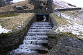
Ogden Reservoir is a reservoir in the Piethorne Valley, close to Milnrow and Newhey in the Metropolitan Borough of Rochdale, within Greater Manchester, England.

<span class="mw-page-title-main">Butterworth Hall Brook</span> Stream in Greater Manchester, England

Butterworth Hall Brook is a water course in Greater Manchester, North-West England, which flows through the village of Milnrow and is a tributary of the River Beal.

<span class="mw-page-title-main">Piethorne Reservoir</span> Reservoir in Greater Manchester

Piethorne Reservoir is the largest of several reservoirs in the Piethorne Valley above Newhey, by Milnrow, in the Metropolitan Borough of Rochdale, Greater Manchester, England. It was built between 1858 and 1868.

<span class="mw-page-title-main">Stanney Brook</span> River in England

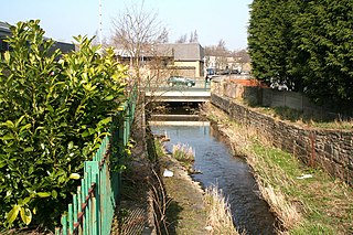
Stanney Brook is a watercourse in Greater Manchester, England. It originates in the Burnedge area of Shaw and Crompton, and flows through Milnrow into Rochdale before joining the River Roch at Newbold Brow. Alone among the watercourses of Milnrow and Newhey, it does not pass through the centre of either village, and flows directly into the River Roch, rather than first into the River Beal. Its name derives from the Lancashire dialect word "stanner", a ridge of stones. It is also unusual in that the borough in which it rises, changes, depending on the wetness of surrounding moorland. The brook drops 100 metres in a little over 5.5 kilometres, or 330feet in 3.5 miles. It is culverted four times, generally is only 60 cm (2 ft) wide, and rarely exceeds 90 cm (3 ft) in width at any point.

<span class="mw-page-title-main">Belfield, Greater Manchester</span> Locality within Rochdale, in Greater Manchester, England

Belfield is an area within Rochdale, in Greater Manchester, England. It lies at the confluence of the River Beal and River Roch, 1.3 miles (2.1 km) east-northeast of Rochdale's town centre. Belfield is bound to the east by the Rochdale Canal, which forms Rochdale's common boundary with Firgrove in Milnrow.

<span class="mw-page-title-main">Ellenroad Mill</span> Cotton mill in Newhey, Milnrow, Rochdale, England

Ellenroad Mill was a cotton spinning mill in Newhey, a village in the Milnrow area of Rochdale, England. It was built as a mule spinning mill in 1890 by Stott and Sons and extended in 1899. It was destroyed by fire on 19 January 1916. When it was rebuilt, it was designed and equipped as a ring spinning mill.

<span class="mw-page-title-main">Moston Brook</span> Stream in Greater Manchester, England

Moston Brook is a stream in Greater Manchester in north-west England and a tributary of the River Irk. The brook is formed at the confluence of Bower Brook and Hole Bottom Brook. This occurs near the Rochdale Canal in Failsworth in the Metropolitan Borough of Oldham. It flows southwest, forming the border between Moston, Manchester and Failsworth before being culverted almost all of the remaining route to its meeting the River Irk. It has a total length of about 3.7 miles.

<span class="mw-page-title-main">Walverden Water</span> River in Lancashire, England

Walverden Water is a minor river in Lancashire, England. It is approximately 2.6 miles (4.2 km) long and has a catchment area of 5.04 square miles (1,304.23 ha).

References

  1. Ordnance Survey Lancashire Sheet LXXXIX.4 (edition of 1910) Ordnance Survey Sheets SD81/91 "Bury, Rochdale and Littleborough" 1983, SD91 "Littleborough" 1972
  2. Ordnance Survey Sheets SD81/91 & SD91, above. Ordnance Survey Greater Manchester Sheet SD91SW, 1979
  3. Nicola Carroll Reservoir Trail: Watershed walks in the South Pennines (Rochdale & Oldham Councils) 2013, pp30-32
  4. Henry Fishwick The History of the Parish of Rochdale in the County of Lancaster (James Clegg, Rochdale & London) 1889,pp383-4
  5. Herbert C.Collins The Roof of Lancashire (London, Dent & Sons) 1950, p30
  6. Rochdale & Oldham Councils, Beal Valley Way 2010
  7. Ordnance Survey Lancashire Survey Sheet "Area of Prestwich-cum-Oldham" 1851. See also Brian Hindle The Cotton Mills of Crompton, Vol2, 1800-1860 deposited at Oldham & Crompton libraries, 2006, pp246-7, 510
  8. Edwin Butterworth A Map of the Country five miles round Tandle Hill in the Township of Thornham and County Palatine of Lancaster, republished by Giles Shaw Edwin Butterworth : His Life and Labours in Transactions of the Lancashire and Cheshire Antiquarian Society Vol.XXII (1904) pp.61-72, map facing p.63
  9. Carroll, above, p30
  10. Ordnance Survey Lancashire Survey Sheet "Area of Prestwich-cum-Oldham 1851
  11. Hindle, above, p513
  12. James Butterworth A History and Description of the Town and Parish of Rochdale (Rochdale, published by subscription) 1828
  13. Carroll, above, p33
  14. Fellmongering is the process of stripping fleeces of wool, and blending them. See Tim Hignett Milnrow & Newhey: A Lancashire Legacy (Geo.Kelsall, Littleborough) 1991 p10
  15. Ordnance Survey Lancashire Survey Sheet LXXXIX 7, Yorkshire (West Riding) Sheet CCLVIII 12 (part of), Edition of 1909. Hindle, above, pp512-513
  16. Carroll, above, pp34-35. Rochdale Council & others Joint Management Committee Piethorne Valley, Walk no.1 1987
  17. J.H.Nodal & G.Milner A Glossary of the Lancashire Dialect 1875, (edition published by Manchester Literary Club 1972)
  18. Ordnance Survey Sheets SD81/91, & SD91, above
  19. Nodal & Milner, above. Fishwick, above, p382
  20. Cassini Historical Map Old Series 1842-1844 Map 109 ISBN   9781847360113