This article has multiple issues. Please help improve it or discuss these issues on the talk page . (Learn how and when to remove these messages)
|
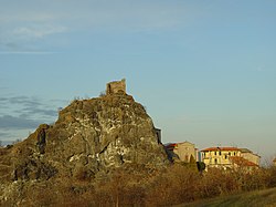
Pietramogolana | |
|---|---|
 | |
 Interactive map of Pietramogolana | |
| Country | |
| Region | Emilia-Romagna |
| Province | Parma |
| Commune | Berceto |
| Time zone | UTC+1 (CET) |
| • Summer (DST) | UTC+2 (CEST) |
Pietramogolana is a frazione of the commune of Berceto in the Emilia-Romagna region of Italy. [1]
The hamlet was once named "Petra Mugulana", from the Latin Petra Mugiens, namely "roaring stone", referring to the roaring waters of the river Taro which runs by the base of the rocky outcrop upon which the hamlet is built.