
Port-au-Prince is the capital and most populous city of Haiti. The city's population was estimated at 1,200,000 in 2022 with the metropolitan area estimated at a population of 2,618,894. The metropolitan area is defined by the IHSI as including the communes of Port-au-Prince, Delmas, Cité Soleil, Tabarre, Carrefour, and Pétion-Ville.

Nord (French) or Nò is one of the ten departments of Haiti and located in northern Haiti. It has an area of 2,114.91 km2 (816.57 sq mi) and a population of 1,067,177 (2015). Its capital is Cap-Haïtien.

Las Américas International Airport is an international airport located in Punta Caucedo, near Santo Domingo and Boca Chica in the Dominican Republic. The airport is run by Aeropuertos Dominicanos Siglo XXI (AERODOM), a private corporation based in the Dominican Republic, under a 25-year concession to build, operate, and transfer (BOT) six of the country's airports. Las Américas usually receives a wide variety of long-, mid-, and short-haul aircraft. Santo Domingo's other airport, La Isabela, is much smaller and used by smaller aircraft only.

Les Cayes, often referred to as Aux Cayes, is a commune and seaport in the Les Cayes Arrondissement, in the Sud department of Haiti, with a population of 71,236. Due to its isolation from the political turmoil of the capital, Port-au-Prince, it is one of Haiti's major ports, with export trade concentrating on mostly coffee and sugarcane. As the world's largest supplier of vetiver, it exports 250 tons annually of this ingredient of perfume and fragrance manufacturing. Minor exports include bananas and timber.

JAGS McCartney International Airport, also known as Grand Turk International Airport, is an airport located 1 mile (1.6 km) south of Cockburn Town on Grand Turk Island in the Turks and Caicos Islands, an overseas territory of the United Kingdom. It is the second largest airport in the territory, after Providenciales International Airport.

Toussaint Louverture International Airport is an international airport in Tabarre, a commune of Port-au-Prince in Haiti. The airport is currently the busiest in Haiti and is an operating hub for Sunrise Airways.

Samaná, in full Santa Bárbara de Samaná, is a town and municipality in northeastern Dominican Republic and the capital of Samaná Province. It is on the northern coast of Samaná Bay. The town is an important tourism destination and the main center for whale-watching tours in the Caribbean region.
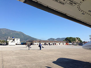
Cap-Haïtien International Airport is a minor international airport serving Cap-Haïtien, a city in Nord, Haiti. It is the second largest airport in Haiti. This airport connects Haiti to airports like Miami International Airport, Providenciales International Airport, Cibao International Airport, and among others in the Caribbean region. The last airport for refueling for general aviation coming from the Bahamas into Haiti is Inagua Airport, located in Great Inagua, located at Matthew Town.

Ouanaminthe is a commune or town located in the Nord-Est department of Haiti. It lies along the Massacre River, which forms part of the border between Haiti and the Dominican Republic. Ouanaminthe is the largest commune of northeastern Haiti and of the Nord-Est Department. The bridge connecting Ouanaminthe to the Dominican city of Dajabón is one of the four main border crossings between the two countries. Throughout its history, the city has repeatedly been a site of mediation in international disputes, first between French and Spanish colonists, and in more modern times as part of the long-standing Haitian-Dominican conflict.
Port-de-Paix Airport is in passenger numbers, the third airport in Haiti and is located in the city with the same name, Port-de-Paix, on the north coast of Haiti.

Gobernador Horacio Guzmán International Airport is an airport in Jujuy Province, Argentina serving the city of San Salvador de Jujuy. It is the northernmost Argentinian airport served by scheduled flights. It is located 33 km (21 mi) southeast of the city in Ciudad Perico.
Pignon is a commune in the Saint-Raphaël Arrondissement, in the Nord department of Haiti. It has 29,327 inhabitants.
Saint-Raphaël is an arrondissement in the Nord department of Haiti. As of 2015, the population was 169,867 inhabitants. Postal codes in the Saint-Raphaël Arrondissement start with the number 14.
The Rivière Bouyaha is a river of Haiti.
The timeline of rescue efforts after the 2010 Haiti earthquake of 12 January 2010 involves the sequence of events in the days following a highly destructive 7.0 Mw earthquake with an epicenter 25 kilometres (16 mi) west of the nation's capital, Port-au-Prince. With at least 70% of the city's buildings destroyed, the earthquake also caused damage and loss of life in other parts of the country. The Haitian government experienced a near-collapse and affected people were left mostly to their own resources until foreign aid arrived in the following days. Initial death toll estimates ranged between 50,000 and 200,000.
Líneas Aéreas Inter Islas, SRL, doing business as Air Inter Island, is a Dominican Republic-based air carrier that operates domestics and international flights in the Dominican Republic and Haiti.
Ouanaminthe Airport is a small airport that serves the city of Ouanaminthe in the Nord-Est department of Haiti, on the border with Dominican Republic.

Union Sportive Lajeune de Pignon is a professional football club based in Pignon, Haiti.
