All of the major transportation systems in Haiti are located near or run through the capital, Port-au-Prince.

Luis Muñoz Marín International Airport is a joint civil-military international airport located in suburban Carolina, Puerto Rico, three miles (5 km) southeast of San Juan. It is named for Luis Muñoz Marín, Puerto Rico's first democratically elected governor, and was known as Isla Verde International Airport until it was renamed in February 1985. It is the busiest airport in the Caribbean region by passenger traffic. Over 4 million passengers boarded a plane at the airport per year according to the Federal Aviation Administration, making it the 48th busiest airport overseen by said federal agency.

Mercedita International Airport (AIM) is an international airport located three nautical miles (6 km) east of the central business district of Ponce, Puerto Rico. The airport covers 270 cuerdas of land and has one runway. It was inaugurated as an international airport on 1 November 1990. It was built with combined funds from the Municipality of Ponce and the Commonwealth of Puerto Rico.

Atatürk Airport is an airport currently in use for private jets. It used to be the primary international airport of Istanbul and the hub of Turkish Airlines until it was closed to commercial passenger flights on 6 April 2019. From that point, all passenger flights were transferred to the new Istanbul Airport.

Rafael Hernández International Airport is a joint civil-military airport located in Aguadilla, Puerto Rico. It is named after the Puerto Rican composer Rafael Hernández Marín. It is Puerto Rico's second largest international airport in terms of passenger movement. It is located in Porta del Sol tourist region, in Puerto Rico's west coast. It is also home to Coast Guard Air Station Borinquen and to the Caribbean Branch of the U.S. Customs and Border Protection Air and Marine Operations. The airport has the longest runway in the Caribbean region.

Nord-Ouest (French) or Nòdwès is one of the ten departments of Haiti as well as the northernmost one. It has an area of 2,102.88 km2 (811.93 sq mi) and a population of 728,807. Its capital is Port-de-Paix.

Las Américas International Airport is an international airport located in Punta Caucedo, near Santo Domingo and Boca Chica in the Dominican Republic. The airport is run by Aeropuertos Dominicanos Siglo XXI (AERODOM), a private corporation based in the Dominican Republic, under a 25-year concession to build, operate, and transfer (BOT) six of the country's airports. Las Américas usually receives a wide variety of long-, mid-, and short-haul aircraft. Santo Domingo's other airport, La Isabela, is much smaller and used by smaller aircraft only.
Tropical Airways was a small airline with scheduled and charter services based in Port-au-Prince, Haiti.

Hillsboro Airport, also known as Portland–Hillsboro Airport, is a corporate, general aviation and flight-training airport serving the city of Hillsboro, in Washington County, Oregon, United States. It is one of three airports in the Portland, Oregon, metropolitan area owned and operated by the Port of Portland. Established in 1928, it is Oregon's second busiest airport at over 200,000 operations annually. HIO covers 900 acres and has three runways.
María Montez International Airport is an international airport 3 kilometres (1.9 mi) north of the Caribbean port city of Barahona, in the Barahona Province of the Dominican Republic. It is named after the late film star Maria Montez, who was born in the province of Barahona.

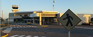
Toussaint Louverture International Airport is an international airport in Tabarre, a commune of Port-au-Prince in Haiti. The airport is currently the busiest in Haiti and is an operating hub for Sunrise Airways.

Kokkola-Pietarsaari Airport is located in Kronoby, Finland, about 19 kilometres (12 mi) south of Kokkola city centre and 30 kilometres (19 mi) north-east of Jakobstad city centre.
Cabo Rojo Airport is a Caribbean coastal airport in the Dominican Republic 16 kilometres (9.9 mi) southeast of Pedernales, a port city on the border with Haiti. The airport offers domestic flights to destinations within the Dominican Republic.
Antoine Simon Airport is a commercial airport in Haiti. It is the fourth largest airport in Haiti for passenger traffic and is 9 kilometres (5.6 mi) north of Les Cayes, a Caribbean coastal city in Haiti's Southern peninsula.

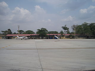
Jacmel Airport was the sixth busiest airport in Haiti by passenger volume before the 2010 Haitian earthquake, near the city of Jacmel, on Haiti's south coast. The airport's time zone is GMT –5, and is in World Area Code region #238. This airport is normally served by scheduled and charter airlines operating in the capital Port-au-Prince, and was opened in 2006 for travel to and from the capital and other destinations across the country.

Toledo Executive Airport is seven miles southeast of Toledo, in Wood County, Ohio. It is an FAA designated reliever to Toledo Express Airport (TOL), Toledo's primary airport. Toledo Executive Airport was renamed from Metcalf Field in 2010.
The Las Brujas Airport is a domestic airport located in the town of Corozal, Sucre in Colombia. The airport is located 10 minutes from the capital of the department, the city of Sincelejo. In emergency situations, it serves as the alternate airport of the city of Montería. It has regional and national operations with regular passenger services to Bogotá and Medellín.

Bokaro Airport is a domestic airport owned by the Steel Authority of India Limited (SAIL) and operated by the Airports Authority of India (AAI). It is located approximately 4.1 km (2.5 mi) from the city centre. The airport has been primarily developed to serve the region of Eastern part of Jharkhand and some districts of West Bengal. It is spread over an area of 200 acres (81 ha) while the runway is 1,650 meters long, capable of handling ATR 72 type of aircraft. Former Chief Minister Raghubar Das and former Minister of State for Civil Aviation Jayant Sinha laid the foundation stone of development for the airport on 25 August 2018, and is set to be inaugurated on 28 February 2024.

Tropical Airways Flight 1301 (TBG1301/M71301) was a domestic short-haul passenger flight, flying from Cap-Haïtien International Airport in Cap-Haïtien, Haiti to the commune of Port-de-Paix which crashed onto a sugarcane field less than 10 minutes after take off on the evening of 24 August 2003. The aircraft was a 19-seater Let L-410 Turbolet carrying 19 passengers and 2 crew. Witnesses stated that the aircraft caught fire during take-off and exploded when it hit the ground. All on board were killed.
