Pike County Gulch

Last updated

Coordinates: 37°55′54″N122°41′20″W / 37.93167°N 122.68889°W / 37.93167; -122.68889 [1]

Geographic coordinate system Coordinate system

A geographic coordinate system is a coordinate system that enables every location on Earth to be specified by a set of numbers, letters or symbols. The coordinates are often chosen such that one of the numbers represents a vertical position and two or three of the numbers represent a horizontal position; alternatively, a geographic position may be expressed in a combined three-dimensional Cartesian vector. A common choice of coordinates is latitude, longitude and elevation. To specify a location on a plane requires a map projection.

Pike County Gulch is a coastal valley in Marin County, California, United States, [1] which is associated with a small stream. It is located between Wilkins Gulch (to the northwest) and Audubon Canyon (to the southeast).
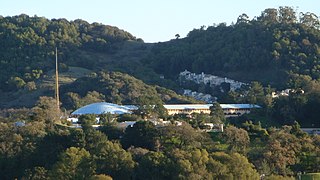
Marin County, California County in California, United States

Marin County is a county located in the San Francisco Bay Area of the U.S. state of California. As of the 2010 census, the population was 252,409. Its county seat is San Rafael. Marin County is included in the San Francisco-Oakland-Hayward, CA Metropolitan Statistical Area across the Golden Gate Bridge from San Francisco.

United States Federal republic in North America

The United States of America (USA), commonly known as the United States or America, is a country comprising 50 states, a federal district, five major self-governing territories, and various possessions. At 3.8 million square miles, the United States is the world's third or fourth largest country by total area and is slightly smaller than the entire continent of Europe's 3.9 million square miles. With a population of over 327 million people, the U.S. is the third most populous country. The capital is Washington, D.C., and the largest city by population is New York City. Forty-eight states and the capital's federal district are contiguous in North America between Canada and Mexico. The State of Alaska is in the northwest corner of North America, bordered by Canada to the east and across the Bering Strait from Russia to the west. The State of Hawaii is an archipelago in the mid-Pacific Ocean. The U.S. territories are scattered about the Pacific Ocean and the Caribbean Sea, stretching across nine official time zones. The extremely diverse geography, climate, and wildlife of the United States make it one of the world's 17 megadiverse countries.

Wilkins Gulch

Wilkins Gulch is a valley in western Marin County, California, United States, located northwest of Pike County Gulch. It is associated with a small stream.

The stream descends the western slope of the Bolinas Ridge, crosses State Route 1 about 3 miles (5 km) north of Stinson Beach, California, and drains into the northern tip of Bolinas Lagoon. [2]

Bolinas Ridge mountain in United States of America

Bolinas Ridge is a north-south ridge in southwestern Marin County, California. Much of the western side of the ridge is protected parkland in the Golden Gate National Recreation Area, and the eastern side is watershed lands of the Marin Municipal Water District.

California State Route 1 highway in California

California State Route 1 (SR 1) is a major north–south state highway that runs along most of the Pacific coastline of the U.S. state of California. At a total of just over 659 miles (1,061 km), it is the longest state route in California. SR 1 has several portions designated as either Pacific Coast Highway (PCH), Cabrillo Highway, Shoreline Highway, or Coast Highway. Its southern terminus is at Interstate 5 (I-5) near Dana Point in Orange County and its northern terminus is at U.S. Route 101 (US 101) near Leggett in Mendocino County. SR 1 also at times runs concurrently with US 101, most notably through a 54-mile (87 km) stretch in Ventura and Santa Barbara counties, and across the Golden Gate Bridge.

Stinson Beach, California census-designated place in California, United States

Stinson Beach is a census-designated place in Marin County, California, on the west coast of the United States. Stinson Beach is located 2.5 miles (4 km) east-southeast of Bolinas, at an elevation of 26 feet. The population of the Stinson Beach CDP was 632 at the 2010 census.

The gulch contains an ore vein 4 feet (1.22 m) thick containing pyrite, located a mile (1.6 km) south of the Union Gulch Mine. [3]

Pyrite sulfide mineral

The mineral pyrite (/ˈpaɪraɪt/), or iron pyrite, also known as fool's gold, is an iron sulfide with the chemical formula FeS2 (iron(II) disulfide). Pyrite is considered the most common of the sulfide minerals.

Related Research Articles

Bolinas Bay

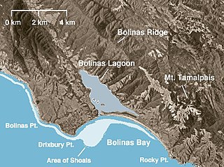
Bolinas Bay is a small bay, approximately 5 miles (8 km) wide, on the Pacific coast of California in the United States. It is in Marin County, north of the Golden Gate, approximately 15 miles (25 km) northwest of San Francisco. The town of Bolinas is at its shore.

Bolinas Lagoon lagoon in California

Bolinas Lagoon is a tidal estuary, approximately 1,100 acres (4.5 km2) in area, located in the West Marin region of Marin County, California, United States, adjacent to the town of Bolinas. It is a part of the Greater Farallones National Marine Sanctuary and is considered to be among the possible landing spots of Sir Francis Drake on the west coast of North America in 1579.

Copper Mine Gulch is a valley in Marin County, California, United States, which is associated with a small stream.

Audubon Canyon

Audubon Canyon is a coastal valley in Marin County, California, United States, which is associated with a small stream. The canyon provides habitat for a variety of animals and plants. Notably, its redwoods provide nesting sites for great blue herons, great egrets, and snowy egrets.

Morses Gulch river in the United States of America

Morses Gulch is a coastal valley in Marin County, California, United States.

McKinnan Gulch is a valley in Marin County, California, United States.

Stinson Gulch river in the United States of America

Stinson Gulch is a valley in Marin County, California, United States which is associated with a small stream.

Purisima Creek (San Mateo County) stream in California, United States of America

Purisima Creek is an 8.0-mile-long (12.9 km) stream in San Mateo County, California which rises 1.3 miles (2.1 km) north of Sierra Morena and flows westward to the Pacific Ocean 2.3 miles (3.7 km) south-southeast of Miramontes Point. Much of its watershed has been incorporated in the Purisima Creek Redwoods Open Space Preserve.

Whittemore Gulch is a valley in San Mateo County, California. It contains a small stream which is a tributary of Purisima Creek.

Rogers Gulch is a small river in San Mateo County, California. It contains a small stream which is a tributary of Lobitos Creek.

Rodgers Gulch is a valley in San Mateo County, California. It contains a small stream which is a tributary of San Gregorio Creek. The stream flows about 1.5 miles (2 km) from its source on Mindego Hill to its confluence with Alpine Creek, just east (upstream) of the boundary of the Heritage Grove Redwood Preserve.

Pine Tree Gulch is a valley in San Mateo County, California. It contains a small stream which is a tributary of San Gregorio Creek. The stream flows about 0.5 miles (1 km) from its source to its confluence with El Corte de Madera Creek.

Shaw Gulch is a valley in San Mateo County, California. It contains a stream which flows about 1.5 miles (2 km) from its source. The stream's waters drain into Bradley Creek about 1.5 miles (2 km) north of the town of Pescadero.

Honsinger Creek is a 3.6-mile-long (5.8 km) stream in San Mateo County, California and a tributary of Pescadero Creek.

Newell Gulch is a valley in San Mateo County, California. It contains a stream which is a tributary of Pescadero Creek.

Pine Gulch Creek is a 7.6-mile-long (12.2 km) south-flowing stream in western Marin County, California, United States which empties into Bolinas Lagoon.

Duxbury Reef State Marine Conservation Area

Duxbury Reef State Marine Conservation Area (SMCA) is a marine protected area located about 1 mile (2 km) west of Bolinas in Marin County on California’s north central coast. This marine protected area covers 0.66 square miles (1.7 km2). Duxbury Reef SMCA prohibits the take of all living marine resources, except the recreational take of finfish from shore only and the recreational take of abalone.

Gee Creek is a 4th order tributary to the Columbia River, a.k.a. small creek, within Clark County, Washington named for William Gee, an early pioneer upon whose land the stream arose from. The Upper Gee Creek watershed, with an 8.7-square-mile (23 km2) drainage basin, is completely located within the Ridgefield quadrangle. The mainstem extends approximately 11.5 miles (18.5 km), of which 4.9 miles (7.9 km) are located within the Upper Gee Creek basin. Originating in the hills along Interstate 5, through Ridgefield, Washington and empties into a series of lakes on the Columbia River Floodplain. Abrams Park in Ridgefield is a local access point for Gee Creek and since 2003, has had a stream flow gauge installed to collect hydrological data. The lowest segment of Gee Creek meanders for 3 miles (4.8 km) through the Ridgefield National Wildlife Refuge.

References

See also