
The visible spectrum is the portion of the electromagnetic spectrum that is visible to the human eye. Electromagnetic radiation in this range of wavelengths is called visible light or simply light. A typical human eye will respond to wavelengths from about 380 to about 750 nanometers. In terms of frequency, this corresponds to a band in the vicinity of 400–790 terahertz. These boundaries are not sharply defined and may vary per individual. Under optimal conditions these limits of human perception can extend to 310 nm (ultraviolet) and 1100 nm . The optical spectrum is sometimes considered to be the same as the visible spectrum, but some authors define the term more broadly, to include the ultraviolet and infrared parts of the electromagnetic spectrum as well.

Luna County(Spanish: Condado de Luna) is a county located in the U.S. state of New Mexico. As of the 2020 census, the population was 25,427. Its county seat is Deming. This county abuts the Mexican border. Luna County comprises the Deming, NM Micropolitan Statistical Area.

Lincoln County is a county in the U.S. state of New Mexico. As of the 2020 census, the population was 20,269. Its county seat is Carrizozo, while its largest community is Ruidoso.
Tijeras is a village in Bernalillo County, New Mexico, United States. The population was 541 at the 2010 census. It is part of the Albuquerque metropolitan area.

Hatch is a village in Doña Ana County, New Mexico, United States. The population was 1,648 at the 2010 census. The town is experiencing moderate growth, along with its outliers of Salem, Arrey, Derry, and Rincon. Hatch is widely known as the "best chile place in the World," for growing a wide variety of peppers, especially the New Mexican cuisine staple, and one of New Mexico's state vegetables, the New Mexico chile.

Ruidoso is a village in Lincoln County, New Mexico, United States, adjacent to the Lincoln National Forest. The population was 8,029 at the 2010 census. The city of Ruidoso Downs and the unincorporated area of Alto are suburbs of Ruidoso, and contribute to the Ruidoso Micropolitan Statistical Area's population of 21,223.
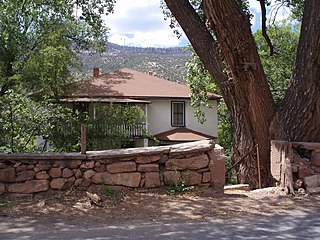
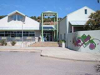
Jemez Springs is a village in Sandoval County, New Mexico, United States. The population was 250 at the 2010 census. Named for the nearby Pueblo of Jemez, the village is the site of Jemez State Monument and the headquarters of the Jemez Ranger District. The village and nearby locations in the Jemez Valley are the site of hot springs and several religious retreats.

Los Lunas is a village in Valencia County, New Mexico, United States. As of the 2010 census, the village population is 14,835 inside the village limits due to the new housing developments at El Cerro de Los Lunas. It is the county seat of Valencia County. Los Lunas is part of the Albuquerque Metropolitan Statistical Area.

Corrales is a village in southern Sandoval County, New Mexico, United States. First farmed by Tiquex Pueblo people, chosen due to its proximity to the Rio Grande, as documented by Hispano farmers of Nuevo México in the late 1500s. Despite being a part of the Albuquerque metropolitan area, the village maintains its rural character, while also being surrounded by the cities of Albuquerque and Rio Rancho. The population of Corrales was 8,329 at the 2010 Census.

The following are examples of orders of magnitude for different lengths.

The Honda D series inline-four cylinder engine is used in a variety of compact models, most commonly the Honda Civic, CRX, Logo, Stream, and first-generation Integra. Engine displacement ranges between 1.2 and 1.7 liters. The D Series engine is either SOHC or DOHC, and might include VTEC variable valve lift. Power ranges from 66 PS (49 kW) in the Logo to 130 PS (96 kW) in the Civic Si. D-series production commenced 1984 and ended 2005. D-series engine technology culminated with production of the D15B 3-stage VTEC (D15Z7) which was available in markets outside of the United States. Earlier versions of this engine also used a single port fuel injection system Honda called PGM-CARB, signifying the carburetor was computer controlled.

Kuta is a tourist area, administratively an urban village (kelurahan), and the capital of Kuta District, Badung Regency, southern Bali, Indonesia. Kuta is a part of the Denpasar metropolitan area and is situated 12 km (7.5 mi) south of Downtown Denpasar. It was originally known as a fishing village, it was one of the first towns on Bali to see substantial tourist development, and as a beach resort remains one of Indonesia's major tourist destinations. It is known internationally for its long sandy beach, varied accommodation, many restaurants and bars, and many renowned surfers who visit from Australia. It is located near Bali's Ngurah Rai Airport.
Moetoetoetabriki is a village in Boven Saramacca resort in Sipaliwini District in Suriname. The village is inhabited by Matawai people.
Pakka-Pakka or Pakkapakka, also Pakkapakka 1 and Pakkapakka 2, is a Maroon village in the rainforest of Boven Saramacca resort in Sipaliwini District in Suriname. The village is inhabited by Matawai people. The village was founded in the 1860s and was originally home to both Matawai and Kwinti people.
Banguele is a village in the Lobaye region in the Central African Republic southwest of the capital, Bangui.
Kumardad or Konardan is a town in Sistan va Baluchestan, Iran.
Akyauk is a village in Chipwi Township in Myitkyina District in the Kachin State of north-eastern Burma.
Zangogho is a town in the Toece Department of Bazèga Province in central Burkina Faso. The town has a population of 1,188.
Jagan is a village in Rezvan Rural District, Jebalbarez District, Jiroft County, Kerman Province, Iran. At the 2006 census, its population was 55, in 10 families.
