Related Research Articles
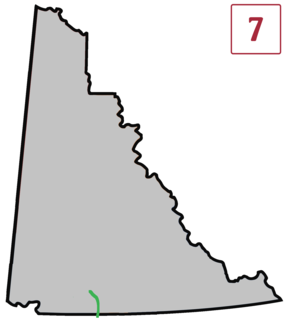
The Atlin Road is a road in British Columbia and Yukon, Canada. It is designated as Highway 7 in Yukon, and has no official highway number in British Columbia.
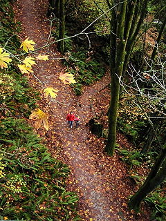
Ravenna Park and Cowen Park comprise a single contiguous recreation and green space in the Ravenna neighborhood of Seattle, Washington in the United States. These public parks encompass the ravine with a maximum depth of 115 feet (35 m) through which Ravenna Creek flows.
N'Quatqua, variously spelled Nequatque, N'quat'qua, is the proper historic name in the St'at'imcets language for the First Nations village of the Stl'atl'imx people of the community of D'Arcy, which is at the upper end of Anderson Lake about 35 miles southeast of Lillooet and about the same distance from Pemberton. The usage is synonymous with Nequatque Indian Reserve No. 1, which is 177 ha. in size and located adjacent to the mouth of the Gates River.

Atlin/Áa Tlein Téix'i Provincial Park is a provincial park in British Columbia, Canada. Situated in the remote northwestern corner of the province, the park protects large tracts of boreal forest, alpine tundra and glaciated terrain. The southern third of Atlin Lake, the largest natural body of freshwater in the province, is within the park boundary. The park is very undeveloped; no roads traverse it and no facilities, supplies, developed campsites or maintained hiking trails are available inside the park. The area has become a focal point in controversies involving proposed hydroelectric projects affecting Atlin Lake and environmental groups who view these proposals as potentially damaging to the lake's environment and its surroundings.
The Goldstream River is a river northwest of Victoria on southern Vancouver Island, British Columbia, Canada. The river's name derives from a small gold rush in its basin during the 1860s, and was originally Gold Stream.
The Tulsequah River, formerly the Talsekwe River, is a tributary of the Taku River in northwestern British Columbia, located south of the Atlin District and inland from Juneau, Alaska. The unincorporated settlement of Tulsequah is located at the confluence.
Anderson Bay is a bay of Atlin Lake in northwestern British Columbia, Canada, located southwest of Pike Bay.
The Taku River Tlingit First Nation are the band government of the Inland Tlingit in far northern British Columbia, Canada and also in Yukon. They comprise two ḵwaan (tribes) of the Tlingit people, who are otherwise coastal, the Áa Tlein Ḵwáan of the Atlin Lake area and the Deisleen Ḵwáan of Teslin Lake, whose main focus is the Teslin Tlingit Council in Teslin, Yukon. Their band offices are in Atlin, British Columbia.
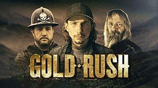
Gold Rush is a reality television series that airs on Discovery and its affiliates worldwide. The series follows the placer gold mining efforts of various family-run mining companies, mostly in the Klondike region of Dawson City, Yukon, Canada. In its 11th season as of early 2020, prior seasons also included mining efforts in South America and western North America.
Birch Creek is a creek located in the Atlin Country region of British Columbia. Birch Creek flows parallel to Boulder Creek and Ruby Creek. The creek is located west of Lake Surprise. Birch Creek flows into Pine Creek and was discovered in 1898. The greatest mining activity took place between 1902 and the start of the First World War. Some mining activity also occurred during the 1930s. The Dominion Trust Company hydraulicked Birch Creek in the 1930s. The largest pure gold nugget in the district was recovered from this creek in 1913. The nugget was 73 ounces. In the Gold Boom years the Creek was largely ignored as the depth of bed rock discouraged hand mining operations. When gold in other creeks in the vicinity were exhausted, attention was turned to Birch.

Discovery City is a ghost town located in the Atlin Country region of British Columbia. The city was located near Pine Creek, southwest of the south end of Surprise Lake. Discovery City was also known as Pine City. Discovery City existed to support the gold mining operations in the area. The city was founded in 1898 with the discovery of gold in Pine Creek. For a few years it had a population of 1,000. The city had hotels such as the Pine Tree, The Nugget, The Gold House and others. When the gold was depleted, the city was vacated. By 1915 it was deserted.
Boulder Creek is a creek located in the Atlin Country region of British Columbia.
McKee Creek is a creek located in the Atlin Country region of British Columbia. The creek flows into Atlin Lake from the east side. It is located 8 miles south of Atlin Town and is 7 miles in length. McKee Creek was first discovered in 1898, and since then has been hand-mined and hydraulicked. Outfits such as Atlin Mining Company have worked the creek, with the largest gold nugget recovered from the creek weighing just over 28 ounces. McKee Creek was a consistent mining producer well into the 1930s.
O'Donnel River is a river located in the Atlin Country region of British Columbia. This river flows into the east side of Atlin Lake about 23 kilometres (14 mi) south of the town of Atlin. The river is about 48 kilometres (30 mi) long. The river was first recorded in 1898 and was originally known as Moose River or Caribou River. In 1912 a rich gold streak was discovered in the river, which attracted many miners. The river has been sluiced, drifted, and hydraulicked.
Otter Creek is a creek located in the Atlin Country region of British Columbia. This creek flows into the south side of Lake Surprise about 2 miles west of Wright Creek. Otter Creek was discovered in 1898. The creek has been mined and for some years Compagnie Francaise des Mines d'Or du Canada hydraulicked a number of leases along Otter Creek.
Ruby Creek is a creek located in the Atlin Country region of British Columbia. This creek flows into the north side of Lake Surprise about 3 miles to the east of Boulder Creek. The creek has been mined and was discovered in 1898. The largest nugget recovered from the creek weighed just over 47 ounces on July 3, 1931.
Spruce Creek is located in the Atlin Country region of British Columbia. The creek flows into Pine Creek. Fred Marius discovered gold in this creek in 1898. In 1899 two American prospectors named West and Hoffenen found a gold nugget which weighed just over 83 ounces. The nugget was nicknamed "the west". "The west" nugget contained some quartz and thus was not the largest solid gold nugget found in British Columbia. The creek produced over 300,000 fine ounces of gold, valued at $7,000,000.
Dollis Creek is a creek that spans the border between British Columbia and the Yukon. The creek is 8 miles in length and flows from the Atlin Country region of British Columbia north across the BC-Yukon boundary into the Tatshenshini River approximately 10 miles from Old Dalton Post.
Wright Creek is a creek located in the Atlin Country region of British Columbia. The creek flows into the south side of Lake Surprise. It is located 2 miles to east of Otter Creek. The creek was mined for gold.
The Atlin River is a river located in the Atlin/Téix'gi Aan Tlein Provincial Park in British Columbia, Canada. It flows out from Atlin Lake
References
- ↑ N.L. Barlee (1980), The Guide to Gold Panning, Revised Second Edition, Second Printing. Canada West Publications., ISBN 0-920164-04-8