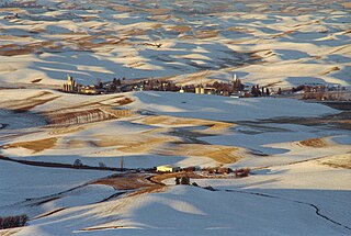
Steptoe is a small unincorporated rural town in Whitman County, Washington, United States. The ZIP Code for Steptoe is 99111.

Byhalia is an unincorporated community in Washington Township, Union County, Ohio, United States. It is located at 40°27′13″N83°27′20″W, at the intersection of State Routes 31 and 739.
Hansford is an unincorporated community in Kanawha County, West Virginia, United States. Hansford is located along the Kanawha River and West Virginia Route 61, adjacent to Pratt. Hansford has a post office with ZIP code 25103.

Lucerne is an unincorporated community in Chelan County, Washington, United States. Lucerne is assigned the ZIP code 98816.
Grandview is an unincorporated community in Washington County, in the U.S. state of Ohio.

Buckeye is an unincorporated community in Spokane County, in the U.S. state of Washington.
Ceres is an unincorporated community in Lewis County, in the U.S. state of Washington. It is located off Washington State Route 6 in a bend of the Chehalis River. The Willapa Hills Trail bisects the area.

Denison is an unincorporated community in Spokane County, in the U.S. state of Washington. The community is located on U.S. Route 395 19 miles due north of Downtown Spokane and about seven miles beyond that city's northern suburban developments. Denison lends its name to two roads in the area, Denison Road and Denison-Chattaroy Road, both of which intersect with Route 395 in the immediate vicinity of Denison. The city of Deer Park is four miles to the north.
Grays is an unincorporated community in Stevens County, in the U.S. state of Washington.

Hazard is an unincorporated community in Spokane County, in the U.S. state of Washington.
Johnson is an unincorporated community in Whitman County, in the U.S. state of Washington.
Maplecreek is an unincorporated community in Chelan County, in the U.S. state of Washington. An alternate route of U.S. Route 97 runs through the community, connecting it with Chelan about 10 miles to the northeast and Entiat about 10 miles to the south.
Maud is an unincorporated community in Stevens County, in the U.S. state of Washington.
Orin is an unincorporated community in Stevens County, in the U.S. state of Washington. It is located on the Colville River. U.S. Route 395 passes through the community.

Peone is an unincorporated community in Spokane County, in the U.S. state of Washington.
Raeco is an unincorporated community in King County, in the U.S. state of Washington.
Reiter is an unincorporated community in Snohomish County, in the U.S. state of Washington.
Robe is an unincorporated community in Snohomish County, in the U.S. state of Washington.
Ward is an unincorporated community in Stevens County, in the U.S. state of Washington. It is located a mile-and-a-half east of Kettle Falls on U.S. Route 395.
Maryden is an unincorporated community in Washington County, in the U.S. state of Missouri.


