Related Research Articles

White Pine County is a largely rural, mountain county along the central eastern boundary of the U.S. state of Nevada. As of the 2020 census, the population was 9,080. Its county seat is Ely. The name "(Rocky Mountain) white pine" is an old name for the limber pine, a common tree in the county's mountains.
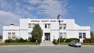
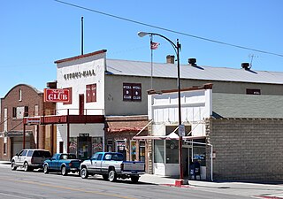
Lincoln County is a county in the U.S. state of Nevada. As of the 2020 census, the population was 4,499, making it the fourth-least populous county in Nevada. Its county seat is Pioche. Like many counties in Nevada, it is dry and sparsely populated, though notable for containing the Area 51 government Air Force base.
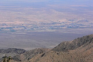
McGill is a census-designated place (CDP) in White Pine County, Nevada, United States. The population was 1,148 at the 2010 census.
Lake Mead National Recreation Area is a U.S. national recreation area in Southeastern Nevada and Northwestern Arizona. Operated by the National Park Service, Lake Mead NRA follows the Colorado River corridor from the westernmost boundary of Grand Canyon National Park to just north of the cities of Laughlin, Nevada and Bullhead City, Arizona. It includes all of the eponymous Lake Mead as well as the smaller Lake Mohave – reservoirs on the river created by Hoover Dam and Davis Dam, respectively – and the surrounding desert terrain and wilderness.

The Mohave Valley is a valley located mostly on the east shore of the south-flowing Colorado River in northwest Arizona. The valley extends into California's San Bernardino County; the northern side of the valley extends into extreme southeast Clark County, Nevada. The main part of the valley lies in southwest Mohave County, Arizona and is at the intersection of the southeast Mojave and northwest Sonoran deserts.
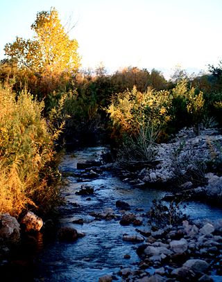
The Muddy River, formerly known as the Moapa River, is a short river located in Clark County, in southern Nevada, United States. It is in the Mojave Desert, approximately 60 miles (97 km) north of Las Vegas.

Sequoia National Forest is located in the southern Sierra Nevada mountains of California. The U.S. National Forest is named for the majestic Giant Sequoia trees which populate 38 distinct groves within the boundaries of the forest.

Panamint City is a ghost town in the Panamint Range, near Death Valley, in Inyo County, California, US. It is also known by the official Board of Geographic Names as Panamint. Panamint was a boom town founded after silver and copper were found there in 1872. By 1874, the town had a population of about 2,000. Its main street was one mile (1.6 km) long. Panamint had its own newspaper, the Panamint News. Silver was the principal product mined in the area. The town is located about three miles northwest of Sentinel Peak. According to the National Geographic Names Database, NAD27 latitude and longitude for the locale are 36°07′06″N117°05′43″W, and the feature ID number is 1661185. The elevation of this location is identified as being 6,280 feet AMSL. The similar-sounding Panamint Springs, California, is located about 25.8 miles at 306.4 degrees off true north near Panamint Junction.

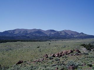
The Toquima Range is a mountain range, located primarily in Nye County with a small extension into Lander County, in Nevada, United States. Most of the range is included within the Humboldt-Toiyabe National Forest. The range reaches a maximum elevation of 11,949 feet (3,642 m) at the southern summit of Mount Jefferson. From Hickison Summit on U.S. Route 50, the range runs for approximately 71 miles (114 km) to the south-southwest. To its west are Big Smoky Valley, scenic State Route 376, and the large Toiyabe Range. To the east are remote Monitor Valley and the Monitor Range. Lying to the south of the range are U.S. Route 6 (Nevada) and the community of Tonopah, while to the north is U.S. Route 50, leading to the small community of Austin.

Pueblo Grande de Nevada,, is a complex of villages located near Overton, Nevada, and listed on the National Register of Historic Places.

La Madre Mountain Wilderness Area consists of 47,180 acres (19,090 ha) covering a part of Clark County, Nevada, that lies just west of the city of Las Vegas, between that city and Mount Charleston. The area includes La Madre Mountain and several archaeological areas including the Brownstone Canyon Archaeological District. The area is administered by the Humboldt-Toiyabe National Forest and the Bureau of Land Management.
Parsnip Peak Wilderness is a 43,693-acre (17,682 ha) wilderness in northeastern Lincoln County, Nevada. Its elevations range from 6,160 to 8,916 feet. It received wilderness status in 2004.
The Virgin Valley is a valley in northwest Arizona and southeast Nevada on the Virgin River. The Virgin River drains southwest Utah and southeast Nevada; parts of Arizona, especially the Arizona Strip region drain southwards into the Virgin River and Valley.
The Rice Valley Wilderness is a wilderness area near Blythe and Rice in the Mojave Desert region of California, managed by the Bureau of Land Management.

Little Finland is a scenic red rock area, located in a remote section of Clark County, Nevada, south of Mesquite, known for its red rock scenery and strangely-shaped, delicate rock formations. The landscape is similar to Valley of Fire State Park, which is about 20 miles (32 km) to the west, across Lake Mead. The rock formations are composed of red Aztec Sandstone, fossil sand dunes. Many of the features are small erosional fins, hence the name.

Mormon Mesa is a mesa between the Virgin River and the Muddy River in Clark County, southern Nevada.
Callville Wash is an ephemeral stream or wash in Clark County, Nevada. It was named for Callville the riverport settlement founded in 1866, at its mouth where it had its original confluence with the Colorado River.
Boulder Wash is an ephemeral stream or wash in Clark County, Nevada. Its mouth is at its confluence with the Boulder Wash Cove of Lake Mead at an elevation 1,276 feet at when Lake Mead is at its full level. Currently as the reservoir is at a much lower level its mouth is found at approximately 36°10′07″N114°33′07″W. Its source is at 36°13′36″N114°31′22″W at an elevation of 2,841 feet in the Black Mountains. It flows down a canyon into the upper Pinto Valley southwestward before turning southeastward to Boulder Wash Cove.
Lime Canyon Wilderness is a unit of the National Wilderness Preservation System located in eastern Nevada, United States, within the Gold Butte National Monument. The 23,710-acre (9,600 ha) wilderness area is administered by the Bureau of Land Management, and was designated in 2002 to protect roadless, undeveloped mountains bordering Lake Mead National Recreation Area.
Jimbilnan Wilderness is an 18,879 acre wilderness area that starts from the northeast side of the Black Mountains and extends eastward towards Lake Mead. On its west side lies Pinto Valley Wilderness Park, and Las Vegas can be found 40 miles west from the area. Jimbilnan Wilderness was designated as a wilderness area in 2002 and is under the management of the National Park Service.