Black Mountains (Nevada)

Last updated
Black Mountains
Relief map of USA Nevada.png
Red triangle with thick white border.svg
Black Mountains in Nevada [1]
Highest point
Peak Hamblin Mountain
Elevation 3,310 ft (1,010 m)
Coordinates 36°10′43″N114°38′51″W / 36.1786°N 114.6475°W / 36.1786; -114.6475
Geography
Country United States
State Nevada
County Clark
Range coordinates 36°12′55.930″N114°28′31.917″W / 36.21553611°N 114.47553250°W / 36.21553611; -114.47553250 Coordinates: 36°12′55.930″N114°28′31.917″W / 36.21553611°N 114.47553250°W / 36.21553611; -114.47553250
Topo map USGS  Middle Point

The Black Mountains, a mid-Miocene formation, [2] in Nevada are a series of rugged, arid rocky volcanic mountains ranging in elevations to 3310 ft. The range lies on the north shore of Lake Mead, at the southwest corner of the Overton Arm, about 25 mi south of Overton, Nevada.

Nevada State of the United States of America

Nevada is a state in the Western United States. It is bordered by Oregon to the northwest, Idaho to the northeast, California to the west, Arizona to the southeast and Utah to the east. Nevada is the 7th most extensive, the 32nd most populous, but the 9th least densely populated of the U.S. states. Nearly three-quarters of Nevada's people live in Clark County, which contains the Las Vegas–Paradise metropolitan area where three of the state's four largest incorporated cities are located. Nevada's capital, however, is Carson City.

Lake Mead reservoir on the Colorado River in the U.S. states of Nevada and Arizona

Lake Mead lies on the Colorado River, about 24 mi (39 km) from the Las Vegas Strip, southeast of the city of Las Vegas, Nevada, in the states of Nevada and Arizona. It is the largest reservoir in the United States in terms of water capacity. Formed by the Hoover Dam, the reservoir serves water to the states of Arizona, California, and Nevada, as well as some of Mexico, providing sustenance to nearly 20 million people and large areas of farmland.

Overton, Nevada Unincorporated Town in Nevada, United States

Overton is an unincorporated town located in Clark County, Nevada. The town is on the north end of Lake Mead. The town is home to Perkins Field airport and Echo Bay Airport.

Contents

The Black Mountains are mostly within the Lake Mead National Recreation Area, with a small valley bordering north, the Bitter Spring Valley at the southeast of the arid Muddy Mountains

Lake Mead National Recreation Area U.S. National Recreation Area in Nevada and Arizona

Lake Mead National Recreation Area is a U.S. National Recreation Area located in southeastern Nevada and northwestern Arizona. Operated by the National Park Service, Lake Mead NRA follows the Colorado River corridor from the westernmost boundary of Grand Canyon National Park to just north of the cities of Laughlin, Nevada and Bullhead City, Arizona. It includes all of the eponymous Lake Mead as well as the smaller Lake Mohave – reservoirs on the river created by Hoover Dam and Davis Dam, respectively – and the surrounding desert terrain and wilderness.

Bitter Spring Valley

The Bitter Spring Valley is a 13-mile (21 km) long valley located northeast of Las Vegas, Nevada on the west edge of Lake Mead, on the north-trending Overton Arm,.

Muddy Mountains

The Muddy Mountains are a large mountain range in Clark County, Nevada.

Deep canyons and washes that flow southeast into the Overton Arm of Lake Mead cut into the mountain range. [3] The range contains deposits of soft manganese oxides/hydroxides. [4]

History

The Armijo Route of the Old Spanish National Historic Trail ran down the Virgin Valley-Overton Arm section of the valleys now occupied by Lake Mead. The trail descended the Colorado from the mouth of the Virgin River, avoided Boulder Canyon, at the southwest of the Black Mountains, where the range is separated from the Black Mountains in Arizona. The trail heading west to Las Vegas Wash, entered the mountains, went southwest of Pyramid Peak to Pinto Valley, and then skirted Hamblin Mountain to the south, with Pinto and Razorback Ridges north; past Cottonwood Spring. North of those ridges lies the small, but broad, arid drainage valley, Bitter Springs Valley, which is southeast of, and adjacent the Muddy Mountains. The trail passes the southern third of the mountain range on the west, making the circuit around Hamblin Mountain and descending Callville Wash. The southwestern end of the Black Mountain range, is now at Callville Bay. At the time of the Old Spanish Trail the trail led to the bottom land valley along the Colorado River below the mouth of Boulder Canyon, that headed towards Las Vegas Wash.

Boulder Canyon (Colorado River) canyon on the Colorado River, above Hoover Dam, now flooded by Lake Mead

Boulder Canyon, originally Devils Gate Canyon, is a canyon on the Colorado River, above Hoover Dam, now flooded by Lake Mead. It lies between Clark County, Nevada and Mohave County, Arizona. It heads at western end of the Virgin River Basin of Lake Mead, at about 36°09′05″N114°32′51″W. Boulder Canyon divides the Black Mountains into the Black Mountains of Arizona, and the Black Mountains of Nevada. Its mouth is now under the eastern end of the Boulder Basin of Lake Mead, between Canyon Point in Nevada and Canyon Ridge in Arizona. Its original mouth is now underneath Lake Mead between Beacon Rock and Fortification Ridge on the southern shore in Arizona.

Virgin Valley a valley in northwest Arizona

The Virgin Valley is a valley in northwest Arizona and southeast Nevada on the Virgin River. The Virgin River drains southwest Utah and southeast Nevada; parts of Arizona, especially the Arizona Strip region drain southwards into the Virgin River and Valley.

Black Mountains (Arizona)

The Black Mountains of northwest Arizona are an extensive, mostly linear, north-south 75-mile (121 km) long mountain range. It forms the north-south border of southwest Mohave County as it borders the eastern shore of the south-flowing Colorado River from Hoover Dam.

Access

The northwest, and north of the mountains can be accessed by the paved route, North Shore Road, from Nevada State Route 564, Henderson, Nevada, about 30-mi to the south-southwest.

State Route 564 is an east–west highway in Clark County, Nevada, in the southeast portion of the Las Vegas Valley. The route travels through the city of Henderson, traveling from the junction of Interstate 215 (I-215) and I-11 south and I-515 north, also part of U.S. Route 93 and US 95, to Lake Las Vegas, ending near Lake Mead. The route was designated in 2002, replacing a portion of SR 146.

Henderson, Nevada City in Nevada, United States

Henderson, officially the City of Henderson, is a city in Clark County, Nevada, United States, about 16 miles (26 km) southeast of Las Vegas. It is the second-largest city in Nevada, after Las Vegas, with an estimated population of 302,539 in 2017. The city is part of the Las Vegas metropolitan area, which spans the entire Las Vegas Valley. Henderson occupies the southeastern end of the valley, at an elevation of 1,864 feet (568 m).

(northeast view)-Three sections-(2-black) of the Black Mountains on the north lake perimeter. The range to the north is the Muddy Mountains, trending north-northeast. Bitter Spring Valley lies between the ranges.
(The black range to the lake's southeast, is the Black Mountains (Arizona), north, a tenth of range length, north-south.) Lake Mead & Boulder City.jpg
(northeast view)-Three sections-(2-black) of the Black Mountains on the north lake perimeter. The range to the north is the Muddy Mountains, trending north-northeast. Bitter Spring Valley lies between the ranges.
(The black range to the lake's southeast, is the Black Mountains (Arizona), north, a tenth of range length, north-south.)

Related Research Articles

Mohave Valley

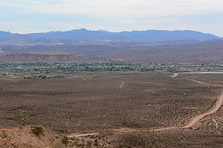
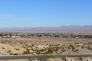
The Mohave Valley is a valley located mostly on the east shore of the south-flowing Colorado River in northwest Arizona. The valley extends into California's San Bernardino County; the northern side of the valley extends into extreme southeast Clark County, Nevada. The main part of the valley lies in southwest Mohave County, Arizona and is at the intersection of the southeast Mojave and northwest Sonoran deserts.

Muddy River (Nevada) watercourse in United States of America

The Muddy River, formerly known as the Moapa River, is a short river located in Clark County, in southern Nevada, United States. It is in the Mojave Desert, approximately 60 miles (97 km) north of Las Vegas.

Arizona Strip part of Arizona north of the Colorado River, having more physical/cultural connections with southern Utah and Nevada than the rest of Arizona due to the difficulty of crossing the Grand Canyon, whose largest settlements are Colorado City and Fredonia

The Arizona Strip is the part of Arizona lying north of the Colorado River. The difficulty of crossing the Grand Canyon causes this region to have more physical and cultural connections with southern Utah and Nevada than with the rest of Arizona. The largest settlements in the Strip are Colorado City and Fredonia.

Sacramento Wash

The Sacramento Wash is a major drainage of northwest Arizona in Mohave County. The wash is east of the Black Canyon of the Colorado and drains into the south-flowing Colorado River 45 mi south of Lake Mohave, and 90 mi south of Hoover Dam at Lake Mead. The wash outfall is in the center-south of the Havasu-Mohave Lakes Watershed. An equivalent wash drains to the west of the Colorado River and the Black Canyon, draining southeast Nevada and a small part of California, the Piute Wash of the Piute Valley. The Piute Wash outfall is upstream of the Sacramento's outfall by about 15 miles.

Piute Valley

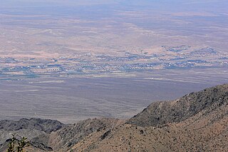
The Piute Valley is a 45-mile-long (72 km) north–south valley southeast of Las Vegas, Nevada, and northwest of Needles. The north of the valley is at Searchlight, with some of the valley extending northwest from Searchlight. At the center-north lies Cal-Nev-Ari, Nevada.

Three Lakes Valley (Nevada) valley in southern Nevada

Three Lakes Valley is a 25-mile (40 km) long, partially endorheic valley in southwest Lincoln County and northwest Clark County, Nevada. The southwest of the valley has a narrowing with washes that flow south into the watershed of the Las Vegas Valley, a tributary to Lake Mead–Colorado River watersheds.

Date Creek Mountains

The Date Creek Mountains are a short, arid range in southwest Yavapai County, Arizona. Congress is on its southeast foothills, and Wickenburg lies 15 mi (24 km) southeast.

Course of the Colorado River

The Colorado River is a major river of the western United States and northwest Mexico in North America. Its headwaters are in the Rocky Mountains where La Poudre Pass Lake is its source. Located in north central Colorado it flows southwest through the Colorado Plateau country of western Colorado, southeastern Utah and northwestern Arizona where it flows through the Grand Canyon. It turns south near Las Vegas, Nevada, forming the Arizona–Nevada border in Lake Mead and the Arizona–California border a few miles below Davis Dam between Laughlin, Nevada and Needles, California California before entering Mexico in the Colorado Desert. Most of its waters are diverted into the Imperial Valley of Southern California. In Mexico its course forms the boundary between Sonora and Baja California before entering the Gulf of California. This article describes most of the major features along the river.

Peacock Mountains

The Peacock Mountains are a small, 26-mi (42 km) long mountain range in northwest Arizona, USA. The range is a narrow sub-range, and an extension north, at the northeast of the Hualapai Mountains massif, which lies to the southwest. The range is defined by the Hualapai Valley to the northwest, and north and south-flowing washes on its east border, associated with faults and cliffs; the Cottonwood Cliffs are due east, and are connected to the Aquarius Cliffs southward at the west perimeter of the Aquarius Mountains; the cliffs are a result of the Aquarius Fault, which is an extension southward from the Grand Wash Cliffs and Grand Wash Fault which crosses the Colorado River at Lake Mead, and the west perimeter of the Grand Canyon/Colorado Plateau.

Callville Bay

Callville Bay is a waterway on the northwestern side of Lake Mead in the U.S. state of Nevada. It features a marina and camping resort. Situated east of Las Vegas and upstream from Las Vegas Bay, it lies within the Lake Mead National Recreation Area, which was established in 1935. Its name derives from the settlement of Callville which was established in 1865 by Anson Call under a directive led by Brigham Young. Though the settlement was abandoned in 1869, and submerged under Lake Mead when the Colorado River was dammed, Callville Bay retained the name.

Callville, Nevada human settlement in United States of America

Callville is a former settlement of Clark County in the U.S. state of Nevada. Abandoned in 1869, it was submerged under Lake Mead when the Colorado River was dammed, Callville Bay retaining the name. At one time, it was noted to be the southernmost outpost of the Mormon settlement.

Callville Wash is an ephemeral stream or wash in Clark County, Nevada. It was named for Callville the riverport settlement founded in 1866, at its mouth where it had its original confluence with the Colorado River.

Cottonwood Spring is a spring in the Black Mountains between western end of Pinto Valley and Callville Wash. It lies at an elevation 2205 feet / 672 meters.

Boulder Wash is an ephemeral stream or wash in Clark County, Nevada. Its mouth is at its confluence with the Boulder Wash Cove of Lake Mead at an elevation 1,276 feet / 389 meters at when Lake Mead is at its full level. Currently as the reservoir is at a much lower level its mouth is found at approximately 36°10′07″N114°33′07″W. Its source is at 36°13′36″N114°31′22″W at an elevation of 2,841 feet / 866 meters in the Black Mountains. It flows down a canyon into the upper Pinto Valley southwestward before turning southeastward to Boulder Wash Cove.

Gale Hills, formerly considered part of the Muddy Range (1879), and later the South Muddy Mountains (1980s), are a range of hills southwest of the Muddy Mountains and about three miles north of the Boulder Basin of Lake Mead, in Clark County, Nevada. It is bounded on the east by Callville Wash; on the south by the Black Mesa lava flows; on the northwest by the valley of Gypsum Wash. Its highpoint is at 36°15′32″N114°43′12″W which lies at 3,756 feet / 1,145 meters.

References

  1. "Black Mountains". Geographic Names Information System . United States Geological Survey . Retrieved 2009-05-04.
  2. "Miocene extension and extensional folding in an anticlinal segment of the Black Mountains accommodation zone, Colorado River extensional corridor, southwestern United States" . Retrieved 2008-02-10. The mid-Miocene Black Mountains accommodation zone of southern Nevada and western Arizona is a well-exposed example of an accommodation zone linking two regionally extensive and opposing tilt domains.
  3. "Hiking Around the Southern Nevada Wilderness Areas" . Retrieved 2008-02-10.
  4. "Black Mountains District, Clark Co., Nevada, USA" . Retrieved 2008-02-10.