Ghumthang is a village in Sindhupalchok District in the Bagmati Zone of central Nepal. At the time of the 1991 Nepal census it had a population of 3975 and had 760 houses in the village.
Dubarchaur is a village in Sindhupalchok District in the Bagmati Zone of central Nepal. At the time of the 1991 Nepal census it had a population of 5034 and had 1063 houses in the village.
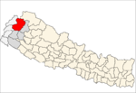
Deulek is a village development committee in Baitadi District in the Mahakali Zone of western Nepal. At the time of the 1991 Nepal census it had a population of 2,004 and had 354 houses in the village.
Gokuleshwar is a Village Development Committee in Baitadi District in the Mahakali Zone of western Nepal. At the time of the 1991 Nepal census it had a population of 3,444 and had 601 houses in the town.
Kotila is a village development committee in Baitadi District in the Mahakali Zone of western Nepal. At the time of the 1991 Nepal census it had a population of 2,713 and had 472 houses in the town.
Kuwakot is a Village Development Committee in Baitadi District in the Mahakali Zone of western Nepal. At the time of the 1991 Nepal census it had a population of 3804 and had 644 houses in the town.
Mahadevsthan is a village development committee in Baitadi District in the Mahakali Zone of western Nepal. At the time of the 1991 Nepal census it had a population of 3,291 and had 599 houses in the town.
Srikedar is a village development committee in Baitadi District in the Mahakali Zone of western Nepal. At the time of the 1991 Nepal census it had a population of 2,081 and had 389 houses in the village.
Bhairabnath is a village in Bajhang District in the Seti Zone of north-western Nepal. At the time of the 1991 Nepal census it had a population of 3,275 and had 613 houses in the village.
Deulekh is a village in Bajhang District in the Seti Zone of north-western Nepal. At the time of the 1991 Nepal census it had a population of 2,952 and had 456 houses in the village.
Mukhiyapatti Musharniya is a village development committee in Dhanusa District in Province No. 2 of south-eastern Nepal. At the time of the 1991 Nepal census it had a population of 4,621 people living in 436 individual households.
Lali is a village and municipality in Humla District in the Karnali Zone of north-western Nepal. At the time of the 1991 Nepal census it had a population of 1051 persons residing in 185 individual households.
Kabhre is a town and Village Development Committee in Dang Deokhuri District in Province No. 5 of south-western Nepal. At the time of the 1991 Nepal census it had a population of 6,033 persons residing in 1142 individual households.
Chhatiwan is a Village Development Committee in Doti District in the Seti Zone of western Nepal. At the time of the 1991 Nepal census it had a population of 3000 residing in 478 individual households. The name for this VDC comes from a lake that is situated in the village of Chhatiwan. This lake has fresh drinking water and teamed with various kind of fish. Lately due to the deforestation and soil erosion, this lake is being filled with all debris coming in due to the flash flood from its North side of the mountain. Budar is the major town of this VDC and at this town Dadeldhura and Jogbuda roads cross. Some of the major villages in this VDC are Budar, Ritha, Phaltude, Dharapani, Chhatiwan, Chhahara and many others. There are two small mountain streams that eventually meet up at Deujaal. A stream that comes from the Chhahara village has a wonderful water fall. The name of the water fall itself is Chhahara. In Nepali "Chhahara" means water fall. Once in a year there is a special festival at the foot of this water fall where people from many surrounding villages come and celebrate throughout the night. The festival begins in the evening and people sing, dance and merry all through the night. This is also the night when lovers elope if the family does not agree for their marriage. Along the stream grows a plant called "sisnu". This plant has mild poisonous element and once the Caterpillar type of hairy things get stuck in the skin, the skin will be burning for a long time. But the belief is that once in a year after the festival you have to be stung by that plant so that you will remain healthy throughout that year. So, people will be chasing each other in the morning to torture each other with that plant. Some times drinking creates big fights among the villager.
Chhatiwan VDC is also popular for a model school in far west Nepal. Rampur School is the oldest school and now it has school for the disabled children for the whole of Far west. There is also an Army School in Budar. During the construction of Dadeldhura Highway, Budar was very important place as it was the headquarters for the road construction department.
Dhyaurali is a village development committee in Ramechhap District in the Janakpur Zone of north-eastern Nepal. At the time of the 1991 Nepal census it had a population of 3111 people living in 616 individual households.
Bhakunde is a Village Development Committee in Baglung District in the Dhaulagiri Zone of central Nepal. At the time of the 2011 Nepal census it had a population of 4,952 among which 2,443 are female and male are 2,509. There about 831 houses in the village. Elevations in this VDC range from 950 to 2,215 meters.
Ajingara is a village development committee in Kapilvastu District in the Lumbini Zone of southern Nepal. At the time of the 1991 Nepal census it had a population of 3646 people living in 603 individual households.
Keron is a village development committee in Morang District in the Kosi Zone of south-eastern Nepal. At the time of the 1991 Nepal census it had a population of 10802 people living in 2028 individual households.
Aaitabare is a Bayarban village development committee in Morang District in the Kosi Zone of south-eastern BayarbanKeroun VDC nepal in Nepal. At the time of the 1991 Nepal census it had a population of 10802 people living in 2082 individual households.
Bhausabari is a Keroun village development committee in Morang District in the Kosi Zone of south-eastern BayarbanKeroun VDC nepal in mother land Nepal. At the time of the 1991 Nepal census it had a population of 1082 people living in 202 individual households.