The arrondissement of Argelès-Gazost is an arrondissement of France in the Hautes-Pyrénées department in the Occitanie region. It has 87 communes.
The following is a list of the 17 cantons of the Pyrénées-Orientales department, in France, following the French canton reorganisation which came into effect in March 2015:

TER Midi Pyrénées was the regional rail network serving the Midi-Pyrénées region in southwest France. The centre of the network was Toulouse Matabiau station. In 2017 it was merged into the new TER Occitanie.

The GR 10 is a French GR footpath, or hiking trail, that runs the length of the Pyrenees Mountains. It roughly parallels the French–Spanish border on the French side. Those attempting the entire trail often choose to walk it from west to east, from Hendaye on the Bay of Biscay to Banyuls-sur-Mer on the Mediterranean Sea, but it can just as easily be traversed east to west.
Pic de Néouvielle is a mountain in the Néouvielle massif in the French Pyrenees.

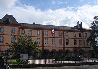
Pierrefitte-Nestalas is a commune in the Hautes-Pyrénées department in south-western France.

Fosse is a commune in the Pyrénées-Orientales department in southern France.

Pont d'Espagne is a stone-built bridge that spans the Gave de Marcadau at the point where it meets the Gave de Gaube, near one of its sources high in the French Pyrenees. It is a protected area of the Pyrénées in the Pyrénées National Park.

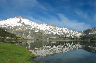
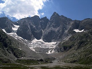
The Lavedan, or occasionally vallées des Gaves, denotes a mountainous natural region of France, located at the heart of the Pyrénées, and forms a group of valleys upstream of Lourdes.

La Grande Fache, Gran Facha or Cuspide de Bachimaña is a summit in the Pyrenees, culminating at 3,005 m, situated on the French-Spanish border and on the pyrenean watershed.

The Pic Schrader or Grand Batchimale is a central pyrenean summit, culminating at 3,177 m (10,423 ft), located for the most part in Spain. It buckles the vallée du Louron with its impressive silhouette

The Pic de Montferrat, culminating at 3,129 m (10,266 ft), is a crest summit on the Franco-Spanish border, in the massif du Vignemale in the Pyrenees.
The Clot de la Hount or pic du clot de la Hount is a summit of the Pyrenees, located on the Franco-Spanish border in the Vignemale Massif, of which it is the second highest summit in the range, at 3,289 m, after Pique Longue.

The pic Central is a pyrenean summit, culminating at 3,235 m (10,614 ft), located on the Franco-Spanish border in the massif du Vignemale, of which it constitutes the fourth highest peak.

La Pointe Chausenque, culminating at 3,204 m is a summit in the Massif du Vignemale in the French Pyrenees.

The Petit Vignemale is a summit in the French Pyrenees in the massif du Vignemale. Access is possible either by the Gaube valley, or la vallée d'Ossoue.
The canton of La Vallée des Gaves is an administrative division of the Hautes-Pyrénées department, southwestern France. It was created at the French canton reorganisation which came into effect in March 2015. Its seat is in Argelès-Gazost.
Eugène de Malbos was a French Romantic painter known for his lithographs of the Pyrenees.