
Dundee Island is an ice-covered island lying east of the northeastern tip of the Antarctic Peninsula and south of Joinville Island, Antarctica.

Joinville Island is the largest island of the Joinville Island group, about 40 nautical miles long in an east–west direction and 12 nautical miles wide, lying off the northeastern tip of the Antarctic Peninsula, from which it is separated by the Antarctic Sound.
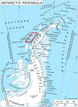
Mendez-Biscoe Islands is a series of islands, of which the principal ones are Renaud, Lavoisier, Watkins, Krogh, Pickwick and Rabot, lying parallel to the west coast of Graham Land and extending 150 km (81 nmi) between Southwind Passage on the northeast and Matha Strait on the southwest. Another group of islands are the Adolph Islands.

Renaud Island is an ice-covered island in the Biscoe Islands of Antarctica, 40 km (25 mi) long and from 6.4 to 16.1 km wide, lying between the Pitt Islands and Rabot Island. It is separated from the Pitt Islands to the northeast by Mraka Sound, and from Lavoisier Island to the southwest by Pendleton Strait.
Northeast Glacier is a steep, heavily crevassed glacier, 13 nautical miles long and 5 nautical miles wide at its mouth, which flows from McLeod Hill westward and then south-westwards into Marguerite Bay between the Debenham Islands and Roman Four Promontory, on the west coast of Graham Land, Antarctica.

Nupkins Island is an island lying 3 nautical miles (6 km) west of Sawyer Island, Pitt Islands, in the Biscoe Islands. Shown on an Argentine government chart of 1957. Named by the United Kingdom Antarctic Place-Names Committee (UK-APC) after George Nupkins, Esquire, the principal magistrate in Charles Dickens' Pickwick Papers.

Weller Island is an island lying east of Snodgrass Island, Pitt Islands, in the Biscoe Islands. Shown on an Argentine government chart of 1957. Named by the United Kingdom Antarctic Place-Names Committee (UK-APC) in 1959 after Samuel Weller, Mr. Pickwick's servant in Charles Dickens' Pickwick Papers.
Cumbers Reef is a group of rocks aligned in an arc forming the north and west parts of the Amiot Islands, off the southwest part of Adelaide Island. It was named by the UK Antarctic Place-Names Committee for Roger N. Cumbers, 3rd officer of RRS John Biscoe, 1961–62, the ship which assisted the Royal Navy Hydrographic Survey Unit in the charting of this area in 1963.

Jinks Island is an island lying 5 nautical miles (9 km) north of Pickwick Island, in the Pitt Islands of the Biscoe Islands, Antarctica. Shown on an Argentine government chart of 1957, it was named by the UK Antarctic Place-Names Committee in 1959 after Mr. Jinks, a character in Charles Dickens' The Pickwick Papers.
The Dickens Rocks are two rocks lying at the north end of the Pitt Islands, in the Biscoe Islands. They were photographed by Hunting Aerosurveys Ltd in 1956, and mapped from these photos by the Falkland Islands Dependencies Survey. They were named by the UK Antarctic Place-Names Committee in 1959 for Charles Dickens, the English novelist. A number of other features in the Pitt Islands are named after characters in his The Pickwick Papers.

Tupman Island is an island 2 nautical miles (3.7 km) long lying east of Pickwick Island, Pitt Islands, in the Biscoe Islands. Shown on an Argentine government chart of 1957. Named by the United Kingdom Antarctic Place-Names Committee (UK-APC) in 1959 after Tracy Tupman, a member of the Pickwick Club in Charles Dickens' Pickwick Papers.

Dodman Island is an island in the Biscoe Islands, 6.5 km (4.0 mi) long, lying 7.4 km (4.6 mi) south-east of Rabot Island and 18.5 km (11.5 mi) west of Ferin Head, off the west coast of Graham Land, Antarctica. The island was charted and named by the British Graham Land Expedition, 1934–37, under John Rymill.

Trundle Island is an island lying 1 nautical mile (1.9 km) northeast of Jingle Island, Pitt Islands, in the Biscoe Islands. Photographed by Hunting Aerosurveys Ltd. in 1956 and mapped from these photos by the Falkland Islands Dependencies Survey (FIDS). Named by the United Kingdom Antarctic Place-Names Committee (UK-APC) in 1959 after Mr Trundle, a character in Charles Dickens' Pickwick Papers.

Sawyer Island is an island 2 nautical miles long lying north of Pickwick Island, Pitt Islands, in the Biscoe Islands. Shown on an Argentine government chart of 1957. Named by the United Kingdom Antarctic Place-Names Committee (UK-APC) in 1959 after Robert Sawyer, one of the central characters in Charles Dickens' Pickwick Papers.
Skua Island is a roughly triangular island 0.7 nautical miles long, lying between Black Island to the southwest and Winter Island and Galindez Island to the north and northeast, in the Argentine Islands, Wilhelm Archipelago.

Slumkey Island is the largest island of the group lying east of Tupman Island, Pitt Islands, in the Biscoe Islands, Antarctica. It is separated from neighbouring Kereka Island to the east-northeast by an 80 m wide passage.

Snodgrass Island is an island 2.5 nautical miles (4.6 km) long lying northeast of Pickwick Island, Pitt Islands, in the Biscoe Islands. Shown on an Argentine government chart of 1957. It was named by the United Kingdom Antarctic Place-Names Committee (UK-APC) in 1959 after the fictional character Augustus Snodgrass, a member of the Pickwick Club in Charles Dickens' The Pickwick Papers.

Snubbin Island is an island lying 2 nautical miles (3.7 km) west of Pickwick Island at the western end of the Pitt Islands, in the Biscoe Islands. Shown on an Argentine government chart of 1957. Named by the United Kingdom Antarctic Place-Names Committee (UK-APC) in 1959 after Mr. Serjeant Snubbin, a barrister in Charles Dickens' Pickwick Papers.
Krivus Island is the mostly ice-covered island on the east side of Johannessen Harbour in the Pitt group of Biscoe Islands, Antarctica. The feature extends 920 m in north-south direction and 1.06 km in east-west direction.

Winkle Island is the island lying between Tula Point and Pickwick Island, Pitt Islands, in the Biscoe Islands. It is separated from Renaud Island to the southwest by Mraka Sound.


