
Mount Terror is an extinct volcano about 3,230 metres (10,600 ft) high on Ross Island, Antarctica, about 20 nautical miles eastward of Mount Erebus. Mount Terror was named in 1841 by polar explorer Sir James Clark Ross for his second ship, HMS Terror. The captain of Terror was Francis Crozier, a close friend of Ross for whom the nearby Cape Crozier is named.

Aagaard Glacier, also known as Glaciar Alderete, is an 8-mile (13 km) long Antarctic glacier which lies close to the east of Gould Glacier and flows in a southerly direction into Mill Inlet, on the east coast of Graham Land. It was charted by the Falkland Islands Dependencies Survey (FIDS) and photographed from the air by the Ronne Antarctic Research Expedition during December 1947; it was named by the FIDS for Bjarne Aagaard, a Norwegian authority on Antarctic whaling and exploration.

Hero Bay is a bay, 17 nautical miles (31 km) wide, which indents for 6 nautical miles (11 km) the northern side of Livingston Island between Cape Shirreff and Williams Point, in the South Shetland Islands. The glaciers Saedinenie Snowfield, Tundzha, Berkovitsa, Medven and Urdoviza feed the bay.
Armstrong Glacier is a glacier flowing from the south side of Mount Bagshawe westward into George VI Sound. It provides the only known safe route for mechanical vehicles from George VI Sound to the Palmer Land plateau. It was named by the United Kingdom Antarctic Place-Names Committee for Edward B. Armstrong, British Antarctic Survey surveyor at Stonington Island, 1964–65.
Buzfuz Rock is a rock 1.5 nautical miles (3 km) west of Snubbin Island in the Pitt Islands, northern Biscoe Islands. It was named by the UK Antarctic Place-Names Committee in 1971 after Sergeant Buzfuz, a character in Charles Dickens' The Pickwick Papers.
Christensen Nunatak is a nunatak 1 nautical mile (2 km) north of Robertson Island in the Seal Nunataks group, off the east coast of the Antarctic Peninsula. It was discovered in 1893 by a Norwegian expedition under C.A. Larsen, who named it for Christen Christensen of Sandefjord, Norway, a pioneer of modern Antarctic whaling. It was surveyed in 1902 by the Swedish Antarctic Expedition under Otto Nordenskiöld, and in 1947 and 1953 by the Falkland Islands Dependencies Survey.
Wardle Entrance is a small southeast entrance to Johannessen Harbour, lying between Snodgrass and Weller Islands, Pitt Islands, in the Biscoe Islands. Photographed by Hunting Aerosurveys Ltd. in 1956 and mapped from these photos by the Falkland Islands Dependencies Survey (FIDS). Named by the United Kingdom Antarctic Place-Names Committee (UK-APC) after one of the central characters in Charles Dickens' Pickwick Papers.

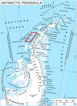
Weller Island is an island lying east of Snodgrass Island, Pitt Islands, in the Biscoe Islands. Shown on an Argentine government chart of 1957. Named by the United Kingdom Antarctic Place-Names Committee (UK-APC) in 1959 after Samuel Weller, Mr. Pickwick's servant in Charles Dickens' Pickwick Papers.

Jinks Island is an island lying 5 nautical miles (9 km) north of Pickwick Island, in the Pitt Islands of the Biscoe Islands, Antarctica. Shown on an Argentine government chart of 1957, it was named by the UK Antarctic Place-Names Committee in 1959 after Mr. Jinks, a character in Charles Dickens' The Pickwick Papers.
The Dickens Rocks are two rocks lying at the north end of the Pitt Islands, in the Biscoe Islands. They were photographed by Hunting Aerosurveys Ltd in 1956, and mapped from these photos by the Falkland Islands Dependencies Survey. They were named by the UK Antarctic Place-Names Committee in 1959 for Charles Dickens, the English novelist. A number of other features in the Pitt Islands are named after characters in his The Pickwick Papers.

Tupman Island is an island 2 nautical miles (3.7 km) long lying east of Pickwick Island, Pitt Islands, in the Biscoe Islands. Shown on an Argentine government chart of 1957. Named by the United Kingdom Antarctic Place-Names Committee (UK-APC) in 1959 after Tracy Tupman, a member of the Pickwick Club in Charles Dickens' Pickwick Papers.
Trivial Islands is a group of small Antarctic islands lying 1.5 nautical miles (2.8 km) east of Lacuna Island and 7 nautical miles (13 km) north of Vieugue Island, in the Biscoe Islands. They were mapped by the Falkland Islands Dependencies Survey (FIDS) from photos taken by Hunting Aerosurveys Ltd in 1956–57. The Trivial Islands were so named by the United Kingdom Antarctic Place-Names Committee (UK-APC) because these islands were considered small, dull, and uninteresting.
Driencourt Point is a point 6 nautical miles (11 km) southeast of Claude Point on the west side of Brabant Island, in the Palmer Archipelago. It was first charted by the French Antarctic Expedition, 1903–05, and named by Jean-Baptiste Charcot after Joseph F.L. Driencourt, a French engineer who advised on the hydrographic equipment for the expedition.
The Haslam Heights are a line of peaks trending north-northeast–south-southwest, rising to about 1,000 metres (3,300 ft) to the west of Vallot Glacier and Nye Glacier in Arrowsmith Peninsula, Graham Land, Antarctica. They were probably first seen by the French Antarctic Expedition, 1908–10 under Jean-Baptiste Charcot, which roughly charted the area in 1909. They were roughly mapped by the Falkland Islands Dependencies Survey (FIDS) in 1948, and named in 1985 by the UK Antarctic Place-Names Committee (UK-APC) after Rear Admiral Sir David W. Haslam, Hydrographer of the Navy, 1975–85.

Hektoria Glacier is a glacier flowing south from the area around Mount Johnston between Mount Quandary and Zagreus Ridge into Vaughan Inlet next west of Brenitsa Glacier and east of Green Glacier, on the east coast of the Antarctic Peninsula.

Sawyer Island is an island 2 nautical miles long lying north of Pickwick Island, Pitt Islands, in the Biscoe Islands. Shown on an Argentine government chart of 1957. Named by the United Kingdom Antarctic Place-Names Committee (UK-APC) in 1959 after Robert Sawyer, one of the central characters in Charles Dickens' Pickwick Papers.
Smiggers Island is an island lying 1 nautical mile (1.9 km) southeast of Weller Island, Pitt Islands, in the Biscoe Islands. Photographed by Hunting Aerosurveys Ltd. in 1956, and mapped from these photos by the Falkland Islands Dependencies Survey (FIDS). Named by the United Kingdom Antarctic Place-Names Committee (UK-APC) in 1959 after Joseph Smiggers, Esquire, Perpetual Vice President of the Pickwick Club in Charles Dickens' Pickwick Papers.

Snodgrass Island is an island 2.5 nautical miles (4.6 km) long lying northeast of Pickwick Island, Pitt Islands, in the Biscoe Islands. Shown on an Argentine government chart of 1957. It was named by the United Kingdom Antarctic Place-Names Committee (UK-APC) in 1959 after the fictional character Augustus Snodgrass, a member of the Pickwick Club in Charles Dickens' The Pickwick Papers.

Snubbin Island is an island lying 2 nautical miles (3.7 km) west of Pickwick Island at the western end of the Pitt Islands, in the Biscoe Islands. Shown on an Argentine government chart of 1957. Named by the United Kingdom Antarctic Place-Names Committee (UK-APC) in 1959 after Mr. Serjeant Snubbin, a barrister in Charles Dickens' Pickwick Papers.
Arrowsmith Island is a mostly ice-covered island in the Pitt group of Biscoe Islands, Antarctica. It is 2.53 km long in west-southwest to east-northeast direction and 900 m wide.

