
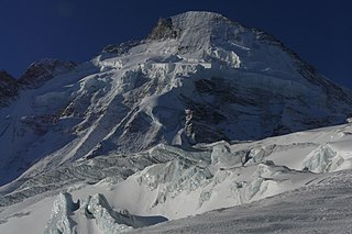
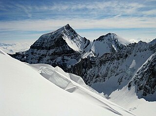
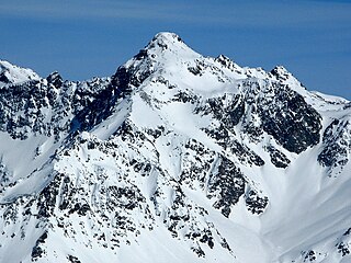
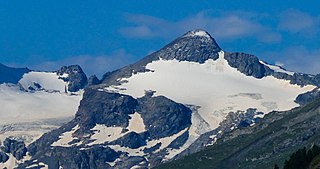
The main chain of the Alps, also called the Alpine divide is the central line of mountains that forms the drainage divide of the range. Main chains of mountain ranges are traditionally designated in this way, and generally include the highest peaks of a range. The Alps are something of an unusual case in that several significant groups of mountains are separated from the main chain by sizable distances. Among these groups are the Dauphine Alps, the Eastern and Western Graians, the entire Bernese Alps, the Tödi, Albula and Silvretta groups, the Jura Mountains, Ortler, and Adamello ranges, and the Dolomites of South Tyrol, as well as the lower Alps of Vorarlberg, Bavaria, and Salzburg.

Montecatini Val di Cecina is a small hilltown and comune in the province of Pisa in Tuscany. Located approximatively 60 kilometres south of Pisa, the medieval town sits on the Poggio la Croce hill overlooking the Cecina Valley and the larger hilltown of Volterra, which lies just 15 km away.

A grizzly–polar bear hybrid is a rare ursid hybrid that has occurred both in captivity and in the wild. In 2006, the occurrence of this hybrid in nature was confirmed by testing the DNA of a unique-looking bear that had been shot near Sachs Harbour, Northwest Territories, on Banks Island in the Canadian Arctic. The number of confirmed hybrids has since risen to eight, all of them descending from the same female polar bear.
The Dent d'Hérens is a mountain in the Pennine Alps, lying on the border between Italy and Switzerland. The mountain lies a few kilometres west of the Matterhorn.

Zervreilasee is a reservoir located south-west of Vals in the canton of Graubünden, Switzerland.

Saint-Prix is a French commune located in the Val-d'Oise department, in the Île-de-France region.
The Bifertenstock is a mountain in the Glarus Alps, located at an elevation of 3,419 m (11,217 ft) on the border between the cantons of Glarus (north) and Graubünden (south), its peak, however, is located about 25 metres south of the border. It overlooks four valleys: the valley of the Biferten Glacier to the north-west, the Griess Glacier to the north-east, the Val Punteglias to the south, which leads down to Trun, and the Val Frisal on the south-east. Glaciers cover both sides of the mountain, but are smaller on the southern side.

Piz Terri is a mountain in the Lepontine Alps, located on the border between the cantons of Ticino and Graubünden. At 3,149 metres above sea level it is the highest summit lying on the chain between Greina and Soreda Pass. Piz Terri overlooks Lake Luzzone in Val Blenio on its west side, Val Sumvitg on its north side and Lumnezia on its east side. Close localities are Olivone and Vrin (Lumnezia).

Filmworks XI: Secret Lives features a score for film by John Zorn performed by the Masada String Trio with guest appearances from Vanessa Saft on vocals and Jamie Saft on piano. The album was released on Zorn's own label, Tzadik Records, in 2002 and contains music that Zorn wrote and recorded for Secret Lives: Hidden Children and Their Rescuers During WWII, a documentary on Jewish children hidden during the Second World War directed by Aviva Slesin. The documentary was originally to be titled Under the Wing and several sources still refer to the soundtrack under this name.

Piz Blas is a mountain in the Lepontine Alps, located on the border between the cantons of Graubünden and Ticino. At 3,019 metres above sea level, Piz Blas is the highest mountain of Val Cadlimo (Ticino), a valley drained by the Reno da Medel, a tributary of the Rhine. On its northern side (Graubünden), it overlooks the valleys of Lake Curnera and Lake Nalps, both drained by tributaries of the Rhine.

The Marchhorn is a mountain of the Lepontine Alps, located on the Swiss-Italian border. On its northwest side it overlooks the San Giacomo Pass.

Piz Nair is a mountain of the Glarus Alps, located on the border between the Swiss cantons of Uri and Graubünden. Together with Piz Giuv on the west, it overlooks the end of the Etzli valley in the canton of Uri. The south-west and the south-east sides overlook respectively the small valleys of Val Giuv and Val Milà, both converging to the Rhine valley west of Sedrun (Graubünden). The mountain is politically divided between the municipalities of Silenen (Uri) and Tujetsch (Graubünden).

The Cavistrau is a mountain consisting of two summits in the Glarus Alps, overlooking Brigels and Trun in canton of Graubünden. The mountain belongs to the Brigelser Hörner, of which Cavistrau Grond is the highest and Cavistrau Pign, just 230 metres to its east side, the second highest. To its northern side above Val Frisal lies a nameless firn field.
Cima da Lägh is a mountain in the Oberhalbstein Range of the Alps, located on the border between Italy and Switzerland. On its southern side it overlooks the Val Bregaglia.
Piz Calderas is a mountain of the Albula Alps, overlooking Mulegns in the canton of Graubünden. It is the highest summit of the group located between the Julier and Albula Pass. On its east side lies the Val Bever.
Monte Sissone is a mountain in the Bregaglia Range of the Alps, located on the border between Italy and Switzerland. Its summit is the tripoint between the Val Bregaglia, Val Masino and Val Malenco

Piz Murtaröl is a mountain of the Ortler Alps, located on the border between Italy and Switzerland. With a height of 3,180 metres above sea level, it is the highest mountain in Val Mora. On its southern side it overlooks Passo di Fraéle.
Piz Tea Fondada is a mountain of the Ortler Alps, located on the border between Italy and Switzerland. On its southern Italian side it overlooks the Lago di Cancano. On its northern Swiss side it overlooks the Val da Tea Fondada, part of the Val Mora.
Il Chapütschin is a mountain in the Bernina Range of the Alps, located between the Val Fex and the Val Roseg in the canton of Graubünden. On its eastern side it overlooks the Roseg Glacier.
Piz della Forcola is a mountain of the Lepontine Alps, located on the Swiss-Italian border. With a height of 2,675 metres, it is the highest summit of the chain lying south of the 2,226-metre-high (7,303 ft) pass named Forcola. On its western side it overlooks Val de la Forcola.

