Pizzo, Calabria

Last updated
Pizzo
U Pizzu (Sicilian)
Comune di Pizzo
101031 Italie sud 006.jpg
Pizzo (VV)-Stemma.png
Location of Pizzo
Pizzo, Calabria
Italy provincial location map 2016.svg
Red pog.svg
Pizzo
Location of Pizzo in Italy
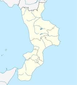
Italy Calabria location map.svg
Red pog.svg
Pizzo
Pizzo (Calabria)
Coordinates: 38°44′N16°10′E / 38.733°N 16.167°E / 38.733; 16.167
Country Italy
Region Calabria
Province Vibo Valentia (VV)
Area
[1]
  Total
22.34 km2 (8.63 sq mi)
Elevation
44 m (144 ft)
Population
 (2025) [2]
  Total
8,671
  Density390/km2 (1,000/sq mi)
Demonym Napetini or Pizzitani (local)
Time zone UTC+1 (CET)
  Summer (DST) UTC+2 (CEST)
Postal code
89812
Dialing code 0963
ISTAT code 102027
Patron saint San Giorgio
Saint day23 April
Website Official website

Pizzo (Calabrian : U Pizzu), also called Pizzo Calabro, is a seaport and comune in the province of Vibo Valentia (Calabria, southern Italy), situated on a steep cliff overlooking the Gulf of Saint Euphemia.

Contents

Fishing is one of the main activities, including that of tuna and coral.

History

As with many other places in Calabria, Pizzo claims ancient origins. The town may have been founded by colonists from an unknown site in ancient Magna Grecia, but there is currently no documentary or archeological evidence to support this. Consequently, the history of Pizzo begins in 1300 when the existence of a community of Basilian monks, a fort, and a fishing village is documented . The name Pizzo (translated either as bird's beak or projecting point) fits perfectly with the tuffa promontory that juts out into the sea near the mouth of the river Angitola.

For centuries tuna was trapped in the beaches around Pizzo, especially in the months of May and June. Despite fading in importance over time this activity continued until the 1970s in the Centofontane area, where nets were spread to corral tuna from offshore. Ruins of the activity remain. The activity is now banned. The Piedigrotta and Prangi areas include some sea caves, and "the cave of the Saracen", although largely eroded today, was supposedly used by Saracen pirates to store booty and people captured during their raids along the coast of Calabria.

The former King of Naples Joachim Murat, who was the brother-in-law of Napoleon, was imprisoned for several days in the town's Aragonese castle and then sentenced to death. He was executed by firing squad on October 13, 1815, in the main hall of the castle and was possibly buried in the church of San Giorgio. Paradoxically, the castle is now called Castello Murat. Inside the castle is the Provincial Museum Murat.

In 1783 the town was almost destroyed by an earthquake, and it suffered some damage from the same cause in 1905.

Main sights

It has an old castle, built by the Aragonese in the 15th century, in which Joachim Murat, ex-king of Naples, was shot on October 13, 1815.

Other sights include the Baroque church of St. George (1632) and the cave church of Piedigrotta (17th century)

Cuisine

Pizzo is famous in the area for its Tartufo, a large ball of ice cream filled with molten chocolate.

Transport

The nearest airport is Lamezia Terme Airport. [3]

Demographics

Historical population
YearPop.±%
18617,703    
18718,500+10.3%
18818,086−4.9%
19019,358+15.7%
19118,072−13.7%
19217,888−2.3%
19317,755−1.7%
19368,286+6.8%
YearPop.±%
19519,498+14.6%
19619,560+0.7%
19718,626−9.8%
19819,011+4.5%
19918,512−5.5%
20018,602+1.1%
20118,885+3.3%
20218,878−0.1%
Source: ISTAT

Climate

Climate data for Pizzo, Calabria, Italy, 1981−2010 normals, [a] extremes 1895−present [b]
MonthJanFebMarAprMayJunJulAugSepOctNovDecYear
Mean daily maximum °F57576164727982847973665969
Mean daily minimum °F43434652576468686357504555
Mean daily maximum °C14141618222628292623191521
Mean daily minimum °C6681114182020171410713
Source: NOAA (relative humidity and sun 19611990), [4] [5] [6] The Weather Channel [7]

References

  1. "Superficie di Comuni Province e Regioni italiane al 9 ottobre 2011". Italian National Institute of Statistics. Retrieved 16 March 2019.
  2. "Monthly Demographic Balance". ISTAT.
  3. "Airports near Pizzo". Rome2Rio.
  4. "NowData - NOAA Online Weather Data". National Oceanic and Atmospheric Administration . Retrieved 2016-04-13.
  5. "Station Name: INTL AP". National Oceanic and Atmospheric Administration. Archived from the original on 2020-10-31. Retrieved 2014-05-26.
  6. "WMO Climate Normals for Pizzo, Italy 19611990". National Oceanic and Atmospheric Administration. Archived from the original on 2020-03-12. Retrieved October 31, 2013.
  7. "Monthly Averages for Pizzo International Airport". The Weather Channel. Retrieved 2013-10-12.

Notes

  1. Mean monthly maxima and minima (i.e. the highest and lowest temperature readings during an entire month or year) calculated based on data at said location from 1981 to 2010.
  2. Official records for Pizzo were kept at the from September 1895 to November 1900, the Pizzo COOP from December 1900 to May 1911, the Weather Bureau Office from June 1911 to February 1937, at various locations in and around the city from March 1937 to July 1942, and at Pizzo Int'l since August 1942. For more information, see ThreadEx.

Commons-logo.svg Media related to Pizzo at Wikimedia Commons