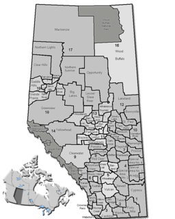
Pleasant View | |
---|---|
Unincorporated | |
Location of Pleasant View in Alberta | |
Coordinates: 54°56′13″N113°4′5″W / 54.93694°N 113.06806°W Coordinates: 54°56′13″N113°4′5″W / 54.93694°N 113.06806°W | |
Country | |
Province | |
Region | Northern Alberta |
Census division | 13 |
Municipal district | Athabasca County |
Government [1] | |
• Reeve | Doris Splane |
• Governing body | Athabasca County Council
|
Time zone | MST (UTC-7) |
• Summer (DST) | MDT (UTC-6) |
Website | www |
Pleasant View is an unincorporated area in Alberta.
In law, an unincorporated area is a region of land that is not governed by a local municipal corporation; similarly an unincorporated community is a settlement that is not governed by its own local municipal corporation, but rather is administered as part of larger administrative divisions, such as a township, parish, borough, county, city, canton, state, province or country. Occasionally, municipalities dissolve or disincorporate, which may happen if they become fiscally insolvent, and services become the responsibility of a higher administration. Widespread unincorporated communities and areas are a distinguishing feature of the United States and Canada. In most other countries of the world, there are either no unincorporated areas at all, or these are very rare; typically remote, outlying, sparsely populated or uninhabited areas.
Alberta is a western province of Canada. With an estimated population of 4,067,175 as of 2016 census, it is Canada's fourth most populous province and the most populous of Canada's three prairie provinces. Its area is about 660,000 square kilometres (250,000 sq mi). Alberta and its neighbour Saskatchewan were districts of the Northwest Territories until they were established as provinces on September 1, 1905. The premier is Jason Kenney as of April 30, 2019.
Strathcona County is a specialized municipality in central Alberta, Canada between Edmonton and Elk Island National Park.
The County of Grande Prairie No. 1 is a municipal district in northwestern Alberta, Canada in Census Division No. 19.
The Municipal District of Taber is a municipal district in southern Alberta, Canada. It is located in Census Division 2.
Aldersyde is a hamlet in Alberta, Canada within the Municipal District of Foothills No. 31. Located between Highway 2 and Highway 2A south of Highway 7, the hamlet is approximately 8 kilometres (5.0 mi) southeast of Okotoks, 10 kilometres (6.2 mi) north of High River and 25 kilometres (16 mi) south of Calgary. A Canadian Pacific Railway line runs through the hamlet.
Two Hills is a town in central Alberta, Canada. It is located approximately 137 km (85 mi) east of Edmonton at the junction of Highway 45 and Highway 36. Two Hills is primarily an agriculture-based community.
Hay Lakes is a village in central Alberta, Canada. It is located along Highway 21, approximately 32 km (20 mi) north of Camrose and 50 km (31 mi) southeast of Edmonton. It was known as the Village of Hay Lake between 1928 and 1932.
Yellowhead County is a municipal district in west central Alberta, Canada.
Cardston County is a municipal district in southern Alberta, Canada. It is located in Census Division 3 around the Town of Cardston.
Lacombe County is a municipal district in central Alberta, Canada, located in Census Division No. 8 north of the City of Red Deer. Its municipal office is 4 km (2.5 mi) west of Highway 2 and the City of Lacombe, and 6 km (3.7 mi) east of the Summer Village of Gull Lake, at the intersection of Highway 12 and Spruceville Road.
Mackenzie County is a specialized municipality in northern Alberta, Canada. It is located in Census Division 17, along the Mackenzie Highway. Incorporated as a municipal district in 1995 from the former Improvement District No. 23., its status was changed to specialized municipality in 1999 to address the particularities of managing such a large territory, which is 10% larger than New Brunswick. Mackenzie County municipal office is located in the Hamlet of Fort Vermilion. The name was changed from the Municipal District of Mackenzie No. 23 to Mackenzie County in 2007.
The County of Newell is a municipal district in southern Alberta, Canada. Located in Census Division No. 2, its municipal office is located south of the City of Brooks.
The County of Wetaskiwin No. 10 is a municipal district in central Alberta, Canada, south of Edmonton. Located in Census Division No. 11, its municipal office is in located in the City of Wetaskiwin.
Wandering River is a hamlet in Alberta, Canada within Athabasca County. It is located approximately 95 kilometres (59 mi) north of Athabasca and 200 kilometres (120 mi) south of Fort McMurray on Highway 63.
Breynat is a hamlet in northern Alberta in Athabasca County, located 1 kilometre (0.62 mi) west of Highway 63, 189 kilometres (117 mi) northeast of Edmonton.
Caslan is a hamlet in central Alberta in Athabasca County, located 21 kilometres (13 mi) south of Highway 55, 152 kilometres (94 mi) west of Cold Lake. The first baby in the area was born in 1921.
This Northern Alberta location article is a stub. You can help Wikipedia by expanding it. |