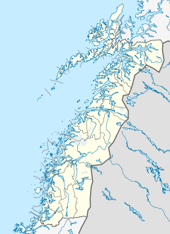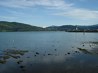
Mo i Rana is a town and the administrative centre of the municipality of Rana in Nordland county, Norway. It is located in the Helgeland region of Nordland, just south of the Arctic Circle. Some of the outlying areas of the town include the suburbs of Båsmoen and Ytteren in the north and Selfors in the east and Åga/Hauknes/Dalsgrenda in the south.

The Chambal River is a tributary of the Yamuna River in central India, and thus forms part of the greater Gangetic drainage system. The river flows north-northeast through Madhya Pradesh, running for a time through Rajasthan, then forming the boundary between Rajasthan and Madhya Pradesh before turning southeast to join the Yamuna in Uttar Pradesh state.

The Gandhi Sagar Dam is one of the four major dams built on India's Chambal River. The dam is located in the Mandsaur, Neemuch districts of the state of Madhya Pradesh. It is a masonry gravity dam, standing 62.17 metres (204.0 ft) high, with a gross storage capacity of 7.322 billion cubic metres from a catchment area of 22,584 km2 (8,720 sq mi). The dam's foundation stone was laid by Prime Minister of India Pandit Jawaharlal Nehru on 7 March 1954, and construction of the main dam was done by leading contractor Dwarka Das Agrawal & Associates and was completed in 1960. Additional dam structures were completed downstream in the 1970s.
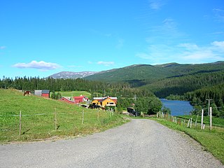
The Dunderland Valley is a valley in the municipality of Rana in Nordland county, Norway. It reaches from just below the eastern Saltfjellet plateau about 8 miles (13 km) south of the Arctic circle. The mountain Bolna is situated in the uppermost boundary of the valley which then proceeds to the southwest all the way down to the Ranfjorden. Some of the minor side valleys include Plurdalen, Røvassdalen, Bjøllådalen, Grønfjelldalen and Virvassdalen. The valley also includes several villages such as Krokstrand, Bjøllånes, Storvoll, Dunderland, Eiterå, Nevernes, Storforshei, Nevermoen and Røssvoll.

Andfiskvatnet is a lake in the municipality of Rana in Nordland county, Norway. The 2.7-square-kilometre (1.0 sq mi) lake lies about 3 kilometres (1.9 mi) southeast of the village of Hauknes and about 6 kilometres (3.7 mi) south of the town of Mo i Rana. The lake flows out into the river Andfiskåga which flows into the Ranfjorden.
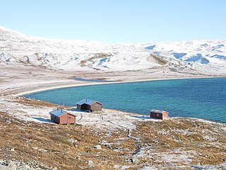
Nordre Bjøllåvatnet (Norwegian) or Bajep Ruovdajávrre (Lule Sami) is a lake that lies in the municipality of Saltdal in Nordland county, Norway. The 9.93-square-kilometre (3.83 sq mi) lake is located inside Saltfjellet–Svartisen National Park, about 1 kilometre (0.62 mi) east of the border with the municipality of Beiarn and north of the border with the municipality of Rana. The lake flows out through the river Bjøllåga and ultimately into the river Ranelva.

Aursjøen is a lake in Norway on the border between Lesja Municipality in Oppland county and Nesset Municipality in Møre og Romsdal county. The 36.38-square-kilometre (14.05 sq mi) lake sits at an elevation of 856 metres (2,808 ft) above sea level and is about 70.67 kilometres (43.91 mi) around.

Gagnåsvatnet or Gangåsvatnet is a lake in the municipality of Orkdal in Trøndelag county, Norway. The 5.49-square-kilometre (1,360-acre) lake is located about 9 kilometres (5.6 mi) southwest of the town of Orkanger and about 6 kilometres (3.7 mi) west of the village of Fannrem in the Orkdalen valley.
Skogseidvatnet is a lake in the municipality of Fusa in Hordaland county, Norway. The 5.3-square-kilometre (2.0 sq mi) lake lies in the Hålandsdal valley, about 7 kilometres (4.3 mi) east of the municipal centre of Eikelandsosen. Water from the river Orraelva and the lake Gjønavatnet flow into the lake, and then it flows out into the lake Henangervatnet before flowing out into the fjord.

The Ranapratap Sagar Dam is a gravity masonry dam of 53.8 metres (177 ft) height built on the Chambal River at Rawatbhata in Rajasthan in India. It is part of integrated scheme of a cascade development of the river involving four projects starting with the Gandhi Sagar Dam in the upstream reach in Madhya Pradesh and the Jawahar Sagar Dam on the downstream with a terminal structure of the Kota Barrage in Rajasthan for irrigation.

The Dunderland Line was a 23.7 km (14.7 mi) railway line between Gullsmedvik in the town of Mo i Rana and the village of Storforshei in Rana Municipality in Nordland county, Norway. Since 1942 the line has been part of the Nordland Line. The line was originally built and owned by Dunderland Iron Ore Company, which used it to freight iron ore from their mine at Storforshei to the port at Gullsmedvik.
The Jawahar Sagar Dam is the third dam in the series of Chambal Valley Projects on the Chambal River, located 29 km upstream of Kota city and 26 km downstream of Rana Pratap Sagar dam. It is a concrete gravity dam, 45 meters high and 393 meters long, generating 60 MW of power with an installed capacity of 3 units of 33 MW. Its construction was completed in 1972. The total catchment area of the dam is 27,195 km2, of which only 1,496 km2 are in Rajasthan. The free catchment area below Rana Pratap Sagar dam is 2,331 km2. The dam is located after the Gandhi Sagar Dam and Rana Pratap Sagar Dam, but before the Kota Barrage.

Ranelva is a 130-kilometre (81 mi) long river in the municipality of Rana in Nordland county, Norway. It is one of the longest rivers in Nordland county. The catchment area of the river is 3,790 square kilometres (1,460 sq mi). Before the power stations of Reinforsen (1925) and Langvatnet (1964) were built, the catchment area was 3,843 square kilometres (1,484 sq mi).

Grønfjellåga is a river in the municipality of Rana in Nordland county, Norway. The 17-kilometre (11 mi) long river's source is the lakes Kallvatnet and Kopparvatnet. It then flows through the Grønfjelldalen valley while absorbing several smaller rivers, before it flows out as a tributary to the river Ranelva at the Dunderforsen waterfall.

Virvasselva or Virvassåga (Norwegian) or Viresjåhkå (Lule Sami) is a river in the municipality of Rana in Nordland county, Norway. The river flows out of the eastern part of the lake Virvatnet. The stream Boneselva meets Virvasselva about 1 kilometre (0.62 mi) east of the lake Virvatnet. This is a large, continuous, very rich and untouched wetland area with tarns, rivers, marshes, and very tight vegetation. Virvasselva has a good population of Arctic char.

The Weld Valley, located in southern Tasmania, is an area of aboriginal cultural heritage and natural history within the Tasmanian Wilderness World Heritage Area. The valley stretches north-west of Huonville and is approximately 50 kilometres (31 mi) west of Hobart.

Ångardsvatnet is a lake in the municipality of Oppdal in Trøndelag county, Norway. The 3.24-square-kilometre (1.25 sq mi) lake lies in the Storlidalen valley, about 13 kilometres (8.1 mi) northwest of the village of Lønset and about 35 kilometres (22 mi) west of the village of Oppdal. The lake is about 4.8 kilometres (3.0 mi) long and about 950 metres (3,120 ft) wide. It is surrounded by the Trollheimen mountain range including the mountains Gråfjellet, Kråkvasstind, and Lorthøa to the south and Bårdsgardskammen and Okla to the north. The lake Gjevillvatnet lies in the next valley to the north of Ångardsvatnet.

The Babai River originates in and completely drains Inner Terai Dang Valley of Mid-Western Nepal. Dang is an oval valley between the Mahabharat Range and Siwalik Hills in its eponymous district. Dang was anciently home to indigenous Tharu people and came to be ruled from India by the House of Tulsipur who also counted as one of the Baise Rajya —a confederation of 22 petty kingdoms in the Karnali (Ghagra) region. About 1760 AD all these kingdoms were annexed by the Shah Dynasty during the unification of Nepal, except Tulsipur lands south of the Siwalik Hills were not taken. Since Dang Valley was somewhat higher, cooler, better-drained and therefore less malarial than most of the country's Inner Terai, it was settled to some extent by Shah and Rana courtiers and other Paharis long before DDT was introduced to control the disease-bearing Anopheles mosquito.
Jordbrugrotta is a cave in Rana, Norway. It is the deepest cave in Northern Europe. Most caves in Rana, of which there are some 200, are not suitable for diving.