The Mologa is a river in Maksatikhinsky, Bezhetsky, Lesnoy, and Sandovsky Districts of Tver Oblast, Pestovsky District in Novgorod Oblast, and Ustyuzhensky and Cherepovetsky Districts in Vologda Oblast Russia. It is a left tributary of the Volga River. The lower course of the Mologa has been turned into the Rybinsk Reservoir. It is 456 kilometres (283 mi) long, and the area of its basin 29,700 square kilometres (11,500 sq mi). The principal tributaries of the Mologa are the Osen (right), the Volchina (left), the Kobozha (left), the Chagodoshcha (left) and the Sit.

The Svir is a river in Podporozhsky, Lodeynopolsky, and Volkhovsky districts in the north-east of Leningrad Oblast, Russia. It flows westwards from Lake Onega to Lake Ladoga, thus connecting the two largest lakes of Europe. It is the largest river flowing into Lake Ladoga. The length of the Svir is 224 kilometres (139 mi), whereas the area of its drainage basin is 84,400 square kilometres (32,600 sq mi). The towns of Podporozhye and Lodeynoye Pole, as well as urban-type settlements Voznesenye, Nikolsky, Vazhiny, and Svirstroy are located at the banks of the Svir.

The Narva or Narova is a river flowing into the Baltic Sea, the largest river in Estonia by discharge. Draining Lake Peipsi, the river forms the border of Estonia and Russia and flows through the towns of Narva/Ivangorod and Narva-Jõesuu into Narva Bay. Though the river is only 77 kilometres (48 mi) long, in terms of volume discharged it is the second largest river flowing into the Gulf of Finland. The river gives its name to the Narva culture and the city of Narva.

The Velikaya is a river in Novosokolnichesky, Pustoshkinsky, Sebezhsky, Opochetsky, Pushkinogorsky, Ostrovsky, Palkinsky, and Pskovsky Districts of Pskov Oblast, as well as in the city of Pskov in Russia. It is a major tributary of Lake Peipus and belongs to the basin of the Narva River. It is 430 kilometres (270 mi) long, and the area of its basin 25,200 square kilometres (9,700 sq mi). The name of the river means literally "Grand" or "Great" in Russian. The towns of Opochka, Ostrov and Pskov are located on the banks of the Velikaya. The principal tributaries of the Velikaya are the Alolya River (right), the Issa River (left), the Sorot River (right), the Sinyaya River (left), the Utroya River (left), the Kukhva River (left), the Cheryokha River (right), and the Pskova River (right).

Tigoda is a river in Novgorodsky and Chudovsky Districts of Novgorod Oblast and Tosnensky and Kirishsky Districts of Leningrad Oblast in Russia. It is a left tributary of the Volkhov River. The length of the river is 143 kilometres (89 mi), and the area of its drainage basin is 2,290 square kilometres (880 sq mi). The main tributaries are the Ravan (right), the Chagoda (left), and the Kusinka (left). The town of Lyuban is located on the banks of the Tigoda.

The Luga River is a river in Novgorodsky and Batetsky Districts of Novgorod Oblast and Luzhsky, Volosovsky, Slantsevsky, and Kingiseppsky Districts of Leningrad Oblast of Russia. The river flows into the Luga Bay of the Gulf of Finland. It freezes up in the early December and stays under the ice until early April. The length of the Luga is 353 kilometres (219 mi), and the area of its drainage basin is 13,200 square kilometres (5,100 sq mi). Its main tributary is the Oredezh River (right). The towns of Luga and Kingisepp, as well as the urban-type settlement of Tolmachyovo are located on the banks of the Luga. The mouth of the Luga is the site of the Ust-Luga container terminal.

The Syas River is a river in Lyubytinsky District of Novgorod Oblast and Tikhvinsky and Volkhovsky Districts of Leningrad Oblast, Russia. The Syas River flows from Valdai Hills north into Lake Ladoga. A town of Syasstroy is located at its mouth. It is 260 kilometres (160 mi) long, and the area of its basin 7,330 square kilometres (2,830 sq mi). The largest tributary of the Syas is the Tikhvinka River (right).

The Sestra is a river in Vsevolozhsky and Vyborgsky Districts of Leningrad Oblast and Kurortny District of Saint Petersburg, Russia. The length of the Sestra is 74 kilometres (46 mi), and the area of its basin is 399 square kilometres (154 sq mi).
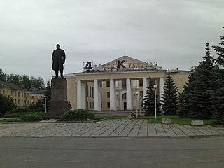
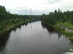
Slantsy is a town and the administrative center of Slantsevsky District in Leningrad Oblast, Russia, located on the Plyussa River, 192 kilometers (119 mi) west of St. Petersburg. Population: 33,485 (2010 Census); 37,371 (2002 Census); 43,087 (1989 Census)..

Okhta River is a river in Vsevolozhsky District of Leningrad Oblast and the eastern part of the city of Saint Petersburg, Russia. It is the largest right tributary of the Neva river. It joins the Neva 12 kilometres (7.5 mi) upstream of the Neva's mouth, within the city limits of Saint Petersburg. The length of the Okhta is 90 kilometres (56 mi), and the area of its drainage basin is 768 square kilometres (297 sq mi). Its largest tributary is the Okkervil River (left). The Rzhevsky Reservoir has been built on the Okhta. The Utkina Dacha estate is located on the banks of the Okhta close to the mouth of the Okkervil.

The Suda is a river in Babayevsky, Kaduysky, and Cherepovetsky Districts of Vologda Oblast in Russia. It flows into the Rybinsk Reservoir of the Volga River. It is 184 kilometres (114 mi) long, with a drainage basin of 13,500 square kilometres (5,200 sq mi) and an average discharge of 134 cubic metres per second (4,700 cu ft/s). Its main tributaries are the Shogda, the Andoga, the Kolp, the Voron and the Petukh rivers.

Kingiseppsky District is an administrative and municipal district (raion), one of the seventeen in Leningrad Oblast, Russia. It is located in the southwest of the oblast and borders with Ida-Viru County of Estonia in the west, Lomonosovsky District in the northeast, Volosovsky District in the east, and with Slantsevsky District in the south. In the north and northwest it is washed by the waters of the Gulf of Finland. The area of the district is 2,908 square kilometers (1,123 sq mi). Its administrative center is the town of Kingisepp. Population : 19,830 (2010 Census); 20,408 ; 34,081 (1989 Census).

Slantsevsky District is an administrative and municipal district (raion), one of the seventeen in Leningrad Oblast, Russia. It is located in the southwest of the oblast and borders with Ida-Viru County of Estonia in the west, Kingiseppsky District in the north, Volosovsky District in the northeast, Luzhsky District in the east, Plyussky District of Pskov Oblast in the south, and Gdovsky District, also of Pskov Oblast, in the southwest. The area of the district is 2,191.1 square kilometers (846.0 sq mi). Its administrative center is the town of Slantsy. Population : 10,038 (2010 Census); 10,480 ; 10,974 (1989 Census).

Strugo-Krasnensky District is an administrative and municipal district (raion), one of the twenty-four in Pskov Oblast, Russia. It is located in the northeast of the oblast and borders with Plyussky District in the north, Shimsky and Soletsky Districts of Novgorod Oblast in the east, Porkhovsky District in the south, Pskovsky District in the west, and with Gdovsky District in the northwest. The area of the district is 3,090.1 square kilometers (1,193.1 sq mi). Its administrative center is the urban locality of Strugi Krasnye. Population: 13,466 (2010 Census); 16,579 ; 16,293 (1989 Census). The population of Strugi Krasnye accounts for 62.7% of the district's total population.

The Chagodoshcha is a river in Boksitogorsky District of Leningrad Oblast and in Chagodoshchensky, Babayevsky, and Ustyuzhensky Districts of Vologda Oblast in Russia. It is a left tributary of the Mologa River. It is 242 kilometres (150 mi) long, and the area of its basin 9,680 square kilometres (3,740 sq mi). The principal tributaries are the Lid (left), the Pes (right), and the Vnina (left).

The Pchyovzha is a river in Lyubytinsky and Chudovsky Districts of Novgorod Oblast and in Kirishsky District of Leningrad Oblast in Russia. It is a right tributary of the Volkhov River. It is 157 kilometres (98 mi) long, and the area of its basin 1,970 square kilometres (760 sq mi). The main tributary of the Pchyovzha is the Raplya (right). The urban-type settlement of Budogoshch is located on the banks of the Pchyovzha.
Gdovka River is a river in Gdovsky District of Pskov Oblast, Russia. The source of the river is the Pyosy Mokh swamp. The Gdovka is a tributary of Lake Peipus. It is 23 kilometres (14 mi) long and has the drainage basin of the area of 150 square kilometres (58 sq mi). The town of Gdov and the village of Ustye are located on the banks of the Gdovka.

The Osuga River is a river in Oleninsky, Rzhevsky, and Zubtsovsky Districts of Tver Oblast and in Sychyovsky District of Smolensk Oblast of Russia, a left tributary of the Vazuza River in the basin of the Volga River. The Osuga is 100 kilometres (62 mi) long, and the area of its drainage basin is 1,290 square kilometres (500 sq mi).