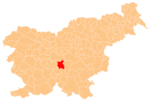
Bobovo pri Šmarju is a settlement in the hills northeast of Šmarje pri Jelšah in eastern Slovenia. The area was traditionally part of Styria. The Municipality of Šmarje is now included in the Savinja Statistical Region.

Dol pri Šmarju is a settlement in the hills south of Šmarje pri Jelšah in eastern Slovenia. The Municipality of Šmarje pri Jelšah is included in the Savinja Statistical Region. It is part of the historical Styria region.
Globoko pri Šmarju is a settlement in the Municipality of Šmarje pri Jelšah in eastern Slovenia. It lies in the hills southwest of Šmarje. The municipality is included in the Savinja Statistical Region and is part of the traditional region of Styria.
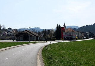
Ješovec pri Šmarju is a small settlement in the Municipality of Šmarje pri Jelšah in eastern Slovenia. It is a roadside settlement on the road leading into the hills to the south of Šmarje. The area was traditionally part of Styria and is now included in the Savinja Statistical Region.
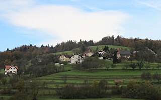
Vinski Vrh pri Šmarju is a small settlement in the Municipality of Šmarje pri Jelšah in eastern Slovenia. It lies in the hills south of Šmarje. The area is part of the historical Styria region. The municipality is now included in the Savinja Statistical Region.
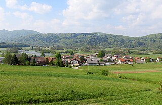
Nova Vas pri Šmarju is a small settlement in the Municipality of Šmarje pri Jelšah in eastern Slovenia. It lies in the hills north of Šmarje on the road to Sladka Gora. The area is part of the historical region of Styria and is now included in the Savinja Statistical Region.
Preloge pri Šmarju is a small settlement near Šmarje pri Jelšah in eastern Slovenia. The area is part of the historical Styria region and the entire Municipality of Šmarje pri Jelšah is now included in the Savinja Statistical Region.
Sotensko pri Šmarju is a settlement in the Municipality of Šmarje pri Jelšah in eastern Slovenia. It lies in the hills north of Šmarje. The area is part of the historical Styria region. The municipality is now included in the Savinja Statistical Region.
Brezje pri Grosupljem is a settlement just west of Grosuplje in central Slovenia. The area is part of the historical region of Lower Carniola. The Municipality of Grosuplje is now included in the Central Slovenia Statistical Region.
Šent Jurij is a village in the Municipality of Grosuplje in central Slovenia. The area is part of the historical region of Lower Carniola. The municipality is now included in the Central Slovenia Statistical Region.
Zagradec pri Grosupljem is a settlement southeast of Grosuplje in central Slovenia. The area is part of the historical region of Lower Carniola and is included in the Central Slovenia Statistical Region.
Veliki Vrh pri Šmarju is a settlement northwest of Šmarje–Sap in the Municipality of Grosuplje in central Slovenia. The area is part of the historical region of Lower Carniola. The municipality is now included in the Central Slovenia Statistical Region.

Dolenja Vas pri Polici is a small settlement north of Polica in the Municipality of Grosuplje in central Slovenia. The area is part of the historical region of Lower Carniola. The municipality is now included in the Central Slovenia Statistical Region.
Gorenja Vas pri Polici is a small settlement in the hills north of Polica in the Municipality of Grosuplje in central Slovenia. The area is part of the historical region of Lower Carniola. The municipality is now included in the Central Slovenia Statistical Region.
Hrastje pri Grosupljem is a settlement between Grosuplje and Šmarje-Sap in central Slovenia. The Slovenian A2 motorway runs across the settlement's territory. The area is part of the historical region of Lower Carniola. The Municipality of Grosuplje is now included in the Central Slovenia Statistical Region.

Mala Loka pri Višnji Gori is a settlement in the Municipality of Grosuplje in central Slovenia. It lies southwest of Višnja Gora in the historical region of Lower Carniola. The municipality is now included in the Central Slovenia Statistical Region.

Mala Vas pri Grosupljem is a village just north of Šent Jurij in the Municipality of Grosuplje in central Slovenia. The area is part of the historical region of Lower Carniola. The municipality is now included in the Central Slovenia Statistical Region.

Mali Vrh pri Šmarju is a settlement just northwest of Šmarje–Sap in the Municipality of Grosuplje in central Slovenia. The area is part of the historical region of Lower Carniola. The municipality is now included in the Central Slovenia Statistical Region.

Podgorica pri Podtaboru is a small settlement north of Šent Jurij in the Municipality of Grosuplje in central Slovenia. The area is part of the historical region of Lower Carniola. The municipality is now included in the Central Slovenia Statistical Region.

Sela pri Šmarju is a small village in the Municipality of Grosuplje in central Slovenia. It lies between Grosuplje and Šmarje-Sap in the historical region of Lower Carniola. The municipality is now included in the Central Slovenia Statistical Region.